Property Record
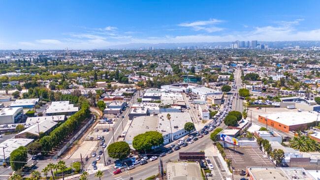
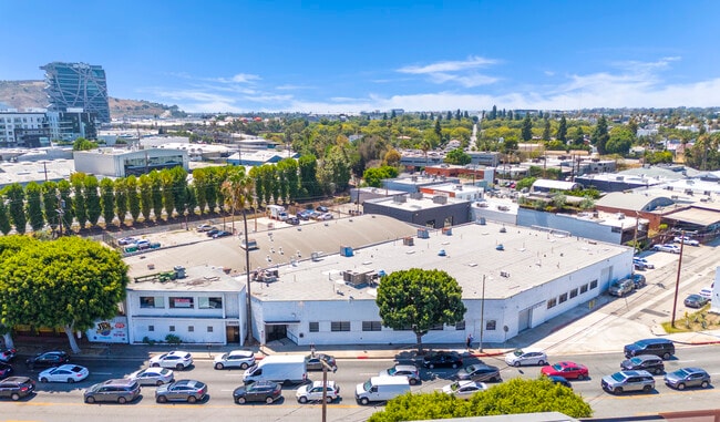
5854 Smiley Dr, Culver City, CA 90232

Current Lease Availabilities
NEARBY LISTINGS FOR SALE OR LEASE
Property Detail
5854 Smiley Dr
Los Angeles-Long Beach-Glendale, CA
Rincon De Los Bueyes Rho
4205-003-038
LICENSED SURVEYORS MAP AS PER BK 13 PG 2 OF L S EX OF STS LOT 66 AND EX OF ST LOTS 65,67,68 AND LOT 69
Lightindustrial
Los Angeles
AO
California
06037C1613G
66
2024
0.40 AC
2025
Westside
702501
Los Angeles
17,651 SF
DEMOGRAPHICS near 5854 Smiley Dr
1 Mile
3 Mile
5 Mile
2024 Total Population
34,225
327,077
980,675
2029 Population
33,394
319,344
958,066
Pop Growth 2024-2029
(2.43%)
(2.36%)
(2.31%)
Average Age
39
40
40
2024 Total Households
12,143
139,140
415,969
HH Growth 2024-2029
(2.71%)
(2.56%)
(2.40%)
Median Household Inc
$75,182
$85,333
$77,001
Avg Household Size
2.70
2.30
2.30
2024 Avg HH Vehicles
2.00
2.00
1.00
Median Home Value
$991,482
$1,055,950
$1,034,826
Median Year Built
1952
1957
1961
Nearby Places
- Restaurants
- Banks
- Shops
- Fitness
- Groceries
PUBLIC TRANSPORTATION
TRANSIT/SUBWAY
La Cienega/Jefferson (Expo Line - Los Angeles County Metropolitan Transportation Authority (Metro))
DRIVE
WALK
Distance
La Cienega/Jefferson (Expo Line - Los Angeles County Metropolitan Transportation Authority (Metro))
1 min
7 min
0.4 mi
COMMUTER RAIL
Union Station (91 Line - Southern California Regional Rail Authority (Metrolink), Antelope Valley Line - Southern California Regional Rail Authority (Metrolink), Orange County Line - Southern California Regional Rail Authority (Metrolink), Riverside Line - Southern California Regional Rail Authority (Metrolink), San Bernardino Line - Southern California Regional Rail Authority (Metrolink), Ventura County Line - Southern California Regional Rail Authority (Metrolink))
DRIVE
WALK
Distance
Union Station (91 Line - Southern California Regional Rail Authority (Metrolink), Antelope Valley Line - Southern California Regional Rail Authority (Metrolink), Orange County Line - Southern California Regional Rail Authority (Metrolink), Riverside Line - Southern California Regional Rail Authority (Metrolink), San Bernardino Line - Southern California Regional Rail Authority (Metrolink), Ventura County Line - Southern California Regional Rail Authority (Metrolink))
16 min
9.5 mi
AIRPORT
Los Angeles International
DRIVE
WALK
Distance
Los Angeles International
17 min
10.5 mi
Bob Hope
DRIVE
WALK
Distance
Bob Hope
31 min
24.0 mi
Long Beach (Daugherty Field)
DRIVE
WALK
Distance
Long Beach (Daugherty Field)
29 min
24.8 mi
Freight Ports
Port of Long Beach
DRIVE
WALK
Distance
Port of Long Beach
1 min
21.1 mi
Nearby Properties
Address
Land Use
TOTAL SIZE
Lot Size
Zoning
Address
Land Use
TOTAL SIZE
Lot Size
Zoning
157,691 SF
45.86 AC
CCS1*
Address
Land Use
TOTAL SIZE
Lot Size
Zoning
1,353,044 SF
6.18 AC
LAC2
Address
Land Use
TOTAL SIZE
Lot Size
Zoning
1,002,990 SF
8.42 AC
LAC4
Address
Land Use
TOTAL SIZE
Lot Size
Zoning
33,373 SF
52.98 AC
LACCS
Address
Land Use
TOTAL SIZE
Lot Size
Zoning
346,856 SF
3.67 AC
CCC3*
Address
Land Use
TOTAL SIZE
Lot Size
Zoning
252,523 SF
2.26 AC
LAC2
Address
Land Use
TOTAL SIZE
Lot Size
Zoning
597,713 SF
11.18 AC
CCS1YY
Address
Land Use
TOTAL SIZE
Lot Size
Zoning
1,232,625 SF
2.40 AC
LAC2
Address
Land Use
TOTAL SIZE
Lot Size
Zoning
871,235 SF
14.56 AC
LAC2
Address
Land Use
TOTAL SIZE
Lot Size
Zoning
476,779 SF
1.57 AC
LAC4
Address
Land Use
TOTAL SIZE
Lot Size
Zoning
133,959 SF
1.23 AC
BHC3*
Address
Land Use
TOTAL SIZE
Lot Size
Zoning
754,581 SF
3.75 AC
LAC1
Address
Land Use
TOTAL SIZE
Lot Size
Zoning
728,063 SF
2.08 AC
LAC4
Address
Land Use
TOTAL SIZE
Lot Size
Zoning
472,363 SF
3.24 AC
LAC4
Address
Land Use
TOTAL SIZE
Lot Size
Zoning
368,411 SF
10.91 AC
C2-2D-CPIO
Address
Land Use
TOTAL SIZE
Lot Size
Zoning
793,274 SF
7.80 AC
LAR4
Address
Land Use
TOTAL SIZE
Lot Size
Zoning
23,312 SF
11.08 AC
C2-2D-CPIO
Address
Land Use
TOTAL SIZE
Lot Size
Zoning
110,580 SF
6.88 AC
LAC2
Address
Land Use
TOTAL SIZE
Lot Size
Zoning
453,182 SF
2.76 AC
LAC4
Address
Land Use
TOTAL SIZE
Lot Size
Zoning
8.93 AC
LAC2
Address
Land Use
TOTAL SIZE
Lot Size
Zoning
679,557 SF
6.41 AC
LAC2
Address
Land Use
TOTAL SIZE
Lot Size
Zoning
786,423 SF
11.74 AC
LAC2
Address
Land Use
TOTAL SIZE
Lot Size
Zoning
634,370 SF
1.89 AC
BHC3*
Address
Land Use
TOTAL SIZE
Lot Size
Zoning
78,793 SF
3.53 AC
LAMR1
Address
Land Use
TOTAL SIZE
Lot Size
Zoning
291,714 SF
1.47 AC
BHC3
Address
Land Use
TOTAL SIZE
Lot Size
Zoning
337,336 SF
2.71 AC
LAR4
Address
Land Use
TOTAL SIZE
Lot Size
Zoning
269,116 SF
2.43 AC
LAC2
Address
Land Use
TOTAL SIZE
Lot Size
Zoning
426,106 SF
2.34 AC
BHC3*
Address
Land Use
TOTAL SIZE
Lot Size
Zoning
274,892 SF
3.53 AC
CCC3EY
Address
Land Use
TOTAL SIZE
Lot Size
Zoning
417,118 SF
1.58 AC
LAC4
The World's #1 Commercial Real Estate Marketplace
Connect with us
© 2025 CoStar Group
The information above has been obtained from sources believed reliable. While we do not doubt its accuracy we have not verified it and make no guarantee, warranty or representation about it. It is your responsibility to independently confirm its accuracy and completeness. Any projections, opinions, assumptions, or estimates used are for example only and do not represent the current or future performance of the property. The value of this transaction to you depends on tax and other factors which should be evaluated by your tax, financial, and legal advisors. You and your advisors should conduct a careful, independent investigation of the property to determine to your satisfaction the suitability of the property for your needs.