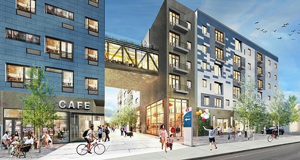
Property Record
5855 Highway 7, Minneapolis, MN 55416
NEARBY LISTINGS FOR SALE OR LEASE
Property Detail
5855 Highway 7
Minneapolis-St. Paul-Bloomington, MN-WI
Place St Louis Park
16-117-21-31-0106
LOT 001 BLOCK 001 B PLACE ST LOUIS PARK IRREGULAR
Apartment
Hennepin
X
Minnesota
27053C0353F
1
2024
2.28 AC
2024
Elmwood
022802
Minneapolis/St Paul
DEMOGRAPHICS near 5855 Highway 7
1 Mile
3 Mile
5 Mile
2024 Total Population
15,294
115,556
373,534
2029 Population
15,038
113,764
368,558
Pop Growth 2024-2029
(1.67%)
(1.55%)
(1.33%)
Average Age
39
40
39
2024 Total Households
7,767
54,030
170,753
HH Growth 2024-2029
(1.47%)
(1.53%)
(1.27%)
Median Household Inc
$92,866
$96,621
$81,743
Avg Household Size
1.90
2.10
2.10
2024 Avg HH Vehicles
1.00
2.00
1.00
Median Home Value
$363,305
$452,217
$389,473
Median Year Built
1968
1962
1962
Nearby Places
Map Layers
Map Styles
 Street
 Aerial
- Restaurants
- Banks
- Shops
- Fitness
- Groceries
PUBLIC TRANSPORTATION
COMMUTER RAIL
Target Field Station (Northstar Corridor - Northstar Commuter Rail)
DRIVE
WALK
Distance
Target Field Station (Northstar Corridor - Northstar Commuter Rail)
12 min
6.7 mi
AIRPORT
Minneapolis-St Paul International/Wold-Chamberlain
DRIVE
WALK
Distance
Minneapolis-St Paul International/Wold-Chamberlain
22 min
13.9 mi
SALE & LEASE HISTORY
LISTING DATE
SALE/LEASE

Jan 02, 2020
For Lease
Nearby Properties
Address
Land Use
TOTAL SIZE
Lot Size
Zoning
Address
Land Use
TOTAL SIZE
Lot Size
Zoning
Address
Land Use
TOTAL SIZE
Lot Size
Zoning
275,782 SF
2.40 AC
C3A
Address
Land Use
TOTAL SIZE
Lot Size
Zoning
659,076 SF
1.45 AC
C3A
Address
Land Use
TOTAL SIZE
Lot Size
Zoning
5.84 AC
Address
Land Use
TOTAL SIZE
Lot Size
Zoning
3,008,334 SF
7.72 AC
Address
Land Use
TOTAL SIZE
Lot Size
Zoning
Address
Land Use
TOTAL SIZE
Lot Size
Zoning
19,726 SF
2.08 AC
PCD1
Address
Land Use
TOTAL SIZE
Lot Size
Zoning
1.50 AC
Address
Land Use
TOTAL SIZE
Lot Size
Zoning
Address
Land Use
TOTAL SIZE
Lot Size
Zoning
Address
Land Use
TOTAL SIZE
Lot Size
Zoning
2,207,532 SF
11.15 AC
Address
Land Use
TOTAL SIZE
Lot Size
Zoning
4,497,396 SF
11.05 AC
Address
Land Use
TOTAL SIZE
Lot Size
Zoning
264,176 SF
1.61 AC
OR2
Address
Land Use
TOTAL SIZE
Lot Size
Zoning
Address
Land Use
TOTAL SIZE
Lot Size
Zoning
390,060 SF
3.11 AC
Address
Land Use
TOTAL SIZE
Lot Size
Zoning
406,842 SF
1.59 AC
Address
Land Use
TOTAL SIZE
Lot Size
Zoning
1.74 AC
Address
Land Use
TOTAL SIZE
Lot Size
Zoning
19.75 AC
Address
Land Use
TOTAL SIZE
Lot Size
Zoning
224,581 SF
13.72 AC
PUD
Address
Land Use
TOTAL SIZE
Lot Size
Zoning
398,595 SF
1.91 AC
Address
Land Use
TOTAL SIZE
Lot Size
Zoning
288,096 SF
10.19 AC
Address
Land Use
TOTAL SIZE
Lot Size
Zoning
524,556 SF
4.56 AC
Address
Land Use
TOTAL SIZE
Lot Size
Zoning
Address
Land Use
TOTAL SIZE
Lot Size
Zoning
280,748 SF
1.60 AC
Address
Land Use
TOTAL SIZE
Lot Size
Zoning
38.20 AC
Address
Land Use
TOTAL SIZE
Lot Size
Zoning
379,488 SF
2.68 AC
Address
Land Use
TOTAL SIZE
Lot Size
Zoning
340,330 SF
2.22 AC
Address
Land Use
TOTAL SIZE
Lot Size
Zoning
576,900 SF
25.79 AC
OR2
Address
Land Use
TOTAL SIZE
Lot Size
Zoning
Address
Land Use
TOTAL SIZE
Lot Size
Zoning
127,084 SF
17.21 AC
The World's #1 Commercial Real Estate Marketplace
Connect with us
© 2025 CoStar Group
The information above has been obtained from sources believed reliable. While we do not doubt its accuracy we have not verified it and make no guarantee, warranty or representation about it. It is your responsibility to independently confirm its accuracy and completeness. Any projections, opinions, assumptions, or estimates used are for example only and do not represent the current or future performance of the property. The value of this transaction to you depends on tax and other factors which should be evaluated by your tax, financial, and legal advisors. You and your advisors should conduct a careful, independent investigation of the property to determine to your satisfaction the suitability of the property for your needs.