Property Record
5859 Abercorn St, Savannah, GA 31405
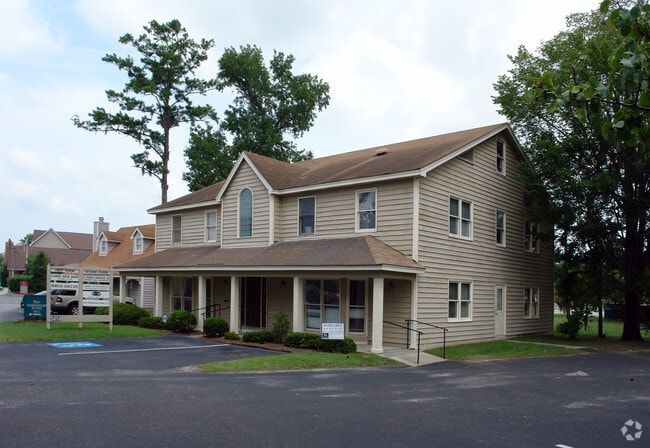


Property Detail
5859 Abercorn St
2013003019
UNITS 1 & 2 ABERCORN OAKS GAZEB0 BUILDINGS CONDOMINIUM CPB 1-101
Officebuilding
Chatham
RIP
Georgia
B and X Area of moderate flood hazard, usually the area between the limits of the 100-year and 500-year floods.
0.05 AC
2024
Greater Savannah
2025
Savannah
004001
Savannah, GA
2,032 SF
NEARBY LISTINGS FOR SALE OR LEASE
DEMOGRAPHICS near 5859 Abercorn St
1 mile
3 mile
5 mile
2025 Total Population
6,797
78,307
159,396
2030 Population
7,143
81,860
166,884
Pop Growth 2025-2030
+ 5.09%
+ 4.54%
+ 4.70%
Average Age
41
39
39
2025 Total Households
2,875
31,716
64,624
HH Growth 2025-2030
+ 4.90%
+ 4.65%
+ 5.02%
Median Household Inc
$63,649
$55,942
$56,587
Avg Household Size
2.20
2.30
2.20
2025 Avg HH Vehicles
2.00
2.00
2.00
Median Home Value
$341,375
$280,363
$284,110
Median Year Built
1969
1965
1969
Nearby Places
Map Layers
Map Styles
 Street
 Aerial
Layers
 Traffic
 Biking
Places
Listings with unknown addresses are not visible on the map
- Restaurants
- Banks
- Shops
- Fitness
- Groceries
PUBLIC TRANSPORTATION
COMMUTER RAIL
Drive
Walk
Distance
14 min
7.4 mi
AIRPORT
Savannah/Hilton Head International
Drive
Walk
Distance
Savannah/Hilton Head International
26 min
14.2 mi
Hilton Head
Drive
Walk
Distance
Hilton Head
67 min
41.4 mi
SALE & LEASE HISTORY
LISTING DATE
SALE/LEASE

Jan 27, 2017
For Lease
Nearby Properties
Address
Land Use
TOTAL SIZE
Lot Size
Zoning
Address
Land Use
TOTAL SIZE
Lot Size
Zoning
14,252 SF
52.91 AC
RIP
Address
Land Use
TOTAL SIZE
Lot Size
Zoning
0.12 AC
R6
Address
Land Use
TOTAL SIZE
Lot Size
Zoning
559,705 SF
44.25 AC
BC
Address
Land Use
TOTAL SIZE
Lot Size
Zoning
6,245 SF
13.52 AC
PUDISB
Address
Land Use
TOTAL SIZE
Lot Size
Zoning
199,424 SF
2.49 AC
BN
Address
Land Use
TOTAL SIZE
Lot Size
Zoning
29,304 SF
27.20 AC
R3
Address
Land Use
TOTAL SIZE
Lot Size
Zoning
52,272 SF
82.59 AC
RIP
Address
Land Use
TOTAL SIZE
Lot Size
Zoning
100 SF
15.62 AC
RM25
Address
Land Use
TOTAL SIZE
Lot Size
Zoning
18,138 SF
12.80 AC
RM25
Address
Land Use
TOTAL SIZE
Lot Size
Zoning
16,896 SF
11.32 AC
IP
Address
Land Use
TOTAL SIZE
Lot Size
Zoning
8,480 SF
16.50 AC
PUDM25
Address
Land Use
TOTAL SIZE
Lot Size
Zoning
14,249 SF
14.92 AC
BC
Address
Land Use
TOTAL SIZE
Lot Size
Zoning
59.65 AC
RIP
Address
Land Use
TOTAL SIZE
Lot Size
Zoning
128,061 SF
29.78 AC
R6
Address
Land Use
TOTAL SIZE
Lot Size
Zoning
85,606 SF
16.30 AC
BC
Address
Land Use
TOTAL SIZE
Lot Size
Zoning
2,226 SF
67.62 AC
IP
Address
Land Use
TOTAL SIZE
Lot Size
Zoning
115,859 SF
1.85 AC
Address
Land Use
TOTAL SIZE
Lot Size
Zoning
4,832 SF
6.43 AC
I-L
Address
Land Use
TOTAL SIZE
Lot Size
Zoning
34,945 SF
18.22 AC
I-P
Address
Land Use
TOTAL SIZE
Lot Size
Zoning
297,627 SF
28.63 AC
PUDIS
Address
Land Use
TOTAL SIZE
Lot Size
Zoning
302,600 SF
7.49 AC
R6
Address
Land Use
TOTAL SIZE
Lot Size
Zoning
15,792 SF
10.50 AC
I-P
Address
Land Use
TOTAL SIZE
Lot Size
Zoning
5,452 SF
5.81 AC
RM25
Address
Land Use
TOTAL SIZE
Lot Size
Zoning
17.78 AC
R1
Address
Land Use
TOTAL SIZE
Lot Size
Zoning
7,500 SF
0.92 AC
RIP
Address
Land Use
TOTAL SIZE
Lot Size
Zoning
79,092 SF
1.18 AC
BC
Address
Land Use
TOTAL SIZE
Lot Size
Zoning
6,296 SF
15.09 AC
PUDM15
Address
Land Use
TOTAL SIZE
Lot Size
Zoning
7,256 SF
8.73 AC
RM25
Address
Land Use
TOTAL SIZE
Lot Size
Zoning
101,262 SF
1.79 AC
BC
Address
Land Use
TOTAL SIZE
Lot Size
Zoning
10,965 SF
17.34 AC
PUDM25
The World's #1 Commercial Real Estate Marketplace
Connect with us
© 2026 CoStar Group
The information above has been obtained from sources believed reliable. While we do not doubt its accuracy we have not verified it and make no guarantee, warranty or representation about it. It is your responsibility to independently confirm its accuracy and completeness. Any projections, opinions, assumptions, or estimates used are for example only and do not represent the current or future performance of the property. The value of this transaction to you depends on tax and other factors which should be evaluated by your tax, financial, and legal advisors. You and your advisors should conduct a careful, independent investigation of the property to determine to your satisfaction the suitability of the property for your needs.