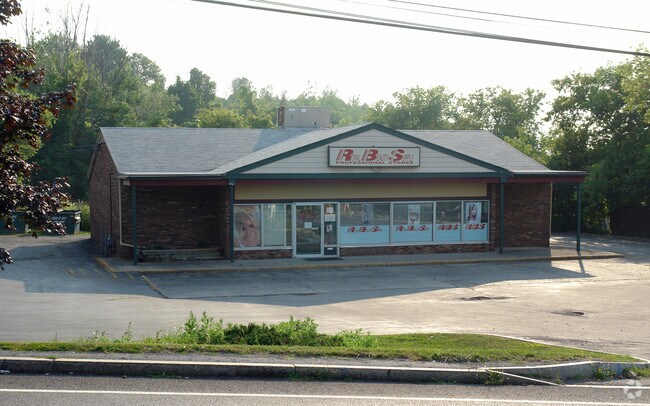
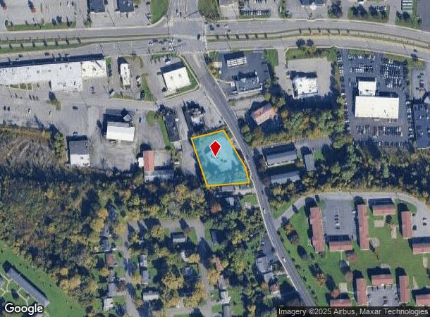
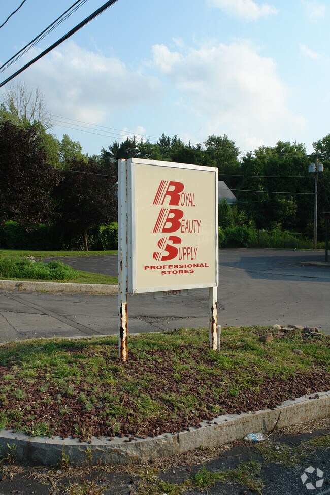
Property Record
5861 Thompson Rd, Syracuse, NY 13214
NEARBY LISTINGS FOR SALE OR LEASE
Property Detail
5861 Thompson Rd
312689-044-000-0002-004-001-0000
FL 50
Officebuilding
Onondaga
X
New York
36067C0237F
4.001
2025
0.78 AC
2024
SE Outer Onondaga County
014600
Syracuse
2,662 SF
Syracuse, NY
DEMOGRAPHICS near 5861 Thompson Rd
1 Mile
3 Mile
5 Mile
2024 Total Population
9,549
80,106
187,403
2029 Population
9,346
78,034
183,610
Pop Growth 2024-2029
(2.13%)
(2.59%)
(2.02%)
Average Age
37
38
38
2024 Total Households
3,680
32,286
75,866
HH Growth 2024-2029
(1.85%)
(2.78%)
(2.07%)
Median Household Inc
$56,288
$55,639
$48,637
Avg Household Size
2.10
2.10
2.20
2024 Avg HH Vehicles
1.00
1.00
1.00
Median Home Value
$138,895
$162,178
$150,111
Median Year Built
1955
1953
1953
Nearby Places
- Restaurants
- Banks
- Shops
- Fitness
- Groceries
PUBLIC TRANSPORTATION
COMMUTER RAIL
DRIVE
WALK
Distance
11 min
6.1 mi
DRIVE
WALK
Distance
11 min
6.1 mi
AIRPORT
Syracuse Hancock International
DRIVE
WALK
Distance
Syracuse Hancock International
18 min
10.8 mi
Nearby Properties
Address
Land Use
TOTAL SIZE
Lot Size
Zoning
Address
Land Use
TOTAL SIZE
Lot Size
Zoning
70,284 SF
74.57 AC
25
Address
Land Use
TOTAL SIZE
Lot Size
Zoning
269,030 SF
11.90 AC
05 - COMME
Address
Land Use
TOTAL SIZE
Lot Size
Zoning
72,200 SF
12.39 AC
06 - INDUS
Address
Land Use
TOTAL SIZE
Lot Size
Zoning
354,492 SF
6.90 AC
25
Address
Land Use
TOTAL SIZE
Lot Size
Zoning
72,800 SF
1.89 AC
06 - INDUS
Address
Land Use
TOTAL SIZE
Lot Size
Zoning
409,062 SF
10
Address
Land Use
TOTAL SIZE
Lot Size
Zoning
218,051 SF
2.32 AC
25
Address
Land Use
TOTAL SIZE
Lot Size
Zoning
38,693 SF
102.34 AC
05 - COMME
Address
Land Use
TOTAL SIZE
Lot Size
Zoning
24,360 SF
3.99 AC
10
Address
Land Use
TOTAL SIZE
Lot Size
Zoning
414,700 SF
1.94 AC
07 - MIXED
Address
Land Use
TOTAL SIZE
Lot Size
Zoning
2,709 SF
39.74 AC
06 - INDUS
Address
Land Use
TOTAL SIZE
Lot Size
Zoning
224,736 SF
2.48 AC
10
Address
Land Use
TOTAL SIZE
Lot Size
Zoning
165,800 SF
1.27 AC
25
Address
Land Use
TOTAL SIZE
Lot Size
Zoning
164,837 SF
0.66 AC
10
Address
Land Use
TOTAL SIZE
Lot Size
Zoning
105,004 SF
2.81 AC
25
Address
Land Use
TOTAL SIZE
Lot Size
Zoning
569,463 SF
94.77 AC
06 - INDUS
Address
Land Use
TOTAL SIZE
Lot Size
Zoning
307,860 SF
1.17 AC
25
Address
Land Use
TOTAL SIZE
Lot Size
Zoning
12,836 SF
148.95 AC
06 - INDUS
Address
Land Use
TOTAL SIZE
Lot Size
Zoning
50,472 SF
4.89 AC
10
Address
Land Use
TOTAL SIZE
Lot Size
Zoning
278,208 SF
1.92 AC
25
Address
Land Use
TOTAL SIZE
Lot Size
Zoning
134,400 SF
1.18 AC
25
Address
Land Use
TOTAL SIZE
Lot Size
Zoning
25,646 SF
88.85 AC
02 - SINGL
Address
Land Use
TOTAL SIZE
Lot Size
Zoning
168,067 SF
25
Address
Land Use
TOTAL SIZE
Lot Size
Zoning
876,645 SF
51.07 AC
05 - COMME
Address
Land Use
TOTAL SIZE
Lot Size
Zoning
217,709 SF
34.53 AC
01 - NOT Z
Address
Land Use
TOTAL SIZE
Lot Size
Zoning
174,750 SF
10.40 AC
06 - INDUS
Address
Land Use
TOTAL SIZE
Lot Size
Zoning
104,400 SF
12.84 AC
06 - INDUS
Address
Land Use
TOTAL SIZE
Lot Size
Zoning
75,000 SF
1.57 AC
25
Address
Land Use
TOTAL SIZE
Lot Size
Zoning
17,388 SF
26.51 AC
07 - MIXED
Address
Land Use
TOTAL SIZE
Lot Size
Zoning
102,905 SF
32 AC
01 - NOT Z
The World's #1 Commercial Real Estate Marketplace
Connect with us
© 2025 CoStar Group
The information above has been obtained from sources believed reliable. While we do not doubt its accuracy we have not verified it and make no guarantee, warranty or representation about it. It is your responsibility to independently confirm its accuracy and completeness. Any projections, opinions, assumptions, or estimates used are for example only and do not represent the current or future performance of the property. The value of this transaction to you depends on tax and other factors which should be evaluated by your tax, financial, and legal advisors. You and your advisors should conduct a careful, independent investigation of the property to determine to your satisfaction the suitability of the property for your needs.