Property Record
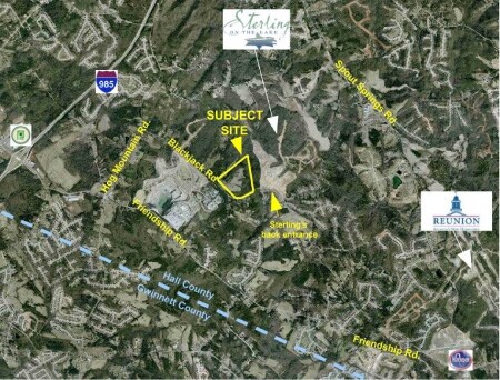
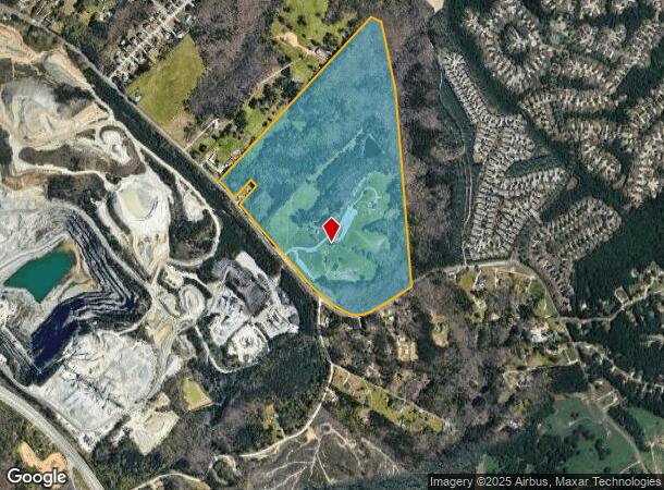
5867 Blackjack Rd, Flowery Branch, GA 30542

NEARBY LISTINGS FOR SALE OR LEASE
Property Detail
5867 Blackjack Rd
15-00047-00-016
BLACK JACK ROAD
Governmentalpublicusegeneral
Hall
X
Georgia
13139C0293H
0
0
107.85 AC
2025
Gainesville/Hall County
001605
Atlanta
2,140 SF
Gainesville, GA
DEMOGRAPHICS near 5867 Blackjack Rd
1 Mile
3 Mile
5 Mile
2024 Total Population
3,432
36,844
97,678
2029 Population
3,826
40,569
106,235
Pop Growth 2024-2029
+ 11.48%
+ 10.11%
+ 8.76%
Average Age
38
39
39
2024 Total Households
1,147
12,088
32,453
HH Growth 2024-2029
+ 11.51%
+ 10.27%
+ 9.03%
Median Household Inc
$112,037
$98,733
$94,298
Avg Household Size
3.00
3.00
2.90
2024 Avg HH Vehicles
2.00
2.00
2.00
Median Home Value
$363,612
$325,325
$345,286
Median Year Built
2005
2003
2003
Nearby Places
Map Layers
Map Styles
 Street
 Aerial
- Restaurants
- Banks
- Shops
- Fitness
- Groceries
Nearby Properties
Address
Land Use
TOTAL SIZE
Lot Size
Zoning
Address
Land Use
TOTAL SIZE
Lot Size
Zoning
815,563 SF
58.80 AC
M-I
Address
Land Use
TOTAL SIZE
Lot Size
Zoning
101,632 SF
78.33 AC
M-I
Address
Land Use
TOTAL SIZE
Lot Size
Zoning
372,813 SF
172.70 AC
RA200
Address
Land Use
TOTAL SIZE
Lot Size
Zoning
273,101 SF
126.33 AC
PRD
Address
Land Use
TOTAL SIZE
Lot Size
Zoning
213,532 SF
44.32 AC
M-I
Address
Land Use
TOTAL SIZE
Lot Size
Zoning
143,000 SF
41.30 AC
M-I
Address
Land Use
TOTAL SIZE
Lot Size
Zoning
458,256 SF
26.39 AC
M-I
Address
Land Use
TOTAL SIZE
Lot Size
Zoning
263,400 SF
8.65 AC
PRD
Address
Land Use
TOTAL SIZE
Lot Size
Zoning
300,000 SF
23.03 AC
M-II
Address
Land Use
TOTAL SIZE
Lot Size
Zoning
350,084 SF
40 AC
M1
Address
Land Use
TOTAL SIZE
Lot Size
Zoning
194,748 SF
1.09 AC
PCD
Address
Land Use
TOTAL SIZE
Lot Size
Zoning
162,013 SF
20.23 AC
RA200
Address
Land Use
TOTAL SIZE
Lot Size
Zoning
158,900 SF
13.94 AC
M-II
Address
Land Use
TOTAL SIZE
Lot Size
Zoning
125,400 SF
21.87 AC
MUNI
Address
Land Use
TOTAL SIZE
Lot Size
Zoning
5,896 SF
40.06 AC
RA200
Address
Land Use
TOTAL SIZE
Lot Size
Zoning
82,604 SF
13.11 AC
G-C
Address
Land Use
TOTAL SIZE
Lot Size
Zoning
31,094 SF
126.02 AC
RA200
Address
Land Use
TOTAL SIZE
Lot Size
Zoning
80,164 SF
8.72 AC
H-B
Address
Land Use
TOTAL SIZE
Lot Size
Zoning
71,951 SF
8.78 AC
PRD
Address
Land Use
TOTAL SIZE
Lot Size
Zoning
68,974 SF
9.81 AC
H-B
Address
Land Use
TOTAL SIZE
Lot Size
Zoning
76.34 AC
M-1
Address
Land Use
TOTAL SIZE
Lot Size
Zoning
50,456 SF
58.60 AC
INST
Address
Land Use
TOTAL SIZE
Lot Size
Zoning
59,172 SF
3.25 AC
M1
Address
Land Use
TOTAL SIZE
Lot Size
Zoning
50,492 SF
10.16 AC
M-I
Address
Land Use
TOTAL SIZE
Lot Size
Zoning
94,098 SF
1.83 AC
MUNI
Address
Land Use
TOTAL SIZE
Lot Size
Zoning
34,560 SF
5.07 AC
M-I
Address
Land Use
TOTAL SIZE
Lot Size
Zoning
67,172 SF
12.05 AC
AR-1
Address
Land Use
TOTAL SIZE
Lot Size
Zoning
72,000 SF
6.98 AC
PCD
Address
Land Use
TOTAL SIZE
Lot Size
Zoning
93,158 SF
2.04 AC
PRD
Address
Land Use
TOTAL SIZE
Lot Size
Zoning
17,110 SF
5.73 AC
PCD
The World's #1 Commercial Real Estate Marketplace
Connect with us
© 2025 CoStar Group
The information above has been obtained from sources believed reliable. While we do not doubt its accuracy we have not verified it and make no guarantee, warranty or representation about it. It is your responsibility to independently confirm its accuracy and completeness. Any projections, opinions, assumptions, or estimates used are for example only and do not represent the current or future performance of the property. The value of this transaction to you depends on tax and other factors which should be evaluated by your tax, financial, and legal advisors. You and your advisors should conduct a careful, independent investigation of the property to determine to your satisfaction the suitability of the property for your needs.