Property Record
5867 Whitaker Rd, Naples, FL 34112


NEARBY LISTINGS FOR SALE OR LEASE
-
-
View all Naples listings for sale on LoopNet.com
Property Detail
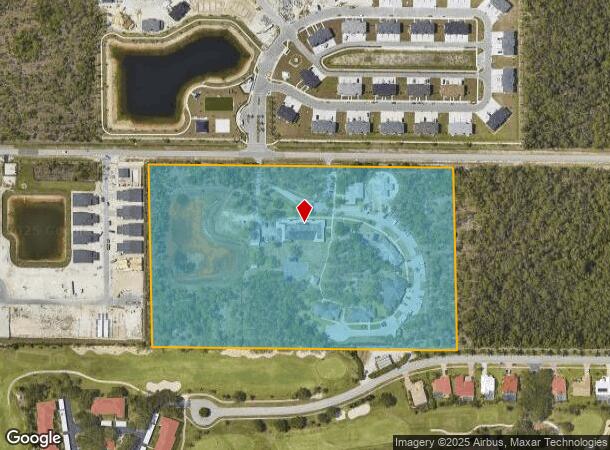
5867 Whitaker Rd
00427160002
Acreage Header
Orphanage
17 50 26 COM NE COR SEC 17 50 26, S0 10 19W 694.42FT, N89 0 59W 933.72FT, POB S0 1 1W 635.27FT,N89 5 25W 1063.66FT, N0 12 49W 636.69FT, S89 0 59E 1066.25FT POB LESS R/W
AE
Collier
12021C0601J
Florida
0
15.55 AC
2025
East Naples
010515
Southwest Florida
27,899 SF
Naples-Marco Island, FL
DEMOGRAPHICS near 5867 Whitaker Rd
1 Mile
3 Mile
5 Mile
2024 Total Population
5,676
67,446
125,481
2029 Population
6,677
77,375
143,380
Pop Growth 2024-2029
+ 17.64%
+ 14.72%
+ 14.26%
Average Age
63
51
49
2024 Total Households
3,022
30,156
54,482
HH Growth 2024-2029
+ 17.41%
+ 14.65%
+ 14.35%
Median Household Inc
$80,895
$64,995
$66,573
Avg Household Size
1.80
2.10
2.20
2024 Avg HH Vehicles
1.00
2.00
2.00
Median Home Value
$234,630
$301,601
$339,401
Median Year Built
1994
1994
1995
Nearby Places
Map Layers
Map Styles
 Street
 Aerial
- Restaurants
- Banks
- Shops
- Fitness
- Groceries
PUBLIC TRANSPORTATION
AIRPORT
Southwest Florida International
DRIVE
WALK
Distance
Southwest Florida International
48 min
35.2 mi
Freight Ports
Port of Miami
DRIVE
WALK
Distance
Port of Miami
147 min
122.1 mi
Nearby Properties
Address
Land Use
TOTAL SIZE
Lot Size
Zoning
Address
Land Use
TOTAL SIZE
Lot Size
Zoning
1,429,641 SF
45.28 AC
P
Address
Land Use
TOTAL SIZE
Lot Size
Zoning
368,003 SF
34.19 AC
PUD
Address
Land Use
TOTAL SIZE
Lot Size
Zoning
484,174 SF
38.74 AC
Address
Land Use
TOTAL SIZE
Lot Size
Zoning
359,711 SF
14.89 AC
Address
Land Use
TOTAL SIZE
Lot Size
Zoning
362,032 SF
15.97 AC
PUD
Address
Land Use
TOTAL SIZE
Lot Size
Zoning
378,021 SF
18.99 AC
PUD
Address
Land Use
TOTAL SIZE
Lot Size
Zoning
305,545 SF
60 AC
A
Address
Land Use
TOTAL SIZE
Lot Size
Zoning
340,436 SF
18.10 AC
PUD
Address
Land Use
TOTAL SIZE
Lot Size
Zoning
368,668 SF
36.96 AC
PUD
Address
Land Use
TOTAL SIZE
Lot Size
Zoning
140,512 SF
12.10 AC
PUD
Address
Land Use
TOTAL SIZE
Lot Size
Zoning
279,871 SF
11.52 AC
Address
Land Use
TOTAL SIZE
Lot Size
Zoning
371,884 SF
22.64 AC
MPUD
Address
Land Use
TOTAL SIZE
Lot Size
Zoning
351,576 SF
17.79 AC
PUD
Address
Land Use
TOTAL SIZE
Lot Size
Zoning
170,126 SF
50 AC
PUD
Address
Land Use
TOTAL SIZE
Lot Size
Zoning
58,639 SF
20 AC
PUD
Address
Land Use
TOTAL SIZE
Lot Size
Zoning
285,739 SF
50 AC
A
Address
Land Use
TOTAL SIZE
Lot Size
Zoning
70,944 SF
9.51 AC
P
Address
Land Use
TOTAL SIZE
Lot Size
Zoning
168,247 SF
25.60 AC
RMF-6
Address
Land Use
TOTAL SIZE
Lot Size
Zoning
240,746 SF
30.45 AC
PUD
Address
Land Use
TOTAL SIZE
Lot Size
Zoning
200,272 SF
7.40 AC
PUD
Address
Land Use
TOTAL SIZE
Lot Size
Zoning
122,803 SF
27.48 AC
PUD
Address
Land Use
TOTAL SIZE
Lot Size
Zoning
98,859 SF
22 AC
PUD
Address
Land Use
TOTAL SIZE
Lot Size
Zoning
106,904 SF
24.56 AC
PUD
Address
Land Use
TOTAL SIZE
Lot Size
Zoning
100,588 SF
24 AC
PUD
Address
Land Use
TOTAL SIZE
Lot Size
Zoning
141,042 SF
17.69 AC
RMF-6
Address
Land Use
TOTAL SIZE
Lot Size
Zoning
85,944 SF
11.81 AC
Address
Land Use
TOTAL SIZE
Lot Size
Zoning
122,611 SF
6.15 AC
PUD
Address
Land Use
TOTAL SIZE
Lot Size
Zoning
191,660 SF
18.87 AC
PUD
Address
Land Use
TOTAL SIZE
Lot Size
Zoning
157,089 SF
6.63 AC
PUD
Address
Land Use
TOTAL SIZE
Lot Size
Zoning
217,721 SF
19.88 AC
PUD
The World's #1 Commercial Real Estate Marketplace
Connect with us
© 2026 CoStar Group
The information above has been obtained from sources believed reliable. While we do not doubt its accuracy we have not verified it and make no guarantee, warranty or representation about it. It is your responsibility to independently confirm its accuracy and completeness. Any projections, opinions, assumptions, or estimates used are for example only and do not represent the current or future performance of the property. The value of this transaction to you depends on tax and other factors which should be evaluated by your tax, financial, and legal advisors. You and your advisors should conduct a careful, independent investigation of the property to determine to your satisfaction the suitability of the property for your needs.