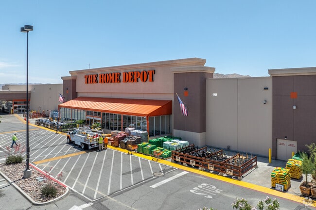
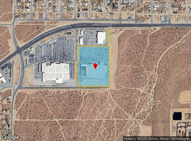
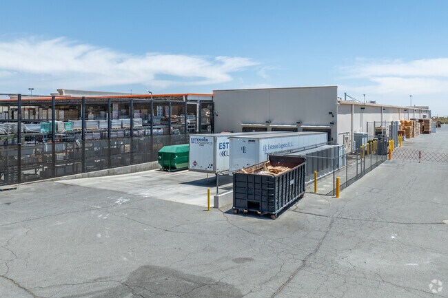
Property Record
58705 29 Palms Hwy, Yucca Valley, CA 92284
NEARBY LISTINGS FOR SALE OR LEASE
Property Detail
58705 29 Palms Hwy
0601-201-45
PARCEL MAP 17455 PARCEL 1 BOOK 228 PAGE 95
Storebuilding
San Bernardino
X
California
06071C8120H
13.07 AC
2024
Twentynine Palms
2025
Inland Empire (California)
010429
Riverside-San Bernardino-Ontario, CA
102,500 SF
DEMOGRAPHICS near 58705 29 Palms Hwy
1 Mile
3 Mile
5 Mile
2024 Total Population
2,560
14,918
32,625
2029 Population
2,648
15,405
33,777
Pop Growth 2024-2029
+ 3.44%
+ 3.26%
+ 3.53%
Average Age
39
41
42
2024 Total Households
961
5,905
13,358
HH Growth 2024-2029
+ 3.43%
+ 3.29%
+ 3.58%
Median Household Inc
$60,294
$67,049
$59,310
Avg Household Size
2.60
2.50
2.40
2024 Avg HH Vehicles
2.00
2.00
2.00
Median Home Value
$199,458
$296,158
$307,476
Median Year Built
1979
1981
1980
Nearby Places
Map Layers
Map Styles
 Street
 Aerial
- Restaurants
- Banks
- Shops
- Fitness
- Groceries
PUBLIC TRANSPORTATION
AIRPORT
Palm Springs International
DRIVE
WALK
Distance
Palm Springs International
48 min
33.8 mi
Freight Ports
Port of Long Beach
DRIVE
WALK
Distance
Port of Long Beach
160 min
125.7 mi
Nearby Properties
Address
Land Use
TOTAL SIZE
Lot Size
Zoning
Address
Land Use
TOTAL SIZE
Lot Size
Zoning
196,781 SF
23.85 AC
Address
Land Use
TOTAL SIZE
Lot Size
Zoning
178,083 SF
1.75 AC
Address
Land Use
TOTAL SIZE
Lot Size
Zoning
51,455 SF
2.83 AC
Address
Land Use
TOTAL SIZE
Lot Size
Zoning
31,345 SF
10.12 AC
Address
Land Use
TOTAL SIZE
Lot Size
Zoning
104,442 SF
7.29 AC
Address
Land Use
TOTAL SIZE
Lot Size
Zoning
17,299 SF
1.74 AC
Address
Land Use
TOTAL SIZE
Lot Size
Zoning
45,139 SF
3.67 AC
Address
Land Use
TOTAL SIZE
Lot Size
Zoning
19,950 SF
1.57 AC
Address
Land Use
TOTAL SIZE
Lot Size
Zoning
41,321 SF
1.83 AC
Address
Land Use
TOTAL SIZE
Lot Size
Zoning
89,981 SF
8.08 AC
Address
Land Use
TOTAL SIZE
Lot Size
Zoning
20,485 SF
2.39 AC
Address
Land Use
TOTAL SIZE
Lot Size
Zoning
50,784 SF
11.37 AC
Address
Land Use
TOTAL SIZE
Lot Size
Zoning
10,399 SF
22.87 AC
Address
Land Use
TOTAL SIZE
Lot Size
Zoning
14,285 SF
1.52 AC
Address
Land Use
TOTAL SIZE
Lot Size
Zoning
46,334 SF
2.20 AC
Address
Land Use
TOTAL SIZE
Lot Size
Zoning
52,500 SF
2.97 AC
926
Address
Land Use
TOTAL SIZE
Lot Size
Zoning
24,693 SF
2.31 AC
Address
Land Use
TOTAL SIZE
Lot Size
Zoning
7,668 SF
0.99 AC
Address
Land Use
TOTAL SIZE
Lot Size
Zoning
17,422 SF
2.40 AC
Address
Land Use
TOTAL SIZE
Lot Size
Zoning
32,900 SF
4.18 AC
Address
Land Use
TOTAL SIZE
Lot Size
Zoning
40,000 SF
3.03 AC
Address
Land Use
TOTAL SIZE
Lot Size
Zoning
18,124 SF
1.07 AC
Address
Land Use
TOTAL SIZE
Lot Size
Zoning
10,064 SF
0.88 AC
Address
Land Use
TOTAL SIZE
Lot Size
Zoning
17,422 SF
2.36 AC
Address
Land Use
TOTAL SIZE
Lot Size
Zoning
22,981 SF
2.02 AC
Address
Land Use
TOTAL SIZE
Lot Size
Zoning
43,920 SF
4.38 AC
Address
Land Use
TOTAL SIZE
Lot Size
Zoning
13,696 SF
2.13 AC
Address
Land Use
TOTAL SIZE
Lot Size
Zoning
4,264 SF
0.60 AC
Address
Land Use
TOTAL SIZE
Lot Size
Zoning
12,060 SF
4.92 AC
The World's #1 Commercial Real Estate Marketplace
Connect with us
© 2026 CoStar Group
The information above has been obtained from sources believed reliable. While we do not doubt its accuracy we have not verified it and make no guarantee, warranty or representation about it. It is your responsibility to independently confirm its accuracy and completeness. Any projections, opinions, assumptions, or estimates used are for example only and do not represent the current or future performance of the property. The value of this transaction to you depends on tax and other factors which should be evaluated by your tax, financial, and legal advisors. You and your advisors should conduct a careful, independent investigation of the property to determine to your satisfaction the suitability of the property for your needs.