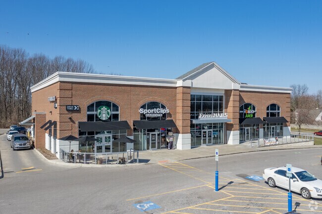
Property Record
5880 Som Center Rd, Willoughby, OH 44094


NEARBY LISTINGS FOR SALE OR LEASE
Property Detail
5880 Som Center Rd
Cleveland-Elyria, OH
Halle Estates
27-A-003-D-00-020
LOT 4 TRACT 11 BLOCK B
Regionalshoppingcenterormallwithanchorstore
Lake
X
Ohio
39035C0102E
4
2025
2 AC
2025
Northeast
201200
Cleveland
10,000 SF
DEMOGRAPHICS near 5880 Som Center Rd
1 Mile
3 Mile
5 Mile
2024 Total Population
10,137
59,264
131,142
2029 Population
10,167
59,069
130,445
Pop Growth 2024-2029
+ 0.30%
(0.33%)
(0.53%)
Average Age
45
43
43
2024 Total Households
5,118
27,439
60,014
HH Growth 2024-2029
+ 0.33%
(0.28%)
(0.48%)
Median Household Inc
$64,031
$65,346
$60,096
Avg Household Size
2.00
2.10
2.10
2024 Avg HH Vehicles
1.00
2.00
2.00
Median Home Value
$165,492
$159,318
$164,796
Median Year Built
1972
1960
1962
Nearby Places
Map Layers
Map Styles
 Street
 Aerial
- Restaurants
- Banks
- Shops
- Fitness
- Groceries
PUBLIC TRANSPORTATION
AIRPORT
Cleveland-Hopkins International
DRIVE
WALK
Distance
Cleveland-Hopkins International
44 min
30.8 mi
Freight Ports
Port of Toledo
DRIVE
WALK
Distance
Port of Toledo
157 min
131.2 mi
SALE & LEASE HISTORY
LISTING DATE
SALE/LEASE

May 01, 2018
For Lease
Mar 21, 2017
For Lease
Nearby Properties
Address
Land Use
TOTAL SIZE
Lot Size
Zoning
Address
Land Use
TOTAL SIZE
Lot Size
Zoning
494,378 SF
11.54 AC
R-MFL
Address
Land Use
TOTAL SIZE
Lot Size
Zoning
208,119 SF
72.98 AC
1-R
Address
Land Use
TOTAL SIZE
Lot Size
Zoning
311,955 SF
31.16 AC
S-CMF
Address
Land Use
TOTAL SIZE
Lot Size
Zoning
332,457 SF
15.93 AC
Address
Land Use
TOTAL SIZE
Lot Size
Zoning
300,691 SF
36.39 AC
1R
Address
Land Use
TOTAL SIZE
Lot Size
Zoning
392,586 SF
6.50 AC
M
Address
Land Use
TOTAL SIZE
Lot Size
Zoning
92,659 SF
4.25 AC
M
Address
Land Use
TOTAL SIZE
Lot Size
Zoning
263,441 SF
17.18 AC
I
Address
Land Use
TOTAL SIZE
Lot Size
Zoning
417,806 SF
28.90 AC
Address
Land Use
TOTAL SIZE
Lot Size
Zoning
75,843 SF
10.23 AC
B
Address
Land Use
TOTAL SIZE
Lot Size
Zoning
71,569 SF
5.74 AC
M
Address
Land Use
TOTAL SIZE
Lot Size
Zoning
272,400 SF
1.07 AC
U2D
Address
Land Use
TOTAL SIZE
Lot Size
Zoning
53,637 SF
13.45 AC
G-BUS
Address
Land Use
TOTAL SIZE
Lot Size
Zoning
65,558 SF
8.80 AC
M
Address
Land Use
TOTAL SIZE
Lot Size
Zoning
54,671 SF
3.72 AC
R
Address
Land Use
TOTAL SIZE
Lot Size
Zoning
113,801 SF
8.48 AC
I
Address
Land Use
TOTAL SIZE
Lot Size
Zoning
246,997 SF
10 AC
R-100
Address
Land Use
TOTAL SIZE
Lot Size
Zoning
136,722 SF
10.25 AC
GB
Address
Land Use
TOTAL SIZE
Lot Size
Zoning
164,666 SF
8 AC
R-100
Address
Land Use
TOTAL SIZE
Lot Size
Zoning
163,353 SF
12.43 AC
R-BUS
Address
Land Use
TOTAL SIZE
Lot Size
Zoning
40,034 SF
3.74 AC
M
Address
Land Use
TOTAL SIZE
Lot Size
Zoning
174,098 SF
20.51 AC
U-1
Address
Land Use
TOTAL SIZE
Lot Size
Zoning
85,426 SF
10.65 AC
R
Address
Land Use
TOTAL SIZE
Lot Size
Zoning
431,066 SF
6.15 AC
I
Address
Land Use
TOTAL SIZE
Lot Size
Zoning
111,819 SF
14.13 AC
Address
Land Use
TOTAL SIZE
Lot Size
Zoning
123,129 SF
11.29 AC
R
Address
Land Use
TOTAL SIZE
Lot Size
Zoning
70,192 SF
4.11 AC
1-R
Address
Land Use
TOTAL SIZE
Lot Size
Zoning
122,130 SF
9.51 AC
Address
Land Use
TOTAL SIZE
Lot Size
Zoning
135,414 SF
4 AC
Address
Land Use
TOTAL SIZE
Lot Size
Zoning
151,690 SF
15.39 AC
The World's #1 Commercial Real Estate Marketplace
Connect with us
© 2026 CoStar Group
The information above has been obtained from sources believed reliable. While we do not doubt its accuracy we have not verified it and make no guarantee, warranty or representation about it. It is your responsibility to independently confirm its accuracy and completeness. Any projections, opinions, assumptions, or estimates used are for example only and do not represent the current or future performance of the property. The value of this transaction to you depends on tax and other factors which should be evaluated by your tax, financial, and legal advisors. You and your advisors should conduct a careful, independent investigation of the property to determine to your satisfaction the suitability of the property for your needs.