Property Record
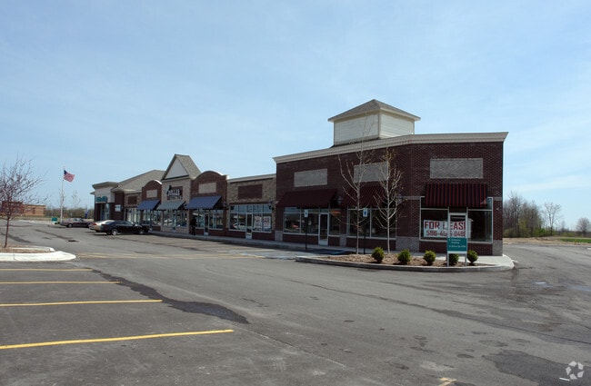
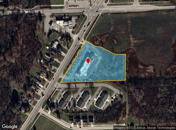
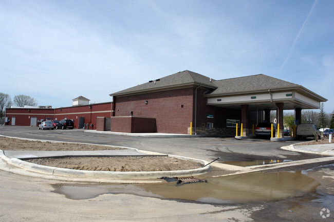
58808 Gratiot Ave, New Haven, MI 48048
NEARBY LISTINGS FOR SALE OR LEASE
-
-
View all New Haven listings for sale on LoopNet.com
Property Detail
58808 Gratiot Ave
26-06-34-126-009
T4N R14E SEC 34; COMM AT N 1/4 SEC 34; TH S00*04'34W 716.64 FT; TH S89*47'31"W 664.37 FT TO POB; TH N00*12'29"E 266.03 FT; TH
Centrallyassessed
Macomb
X
Michigan
26099C0256G
4.05 AC
2025
St Clair & Lapeer Counties
2025
Detroit
218001
Detroit-Warren-Dearborn, MI
13,145 SF
DEMOGRAPHICS near 58808 Gratiot Ave
1 Mile
3 Mile
5 Mile
2024 Total Population
7,176
17,087
58,867
2029 Population
7,225
17,099
58,764
Pop Growth 2024-2029
+ 0.68%
+ 0.07%
(0.17%)
Average Age
35
38
40
2024 Total Households
2,167
5,509
22,008
HH Growth 2024-2029
+ 0.78%
+ 0.05%
(0.14%)
Median Household Inc
$59,941
$71,500
$76,622
Avg Household Size
3.00
2.80
2.60
2024 Avg HH Vehicles
2.00
2.00
2.00
Median Home Value
$171,116
$218,113
$248,281
Median Year Built
2004
2000
1995
Nearby Places
Map Layers
Map Styles
 Street
 Aerial
- Restaurants
- Banks
- Shops
- Fitness
- Groceries
PUBLIC TRANSPORTATION
AIRPORT
Windsor International
DRIVE
WALK
Distance
Windsor International
69 min
45.6 mi
Nearby Properties
Address
Land Use
TOTAL SIZE
Lot Size
Zoning
Address
Land Use
TOTAL SIZE
Lot Size
Zoning
115,695 SF
Address
Land Use
TOTAL SIZE
Lot Size
Zoning
316,907 SF
21.18 AC
M2 GEN
Address
Land Use
TOTAL SIZE
Lot Size
Zoning
2,520 SF
712.24 AC
AG
Address
Land Use
TOTAL SIZE
Lot Size
Zoning
210,688 SF
20.13 AC
CG
Address
Land Use
TOTAL SIZE
Lot Size
Zoning
179,250 SF
26.35 AC
M2 GEN
Address
Land Use
TOTAL SIZE
Lot Size
Zoning
7,262 SF
127.87 AC
MH
Address
Land Use
TOTAL SIZE
Lot Size
Zoning
89,620 SF
17.89 AC
Address
Land Use
TOTAL SIZE
Lot Size
Zoning
3,799 SF
56.46 AC
MH
Address
Land Use
TOTAL SIZE
Lot Size
Zoning
26,578 SF
31.52 AC
IR
Address
Land Use
TOTAL SIZE
Lot Size
Zoning
88,116 SF
5.66 AC
IO
Address
Land Use
TOTAL SIZE
Lot Size
Zoning
10,297 SF
1.91 AC
AG
Address
Land Use
TOTAL SIZE
Lot Size
Zoning
30,878 SF
5.32 AC
IO
Address
Land Use
TOTAL SIZE
Lot Size
Zoning
55,821 SF
M2 GEN
Address
Land Use
TOTAL SIZE
Lot Size
Zoning
15,788 SF
4.28 AC
CG
Address
Land Use
TOTAL SIZE
Lot Size
Zoning
58,392 SF
3.66 AC
M1 LIG
Address
Land Use
TOTAL SIZE
Lot Size
Zoning
82,370 SF
19.14 AC
M2 GEN
Address
Land Use
TOTAL SIZE
Lot Size
Zoning
19,280 SF
3.97 AC
M2 GEN
Address
Land Use
TOTAL SIZE
Lot Size
Zoning
85,097 SF
4.87 AC
M2 GEN
Address
Land Use
TOTAL SIZE
Lot Size
Zoning
21,944 SF
131.37 AC
CG
Address
Land Use
TOTAL SIZE
Lot Size
Zoning
18,905 SF
6.40 AC
RO
Address
Land Use
TOTAL SIZE
Lot Size
Zoning
3,418 SF
60 AC
CG
Address
Land Use
TOTAL SIZE
Lot Size
Zoning
32,476 SF
Address
Land Use
TOTAL SIZE
Lot Size
Zoning
3,927 SF
85.22 AC
MF
Address
Land Use
TOTAL SIZE
Lot Size
Zoning
26,578 SF
22.50 AC
Address
Land Use
TOTAL SIZE
Lot Size
Zoning
20,434 SF
2.89 AC
SF II
Address
Land Use
TOTAL SIZE
Lot Size
Zoning
49,682 SF
6.31 AC
M2 GEN
Address
Land Use
TOTAL SIZE
Lot Size
Zoning
68,000 SF
10.54 AC
CC
Address
Land Use
TOTAL SIZE
Lot Size
Zoning
5,682 SF
47.12 AC
RT
Address
Land Use
TOTAL SIZE
Lot Size
Zoning
27,720 SF
19.14 AC
M2 GEN
The World's #1 Commercial Real Estate Marketplace
Connect with us
© 2026 CoStar Group
The information above has been obtained from sources believed reliable. While we do not doubt its accuracy we have not verified it and make no guarantee, warranty or representation about it. It is your responsibility to independently confirm its accuracy and completeness. Any projections, opinions, assumptions, or estimates used are for example only and do not represent the current or future performance of the property. The value of this transaction to you depends on tax and other factors which should be evaluated by your tax, financial, and legal advisors. You and your advisors should conduct a careful, independent investigation of the property to determine to your satisfaction the suitability of the property for your needs.