Property Record
5890 Salem Rd, Covington, GA 30016
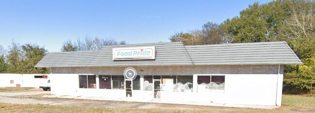
Property Detail
5890 Salem Rd
0028000000076000
0.60 AC SALEM RD
Conveniencestore
Newton
C1
Georgia
B and X Area of moderate flood hazard, usually the area between the limits of the 100-year and 500-year floods.
0.60 AC
2025
Lithonia/Conyers
2025
Atlanta
100507
Atlanta-Sandy Springs-Roswell, GA
7,452 SF
NEARBY LISTINGS FOR SALE OR LEASE
-
-
View all Covington listings for sale on LoopNet.com
DEMOGRAPHICS near 5890 Salem Rd
1 mile
3 mile
5 mile
2025 Total Population
4,076
30,244
81,394
2030 Population
4,492
32,873
88,302
Pop Growth 2025-2030
+ 10.21%
+ 8.69%
+ 8.49%
Average Age
37
37
38
2025 Total Households
1,322
10,286
28,704
HH Growth 2025-2030
+ 10.29%
+ 8.79%
+ 8.63%
Median Household Inc
$68,183
$73,698
$73,406
Avg Household Size
3.00
2.90
2.80
2025 Avg HH Vehicles
2.00
2.00
2.00
Median Home Value
$248,575
$249,649
$257,684
Median Year Built
2003
2000
1998
Nearby Places
Map Layers
Map Styles
 Street
 Aerial
Layers
 Traffic
 Biking
Places
Listings with unknown addresses are not visible on the map
- Restaurants
- Banks
- Shops
- Fitness
- Groceries
PUBLIC TRANSPORTATION
AIRPORT
Hartsfield - Jackson Atlanta International
Drive
Walk
Distance
Hartsfield - Jackson Atlanta International
53 min
37.8 mi
Freight Ports
Georgia Ports - Savannah
Drive
Walk
Distance
Georgia Ports - Savannah
268 min
225.0 mi
Nearby Properties
Address
Land Use
TOTAL SIZE
Lot Size
Zoning
Address
Land Use
TOTAL SIZE
Lot Size
Zoning
1,158,095 SF
161.26 AC
Address
Land Use
TOTAL SIZE
Lot Size
Zoning
1,158,095 SF
0.01 AC
Address
Land Use
TOTAL SIZE
Lot Size
Zoning
306,886 SF
118.50 AC
R2
Address
Land Use
TOTAL SIZE
Lot Size
Zoning
19,292 SF
8.20 AC
H1
Address
Land Use
TOTAL SIZE
Lot Size
Zoning
92,162 SF
11.21 AC
R2
Address
Land Use
TOTAL SIZE
Lot Size
Zoning
5,160 SF
45.17 AC
C1
Address
Land Use
TOTAL SIZE
Lot Size
Zoning
82,716 SF
21.04 AC
R2
Address
Land Use
TOTAL SIZE
Lot Size
Zoning
65,008 SF
23.81 AC
R2
Address
Land Use
TOTAL SIZE
Lot Size
Zoning
151,955 SF
26.17 AC
R1
Address
Land Use
TOTAL SIZE
Lot Size
Zoning
64,799 SF
19.10 AC
E6
Address
Land Use
TOTAL SIZE
Lot Size
Zoning
4,768 SF
263.26 AC
C1
Address
Land Use
TOTAL SIZE
Lot Size
Zoning
54,712 SF
54.54 AC
E6
Address
Land Use
TOTAL SIZE
Lot Size
Zoning
66,660 SF
12.80 AC
C1
Address
Land Use
TOTAL SIZE
Lot Size
Zoning
65,360 SF
20 AC
E6
Address
Land Use
TOTAL SIZE
Lot Size
Zoning
36,615 SF
9.78 AC
E2
Address
Land Use
TOTAL SIZE
Lot Size
Zoning
58,892 SF
17.52 AC
E6
Address
Land Use
TOTAL SIZE
Lot Size
Zoning
311,423 SF
20.78 AC
I1
Address
Land Use
TOTAL SIZE
Lot Size
Zoning
331.12 AC
AR
Address
Land Use
TOTAL SIZE
Lot Size
Zoning
4,576 SF
1.46 AC
Address
Land Use
TOTAL SIZE
Lot Size
Zoning
10,714 SF
1.87 AC
Address
Land Use
TOTAL SIZE
Lot Size
Zoning
11,862 SF
1.76 AC
C1
Address
Land Use
TOTAL SIZE
Lot Size
Zoning
14,328 SF
1.20 AC
C1
Address
Land Use
TOTAL SIZE
Lot Size
Zoning
292.79 AC
AR
Address
Land Use
TOTAL SIZE
Lot Size
Zoning
2,858 SF
11 AC
R1
Address
Land Use
TOTAL SIZE
Lot Size
Zoning
383.52 AC
Address
Land Use
TOTAL SIZE
Lot Size
Zoning
2,120 SF
229.12 AC
AR
Address
Land Use
TOTAL SIZE
Lot Size
Zoning
30,456 SF
6.99 AC
R2
Address
Land Use
TOTAL SIZE
Lot Size
Zoning
672 SF
5.13 AC
E1
Address
Land Use
TOTAL SIZE
Lot Size
Zoning
8,000 SF
2.38 AC
C1
Address
Land Use
TOTAL SIZE
Lot Size
Zoning
394.98 AC
AR
The World's #1 Commercial Real Estate Marketplace
Connect with us
© 2026 CoStar Group
The information above has been obtained from sources believed reliable. While we do not doubt its accuracy we have not verified it and make no guarantee, warranty or representation about it. It is your responsibility to independently confirm its accuracy and completeness. Any projections, opinions, assumptions, or estimates used are for example only and do not represent the current or future performance of the property. The value of this transaction to you depends on tax and other factors which should be evaluated by your tax, financial, and legal advisors. You and your advisors should conduct a careful, independent investigation of the property to determine to your satisfaction the suitability of the property for your needs.