Property Record
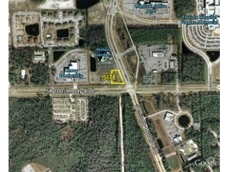
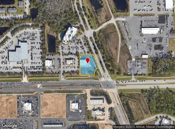
5890 E State Highway 100 E, Palm Coast, FL 32164

NEARBY LISTINGS FOR SALE OR LEASE
Property Detail
5890 E State Highway 100 E
Deltona-Daytona Beach-Ormond Beach, FL
100/Town Center
08-12-31-5816-00000-0030
100/TOWN CENTER MB 36 PG 84 LOT 3 (1.08 AC) OR 1619/825 OR 2403/570 OR 2404/1885
Regionalshoppingcenterormallwithanchorstore
Flagler
X
Florida
12035C0230E
3
2023
1.08 AC
2024
Daytona Area
060213
Other Market Areas
8,059 SF
DEMOGRAPHICS near 5890 E State Highway 100 E
1 Mile
3 Mile
5 Mile
2024 Total Population
1,950
20,235
65,969
2029 Population
2,442
24,906
80,782
Pop Growth 2024-2029
+ 25.23%
+ 23.08%
+ 22.45%
Average Age
45
45
47
2024 Total Households
989
8,234
26,857
HH Growth 2024-2029
+ 24.67%
+ 22.43%
+ 21.69%
Median Household Inc
$29,596
$59,081
$63,252
Avg Household Size
2.00
2.40
2.40
2024 Avg HH Vehicles
1.00
2.00
2.00
Median Home Value
$263,559
$263,196
$269,838
Median Year Built
2010
2005
2002
Nearby Places
- Restaurants
- Banks
- Shops
- Fitness
- Groceries
PUBLIC TRANSPORTATION
AIRPORT
Daytona Beach International
DRIVE
WALK
Distance
Daytona Beach International
33 min
25.2 mi
Freight Ports
Jacksonville Port
DRIVE
WALK
Distance
Jacksonville Port
84 min
71.3 mi
SALE & LEASE HISTORY
LISTING DATE
SALE/LEASE

Sep 24, 2016
For Sale
Sep 24, 2016
For Sale
Feb 15, 2019
For Sale
Nearby Properties
Address
Land Use
TOTAL SIZE
Lot Size
Zoning
Address
Land Use
TOTAL SIZE
Lot Size
Zoning
298,912 SF
94.85 AC
COM-2
Address
Land Use
TOTAL SIZE
Lot Size
Zoning
4,984 SF
85.53 AC
PSP
Address
Land Use
TOTAL SIZE
Lot Size
Zoning
215,542 SF
1,165.37 AC
I-C
Address
Land Use
TOTAL SIZE
Lot Size
Zoning
280,742 SF
16.06 AC
MPD
Address
Land Use
TOTAL SIZE
Lot Size
Zoning
225,108 SF
41.71 AC
MPD
Address
Land Use
TOTAL SIZE
Lot Size
Zoning
90,371 SF
15.71 AC
PUD
Address
Land Use
TOTAL SIZE
Lot Size
Zoning
141,171 SF
8.18 AC
MPD
Address
Land Use
TOTAL SIZE
Lot Size
Zoning
58,708 SF
8.41 AC
PSP
Address
Land Use
TOTAL SIZE
Lot Size
Zoning
904.63 AC
PUD
Address
Land Use
TOTAL SIZE
Lot Size
Zoning
76,544 SF
48.85 AC
R/C
Address
Land Use
TOTAL SIZE
Lot Size
Zoning
459,150 SF
23.52 AC
COM-3
Address
Land Use
TOTAL SIZE
Lot Size
Zoning
15.91 AC
PSP
Address
Land Use
TOTAL SIZE
Lot Size
Zoning
220,314 SF
17.41 AC
MPD
Address
Land Use
TOTAL SIZE
Lot Size
Zoning
82,459 SF
4.09 AC
MPD
Address
Land Use
TOTAL SIZE
Lot Size
Zoning
122,353 SF
17.97 AC
MPD
Address
Land Use
TOTAL SIZE
Lot Size
Zoning
45.82 AC
C-2
Address
Land Use
TOTAL SIZE
Lot Size
Zoning
96.56 AC
MPD
Address
Land Use
TOTAL SIZE
Lot Size
Zoning
68,684 SF
9.68 AC
MPD
Address
Land Use
TOTAL SIZE
Lot Size
Zoning
89,590 SF
9.90 AC
B-1
Address
Land Use
TOTAL SIZE
Lot Size
Zoning
42,025 SF
15.64 AC
MPD
Address
Land Use
TOTAL SIZE
Lot Size
Zoning
112,500 SF
5 AC
HC
Address
Land Use
TOTAL SIZE
Lot Size
Zoning
84,082 SF
10.35 AC
COM-2
Address
Land Use
TOTAL SIZE
Lot Size
Zoning
28,643 SF
8.45 AC
COM-3
Address
Land Use
TOTAL SIZE
Lot Size
Zoning
59,889 SF
0.75 AC
R-3A
Address
Land Use
TOTAL SIZE
Lot Size
Zoning
28,591 SF
3.84 AC
PUD
Address
Land Use
TOTAL SIZE
Lot Size
Zoning
20,990 SF
18.10 AC
Address
Land Use
TOTAL SIZE
Lot Size
Zoning
117.21 AC
AC
Address
Land Use
TOTAL SIZE
Lot Size
Zoning
50,497 SF
9.74 AC
MPD
The World's #1 Commercial Real Estate Marketplace
Connect with us
© 2025 CoStar Group
The information above has been obtained from sources believed reliable. While we do not doubt its accuracy we have not verified it and make no guarantee, warranty or representation about it. It is your responsibility to independently confirm its accuracy and completeness. Any projections, opinions, assumptions, or estimates used are for example only and do not represent the current or future performance of the property. The value of this transaction to you depends on tax and other factors which should be evaluated by your tax, financial, and legal advisors. You and your advisors should conduct a careful, independent investigation of the property to determine to your satisfaction the suitability of the property for your needs.