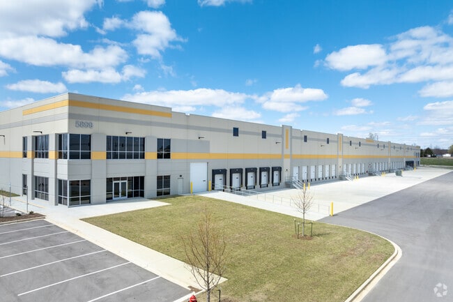
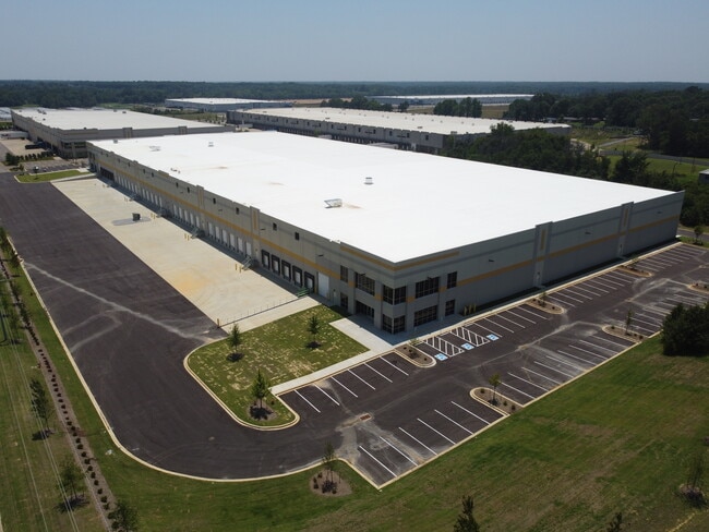
Property Record
5899 Fedex Ln, Olive Branch, MS 38654

Current Lease Availabilities
NEARBY LISTINGS FOR SALE OR LEASE
Property Detail
5899 Fedex Ln
Memphis, TN-MS-AR
Prologis Park 1St Rev Lot 1
2062040500000101
PROLOGIS PARK DESOTO 1ST REV LOT 1A
Warehouse
DeSoto
X
Mississippi
28033C0104H
1a
2025
11.29 AC
2025
DeSoto
070821
Memphis
193,842 SF
DEMOGRAPHICS near 5899 Fedex Ln
1 Mile
3 Mile
5 Mile
2024 Total Population
1,912
30,889
69,600
2029 Population
2,100
33,652
74,262
Pop Growth 2024-2029
+ 9.83%
+ 8.94%
+ 6.70%
Average Age
42
39
39
2024 Total Households
803
11,197
24,892
HH Growth 2024-2029
+ 9.71%
+ 8.96%
+ 6.66%
Median Household Inc
$80,102
$79,937
$81,764
Avg Household Size
2.30
2.70
2.80
2024 Avg HH Vehicles
2.00
2.00
2.00
Median Home Value
$253,896
$237,991
$244,763
Median Year Built
1996
1997
1997
Nearby Places
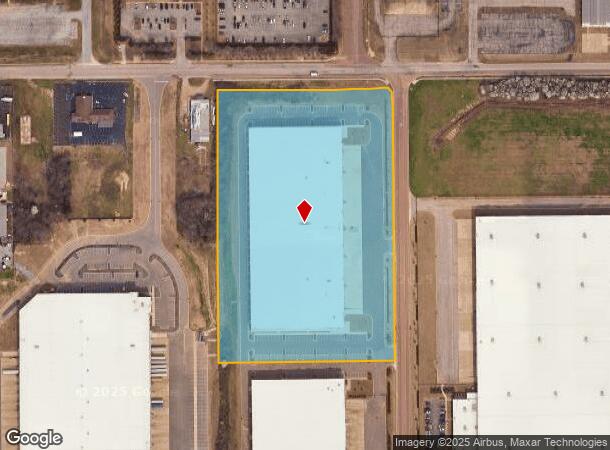
Map Layers
Map Styles
 Street
 Aerial
- Restaurants
- Banks
- Shops
- Fitness
- Groceries
PUBLIC TRANSPORTATION
AIRPORT
Memphis International
DRIVE
WALK
Distance
Memphis International
23 min
14.7 mi
Freight Ports
Port of Shreveport
DRIVE
WALK
Distance
Port of Shreveport
428 min
388.4 mi
Nearby Properties
Address
Land Use
TOTAL SIZE
Lot Size
Zoning
Address
Land Use
TOTAL SIZE
Lot Size
Zoning
864,054 SF
72.19 AC
M-1
Address
Land Use
TOTAL SIZE
Lot Size
Zoning
860,464 SF
54.55 AC
M-1
Address
Land Use
TOTAL SIZE
Lot Size
Zoning
693,680 SF
47.15 AC
M-1
Address
Land Use
TOTAL SIZE
Lot Size
Zoning
814,054 SF
51.14 AC
M-1
Address
Land Use
TOTAL SIZE
Lot Size
Zoning
390,874 SF
122.03 AC
M-1
Address
Land Use
TOTAL SIZE
Lot Size
Zoning
445,114 SF
32.34 AC
M-1
Address
Land Use
TOTAL SIZE
Lot Size
Zoning
27,669 SF
34.27 AC
R-4
Address
Land Use
TOTAL SIZE
Lot Size
Zoning
10,155 SF
26.43 AC
R-4
Address
Land Use
TOTAL SIZE
Lot Size
Zoning
368,608 SF
21.85 AC
M-1
Address
Land Use
TOTAL SIZE
Lot Size
Zoning
13,554 SF
15.32 AC
PUD
Address
Land Use
TOTAL SIZE
Lot Size
Zoning
329,096 SF
21.64 AC
M-1
Address
Land Use
TOTAL SIZE
Lot Size
Zoning
250,364 SF
13.72 AC
M-1
Address
Land Use
TOTAL SIZE
Lot Size
Zoning
11,097 SF
13.39 AC
PUD
Address
Land Use
TOTAL SIZE
Lot Size
Zoning
217,448 SF
19.07 AC
M-1
Address
Land Use
TOTAL SIZE
Lot Size
Zoning
218,400 SF
14.52 AC
M-1
Address
Land Use
TOTAL SIZE
Lot Size
Zoning
185,731 SF
18.49 AC
C-4
Address
Land Use
TOTAL SIZE
Lot Size
Zoning
44,445 SF
44 AC
C-3
Address
Land Use
TOTAL SIZE
Lot Size
Zoning
12,770 SF
Address
Land Use
TOTAL SIZE
Lot Size
Zoning
134,560 SF
15.87 AC
C-4
Address
Land Use
TOTAL SIZE
Lot Size
Zoning
46,297 SF
12.93 AC
PUD
Address
Land Use
TOTAL SIZE
Lot Size
Zoning
160,240 SF
23.89 AC
M-2
Address
Land Use
TOTAL SIZE
Lot Size
Zoning
104,717 SF
15.81 AC
C-4
Address
Land Use
TOTAL SIZE
Lot Size
Zoning
72,099 SF
3.97 AC
C-4
Address
Land Use
TOTAL SIZE
Lot Size
Zoning
181,300 SF
12.50 AC
M-1
Address
Land Use
TOTAL SIZE
Lot Size
Zoning
128,412 SF
8.08 AC
M-1
Address
Land Use
TOTAL SIZE
Lot Size
Zoning
78,000 SF
9.97 AC
M-1
Address
Land Use
TOTAL SIZE
Lot Size
Zoning
40,287 SF
10.74 AC
C-4
Address
Land Use
TOTAL SIZE
Lot Size
Zoning
119,796 SF
8.48 AC
M-1
Address
Land Use
TOTAL SIZE
Lot Size
Zoning
37,358 SF
2.51 AC
PUD
The World's #1 Commercial Real Estate Marketplace
Connect with us
© 2025 CoStar Group
The information above has been obtained from sources believed reliable. While we do not doubt its accuracy we have not verified it and make no guarantee, warranty or representation about it. It is your responsibility to independently confirm its accuracy and completeness. Any projections, opinions, assumptions, or estimates used are for example only and do not represent the current or future performance of the property. The value of this transaction to you depends on tax and other factors which should be evaluated by your tax, financial, and legal advisors. You and your advisors should conduct a careful, independent investigation of the property to determine to your satisfaction the suitability of the property for your needs.