Property Record
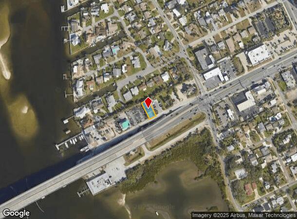
59 Dunlawton Ave, Port Orange, FL 32127


NEARBY LISTINGS FOR SALE OR LEASE
Property Detail
59 Dunlawton Ave
6302-00-00-0040
Dunlawton
Bartavern
W 50 FT OF E 400 FT OF S 129.12 FT ON W/L OF LAND N OF DUNLAWTON BLVD & W OF PENINSULA DR LYING OPPOSITE BLK G PORT ORANGE BEACH PER OR 1479 PG 0040 PER OR 2364 PG 1842 PER OR 5189 PG 3648 PER OR 6091 PG 1282 PER OR 7166 PG 4179 PER OR 7288 PG 3189 P
AE
Volusia
12127C0388J
Florida
2025
0.14 AC
2025
Coastal Daytona Beach
082605
Deltona/Daytona Beach
5,226 SF
Deltona-Daytona Beach-Ormond Beach, FL
DEMOGRAPHICS near 59 Dunlawton Ave
1 Mile
3 Mile
5 Mile
2024 Total Population
4,617
40,783
106,028
2029 Population
5,419
45,915
118,129
Pop Growth 2024-2029
+ 17.37%
+ 12.58%
+ 11.41%
Average Age
55
49
46
2024 Total Households
2,398
19,800
48,526
HH Growth 2024-2029
+ 17.81%
+ 12.97%
+ 11.94%
Median Household Inc
$66,314
$49,190
$52,128
Avg Household Size
1.90
2.00
2.10
2024 Avg HH Vehicles
1.00
2.00
2.00
Median Home Value
$365,760
$226,531
$233,120
Median Year Built
1983
1979
1982
Nearby Places
Map Layers
Map Styles
 Street
 Aerial
- Restaurants
- Banks
- Shops
- Fitness
- Groceries
PUBLIC TRANSPORTATION
AIRPORT
Daytona Beach International
DRIVE
WALK
Distance
Daytona Beach International
19 min
8.7 mi
Orlando Sanford International
DRIVE
WALK
Distance
Orlando Sanford International
59 min
40.4 mi
SALE & LEASE HISTORY
LISTING DATE
SALE/LEASE

Aug 21, 2017
For Sale
Nearby Properties
Address
Land Use
TOTAL SIZE
Lot Size
Zoning
Address
Land Use
TOTAL SIZE
Lot Size
Zoning
325,744 SF
12.23 AC
Address
Land Use
TOTAL SIZE
Lot Size
Zoning
269,133 SF
6.33 AC
Address
Land Use
TOTAL SIZE
Lot Size
Zoning
94,338 SF
7.39 AC
Address
Land Use
TOTAL SIZE
Lot Size
Zoning
9,952 SF
9.30 AC
16RMH
Address
Land Use
TOTAL SIZE
Lot Size
Zoning
9,061 SF
0.23 AC
16RMH
Address
Land Use
TOTAL SIZE
Lot Size
Zoning
3,886 SF
3.99 AC
16RMH
Address
Land Use
TOTAL SIZE
Lot Size
Zoning
Address
Land Use
TOTAL SIZE
Lot Size
Zoning
173,765 SF
0.32 AC
Address
Land Use
TOTAL SIZE
Lot Size
Zoning
9,833 SF
52.38 AC
16RMH
Address
Land Use
TOTAL SIZE
Lot Size
Zoning
131,376 SF
1.88 AC
03T
Address
Land Use
TOTAL SIZE
Lot Size
Zoning
212,782 SF
0.71 AC
Address
Land Use
TOTAL SIZE
Lot Size
Zoning
4,166 SF
51.05 AC
Address
Land Use
TOTAL SIZE
Lot Size
Zoning
157,147 SF
47.79 AC
16A
Address
Land Use
TOTAL SIZE
Lot Size
Zoning
327,223 SF
21.66 AC
Address
Land Use
TOTAL SIZE
Lot Size
Zoning
19,753 SF
1.17 AC
Address
Land Use
TOTAL SIZE
Lot Size
Zoning
109,265 SF
13.45 AC
Address
Land Use
TOTAL SIZE
Lot Size
Zoning
138,930 SF
13.70 AC
16PCD
Address
Land Use
TOTAL SIZE
Lot Size
Zoning
79,205 SF
1.13 AC
03T
Address
Land Use
TOTAL SIZE
Lot Size
Zoning
95,455 SF
1.45 AC
03T
Address
Land Use
TOTAL SIZE
Lot Size
Zoning
80,836 SF
3.03 AC
R3
Address
Land Use
TOTAL SIZE
Lot Size
Zoning
117,890 SF
11.97 AC
Address
Land Use
TOTAL SIZE
Lot Size
Zoning
111,559 SF
5.80 AC
Address
Land Use
TOTAL SIZE
Lot Size
Zoning
5,026 SF
28 AC
16RMH
Address
Land Use
TOTAL SIZE
Lot Size
Zoning
81,793 SF
1.66 AC
03T
Address
Land Use
TOTAL SIZE
Lot Size
Zoning
173,716 SF
6.76 AC
Address
Land Use
TOTAL SIZE
Lot Size
Zoning
1,940 SF
25.37 AC
Address
Land Use
TOTAL SIZE
Lot Size
Zoning
52,536 SF
1.29 AC
03T
Address
Land Use
TOTAL SIZE
Lot Size
Zoning
105,559 SF
19.97 AC
Address
Land Use
TOTAL SIZE
Lot Size
Zoning
87,320 SF
5.52 AC
Address
Land Use
TOTAL SIZE
Lot Size
Zoning
58,500 SF
1.75 AC
03T
The World's #1 Commercial Real Estate Marketplace
Connect with us
© 2025 CoStar Group
The information above has been obtained from sources believed reliable. While we do not doubt its accuracy we have not verified it and make no guarantee, warranty or representation about it. It is your responsibility to independently confirm its accuracy and completeness. Any projections, opinions, assumptions, or estimates used are for example only and do not represent the current or future performance of the property. The value of this transaction to you depends on tax and other factors which should be evaluated by your tax, financial, and legal advisors. You and your advisors should conduct a careful, independent investigation of the property to determine to your satisfaction the suitability of the property for your needs.