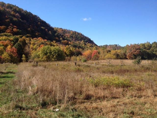
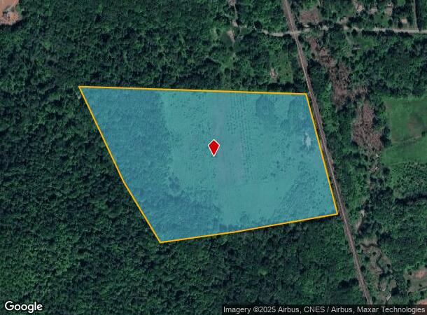
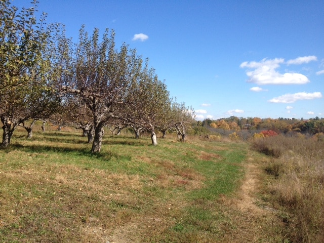
Property Record
59 Esopus Ave, Ulster Park, NY 12487
NEARBY LISTINGS FOR SALE OR LEASE
Property Detail
59 Esopus Ave
2200-071.002-0002-049.000-0000
Ulster
Orchard
New York
X
49.000
36111C0630E
44 AC
2025
Newburgh/Kingston
2024
Other Market Areas
952600
Kingston, NY
1,459 SF
DEMOGRAPHICS near 59 Esopus Ave
1 Mile
3 Mile
5 Mile
2024 Total Population
514
4,035
19,714
2029 Population
506
3,983
19,423
Pop Growth 2024-2029
(1.56%)
(1.29%)
(1.48%)
Average Age
44
45
45
2024 Total Households
186
1,405
7,805
HH Growth 2024-2029
(2.15%)
(1.64%)
(1.65%)
Median Household Inc
$119,444
$107,891
$83,917
Avg Household Size
2.30
2.20
2.30
2024 Avg HH Vehicles
2.00
2.00
2.00
Median Home Value
$352,631
$334,949
$285,752
Median Year Built
1957
1963
1968
Nearby Places
- Restaurants
- Banks
- Shops
- Fitness
- Groceries
PUBLIC TRANSPORTATION
AIRPORT
New York Stewart International
DRIVE
WALK
Distance
New York Stewart International
49 min
31.6 mi
SALE & LEASE HISTORY
LISTING DATE
SALE/LEASE

Sep 06, 2017
For Sale
Nearby Properties
Address
Land Use
TOTAL SIZE
Lot Size
Zoning
Address
Land Use
TOTAL SIZE
Lot Size
Zoning
123,500 SF
407 AC
RF1
Address
Land Use
TOTAL SIZE
Lot Size
Zoning
23,195 SF
142.20 AC
RF1
Address
Land Use
TOTAL SIZE
Lot Size
Zoning
133,760 SF
31.25 AC
LI
Address
Land Use
TOTAL SIZE
Lot Size
Zoning
64,597 SF
200.40 AC
R40
Address
Land Use
TOTAL SIZE
Lot Size
Zoning
28,774 SF
9.11 AC
PUD
Address
Land Use
TOTAL SIZE
Lot Size
Zoning
32,934 SF
3 AC
R40
Address
Land Use
TOTAL SIZE
Lot Size
Zoning
77,650 SF
4.20 AC
LI
Address
Land Use
TOTAL SIZE
Lot Size
Zoning
24,956 SF
100 AC
WF
Address
Land Use
TOTAL SIZE
Lot Size
Zoning
80,688 SF
86.88 AC
WF
Address
Land Use
TOTAL SIZE
Lot Size
Zoning
2,696 SF
101.80 AC
R40
Address
Land Use
TOTAL SIZE
Lot Size
Zoning
9,325 SF
4 AC
GC
Address
Land Use
TOTAL SIZE
Lot Size
Zoning
130.56 AC
RF1
Address
Land Use
TOTAL SIZE
Lot Size
Zoning
25,526 SF
5.60 AC
R40
Address
Land Use
TOTAL SIZE
Lot Size
Zoning
27,597 SF
8.76 AC
R40
Address
Land Use
TOTAL SIZE
Lot Size
Zoning
48,075 SF
3.30 AC
WF
Address
Land Use
TOTAL SIZE
Lot Size
Zoning
10,352 SF
9 AC
R40
Address
Land Use
TOTAL SIZE
Lot Size
Zoning
218.60 AC
R12
Address
Land Use
TOTAL SIZE
Lot Size
Zoning
4,500 SF
262 AC
HI
Address
Land Use
TOTAL SIZE
Lot Size
Zoning
6,016 SF
12.50 AC
R40
Address
Land Use
TOTAL SIZE
Lot Size
Zoning
1,385 SF
82.82 AC
RF1
Address
Land Use
TOTAL SIZE
Lot Size
Zoning
19,289 SF
5 AC
WF
Address
Land Use
TOTAL SIZE
Lot Size
Zoning
207.67 AC
WF
Address
Land Use
TOTAL SIZE
Lot Size
Zoning
11,903 SF
91.10 AC
WF
Address
Land Use
TOTAL SIZE
Lot Size
Zoning
66.30 AC
R40
Address
Land Use
TOTAL SIZE
Lot Size
Zoning
1,056 SF
42.10 AC
R40
Address
Land Use
TOTAL SIZE
Lot Size
Zoning
52.30 AC
RF1
Address
Land Use
TOTAL SIZE
Lot Size
Zoning
167.30 AC
R40
Address
Land Use
TOTAL SIZE
Lot Size
Zoning
41.30 AC
RF1
Address
Land Use
TOTAL SIZE
Lot Size
Zoning
2,039 SF
43.40 AC
GC
Address
Land Use
TOTAL SIZE
Lot Size
Zoning
41,595 SF
4.03 AC
NBD
The World's #1 Commercial Real Estate Marketplace
Connect with us
© 2025 CoStar Group
The information above has been obtained from sources believed reliable. While we do not doubt its accuracy we have not verified it and make no guarantee, warranty or representation about it. It is your responsibility to independently confirm its accuracy and completeness. Any projections, opinions, assumptions, or estimates used are for example only and do not represent the current or future performance of the property. The value of this transaction to you depends on tax and other factors which should be evaluated by your tax, financial, and legal advisors. You and your advisors should conduct a careful, independent investigation of the property to determine to your satisfaction the suitability of the property for your needs.