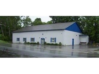
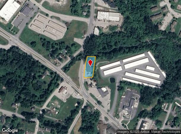
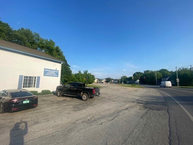
Property Record
59 Harwood Hill Rd, Bennington, VT 05201
NEARBY LISTINGS FOR SALE OR LEASE
-
-
View all Bennington listings for sale on LoopNet.com
Property Detail
59 Harwood Hill Rd
(015)36-50-03-00
WHSE & .38 + .24A
Commercialnec
Bennington
AE
Vermont
50003C0414D
0.62 AC
2024
Vermont South Area
2024
Other Market Areas
970900
Bennington, VT
12,000 SF
DEMOGRAPHICS near 59 Harwood Hill Rd
1 Mile
3 Mile
5 Mile
2024 Total Population
1,478
15,392
18,233
2029 Population
1,499
15,352
18,174
Pop Growth 2024-2029
+ 1.42%
(0.26%)
(0.32%)
Average Age
39
43
43
2024 Total Households
559
6,295
7,478
HH Growth 2024-2029
+ 1.43%
(0.25%)
(0.31%)
Median Household Inc
$57,562
$55,442
$58,129
Avg Household Size
2.50
2.20
2.20
2024 Avg HH Vehicles
1.00
2.00
2.00
Median Home Value
$251,744
$197,729
$203,892
Median Year Built
1975
1959
1961
Nearby Places
Map Layers
Map Styles
 Street
 Aerial
- Restaurants
- Banks
- Shops
- Fitness
- Groceries
PUBLIC TRANSPORTATION
AIRPORT
Albany International
DRIVE
WALK
Distance
Albany International
58 min
37.0 mi
SALE & LEASE HISTORY
LISTING DATE
SALE/LEASE

Mar 29, 2017
For Sale
Jun 15, 2021
For Sale
Nearby Properties
Address
Land Use
TOTAL SIZE
Lot Size
Zoning
Address
Land Use
TOTAL SIZE
Lot Size
Zoning
Address
Land Use
TOTAL SIZE
Lot Size
Zoning
280.62 AC
Address
Land Use
TOTAL SIZE
Lot Size
Zoning
Address
Land Use
TOTAL SIZE
Lot Size
Zoning
85.76 AC
Address
Land Use
TOTAL SIZE
Lot Size
Zoning
Address
Land Use
TOTAL SIZE
Lot Size
Zoning
82.13 AC
Address
Land Use
TOTAL SIZE
Lot Size
Zoning
44.11 AC
Address
Land Use
TOTAL SIZE
Lot Size
Zoning
150,299 SF
109.97 AC
Address
Land Use
TOTAL SIZE
Lot Size
Zoning
84.32 AC
Address
Land Use
TOTAL SIZE
Lot Size
Zoning
Address
Land Use
TOTAL SIZE
Lot Size
Zoning
88,669 SF
11.47 AC
Address
Land Use
TOTAL SIZE
Lot Size
Zoning
11,373 SF
9 AC
Address
Land Use
TOTAL SIZE
Lot Size
Zoning
10.60 AC
Address
Land Use
TOTAL SIZE
Lot Size
Zoning
112,334 SF
10.92 AC
Address
Land Use
TOTAL SIZE
Lot Size
Zoning
19.20 AC
Address
Land Use
TOTAL SIZE
Lot Size
Zoning
66,622 SF
6.20 AC
Address
Land Use
TOTAL SIZE
Lot Size
Zoning
67,249 SF
Address
Land Use
TOTAL SIZE
Lot Size
Zoning
Address
Land Use
TOTAL SIZE
Lot Size
Zoning
48,821 SF
5.75 AC
Address
Land Use
TOTAL SIZE
Lot Size
Zoning
51,856 SF
7.22 AC
Address
Land Use
TOTAL SIZE
Lot Size
Zoning
38,145 SF
7.20 AC
Address
Land Use
TOTAL SIZE
Lot Size
Zoning
151,676 SF
12.60 AC
Address
Land Use
TOTAL SIZE
Lot Size
Zoning
6.40 AC
Address
Land Use
TOTAL SIZE
Lot Size
Zoning
24,012 SF
9.44 AC
Address
Land Use
TOTAL SIZE
Lot Size
Zoning
6.17 AC
Address
Land Use
TOTAL SIZE
Lot Size
Zoning
49,358 SF
2.52 AC
Address
Land Use
TOTAL SIZE
Lot Size
Zoning
Address
Land Use
TOTAL SIZE
Lot Size
Zoning
69,636 SF
6.60 AC
Address
Land Use
TOTAL SIZE
Lot Size
Zoning
4.55 AC
Address
Land Use
TOTAL SIZE
Lot Size
Zoning
31,433 SF
7.51 AC
The World's #1 Commercial Real Estate Marketplace
Connect with us
© 2025 CoStar Group
The information above has been obtained from sources believed reliable. While we do not doubt its accuracy we have not verified it and make no guarantee, warranty or representation about it. It is your responsibility to independently confirm its accuracy and completeness. Any projections, opinions, assumptions, or estimates used are for example only and do not represent the current or future performance of the property. The value of this transaction to you depends on tax and other factors which should be evaluated by your tax, financial, and legal advisors. You and your advisors should conduct a careful, independent investigation of the property to determine to your satisfaction the suitability of the property for your needs.