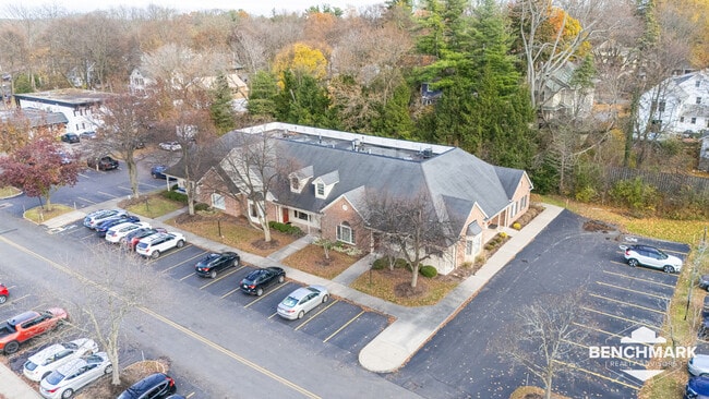
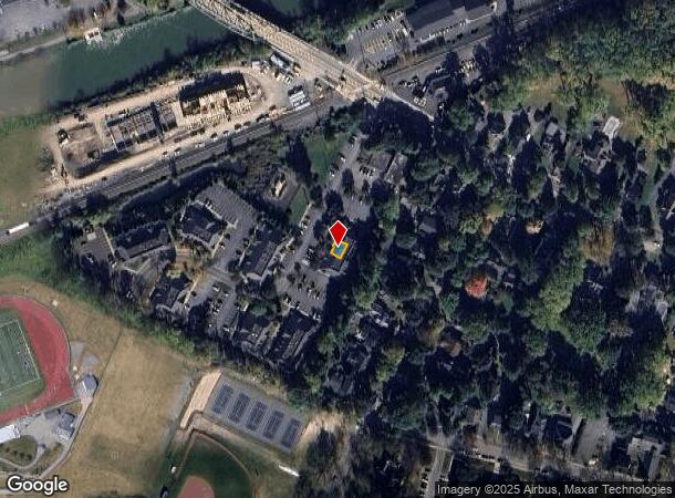
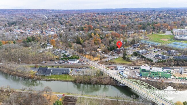
Property Record
59 Monroe Ave, Pittsford, NY 14534
Current Lease Availabilities
NEARBY LISTINGS FOR SALE OR LEASE
Property Detail
59 Monroe Ave
Rochester, NY
Pittsford Village Green Condo
264601-151-180-0004-001-000-D
L24 T12 R5 PITTS VILL GREEN CONDO BDG 1 UNIT D 1985-22
Professionalbldglegalinsurancerealestateetc
Monroe
X
New York
36055C0359G
1.000
2025
0.14 AC
2024
Southeast
012301
Rochester
1,222 SF
DEMOGRAPHICS near 59 Monroe Ave
1 Mile
3 Mile
5 Mile
2024 Total Population
6,375
50,465
149,232
2029 Population
6,357
50,120
148,372
Pop Growth 2024-2029
(0.28%)
(0.68%)
(0.58%)
Average Age
40
44
43
2024 Total Households
2,161
20,708
64,485
HH Growth 2024-2029
(0.37%)
(0.73%)
(0.66%)
Median Household Inc
$116,093
$101,958
$94,123
Avg Household Size
2.30
2.30
2.20
2024 Avg HH Vehicles
2.00
2.00
2.00
Median Home Value
$395,684
$314,944
$284,462
Median Year Built
1962
1965
1964
Nearby Places
- Restaurants
- Banks
- Shops
- Fitness
- Groceries
PUBLIC TRANSPORTATION
COMMUTER RAIL
DRIVE
WALK
Distance
14 min
8.4 mi
AIRPORT
Frederick Douglass/Greater Rochester International
DRIVE
WALK
Distance
Frederick Douglass/Greater Rochester International
16 min
9.5 mi
Nearby Properties
Address
Land Use
TOTAL SIZE
Lot Size
Zoning
Address
Land Use
TOTAL SIZE
Lot Size
Zoning
65,745 SF
154.98 AC
Address
Land Use
TOTAL SIZE
Lot Size
Zoning
70,683 SF
53.22 AC
Address
Land Use
TOTAL SIZE
Lot Size
Zoning
225,000 SF
48.60 AC
Address
Land Use
TOTAL SIZE
Lot Size
Zoning
424,207 SF
39.50 AC
Address
Land Use
TOTAL SIZE
Lot Size
Zoning
130,830 SF
19.20 AC
Address
Land Use
TOTAL SIZE
Lot Size
Zoning
Address
Land Use
TOTAL SIZE
Lot Size
Zoning
209,996 SF
36.56 AC
Address
Land Use
TOTAL SIZE
Lot Size
Zoning
160,758 SF
20.95 AC
02 - SINGL
Address
Land Use
TOTAL SIZE
Lot Size
Zoning
408,790 SF
31.90 AC
02 - SINGL
Address
Land Use
TOTAL SIZE
Lot Size
Zoning
177,828 SF
36.90 AC
Address
Land Use
TOTAL SIZE
Lot Size
Zoning
80,747 SF
9.37 AC
02 - SINGL
Address
Land Use
TOTAL SIZE
Lot Size
Zoning
288,463 SF
34 AC
Address
Land Use
TOTAL SIZE
Lot Size
Zoning
155,517 SF
45.77 AC
Address
Land Use
TOTAL SIZE
Lot Size
Zoning
191,117 SF
31.86 AC
Address
Land Use
TOTAL SIZE
Lot Size
Zoning
2,902 SF
127.70 AC
CEMETERY
Address
Land Use
TOTAL SIZE
Lot Size
Zoning
62,200 SF
17.92 AC
Address
Land Use
TOTAL SIZE
Lot Size
Zoning
11,116 SF
22.60 AC
05 - COMME
Address
Land Use
TOTAL SIZE
Lot Size
Zoning
19,440 SF
16.64 AC
03 - MULTI
Address
Land Use
TOTAL SIZE
Lot Size
Zoning
1,878 SF
56.60 AC
MHP
Address
Land Use
TOTAL SIZE
Lot Size
Zoning
90,684 SF
20.51 AC
LI
Address
Land Use
TOTAL SIZE
Lot Size
Zoning
174,852 SF
44 AC
Address
Land Use
TOTAL SIZE
Lot Size
Zoning
52,080 SF
21.10 AC
Address
Land Use
TOTAL SIZE
Lot Size
Zoning
128,694 SF
15.71 AC
Address
Land Use
TOTAL SIZE
Lot Size
Zoning
106,364 SF
9.70 AC
02 - SINGL
Address
Land Use
TOTAL SIZE
Lot Size
Zoning
6,720 SF
24.10 AC
Address
Land Use
TOTAL SIZE
Lot Size
Zoning
87,336 SF
17.30 AC
03 - MULTI
Address
Land Use
TOTAL SIZE
Lot Size
Zoning
50,387 SF
4.10 AC
02 - SINGL
Address
Land Use
TOTAL SIZE
Lot Size
Zoning
1,728 SF
85.30 AC
Address
Land Use
TOTAL SIZE
Lot Size
Zoning
70,468 SF
318.95 AC
Address
Land Use
TOTAL SIZE
Lot Size
Zoning
216,812 SF
9.13 AC
06 - INDUS
The World's #1 Commercial Real Estate Marketplace
Connect with us
© 2025 CoStar Group
The information above has been obtained from sources believed reliable. While we do not doubt its accuracy we have not verified it and make no guarantee, warranty or representation about it. It is your responsibility to independently confirm its accuracy and completeness. Any projections, opinions, assumptions, or estimates used are for example only and do not represent the current or future performance of the property. The value of this transaction to you depends on tax and other factors which should be evaluated by your tax, financial, and legal advisors. You and your advisors should conduct a careful, independent investigation of the property to determine to your satisfaction the suitability of the property for your needs.