Property Record
59 North St, Hatfield, MA 01038


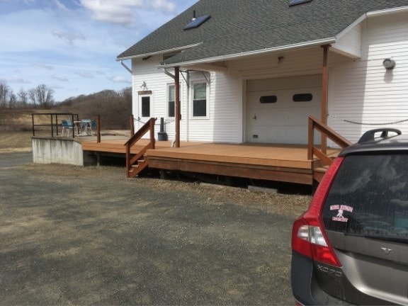

Property Detail
59 North St
HATF-000214-000019
Hampshire
Taxexempt
Massachusetts
I
1.98 AC
2024
Hampshire County
2025
Hartford
821500
Amherst Town-Northampton, MA
10,958 SF
NEARBY LISTINGS FOR SALE OR LEASE
DEMOGRAPHICS near 59 North St
1 mile
3 mile
5 mile
2025 Total Population
1,217
7,524
61,781
2030 Population
1,208
7,445
61,780
Pop Growth 2025-2030
(0.74%)
(1.05%)
0.00%
Average Age
47
47
35
2025 Total Households
562
3,319
18,961
HH Growth 2025-2030
(0.89%)
(0.99%)
(0.26%)
Median Household Inc
$106,122
$105,387
$73,133
Avg Household Size
2.20
2.20
2.10
2025 Avg HH Vehicles
2.00
2.00
2.00
Median Home Value
$483,857
$458,370
$459,930
Median Year Built
1954
1964
1963
Nearby Places
Map Layers
Map Styles
 Street
 Aerial
Layers
 Traffic
 Biking
Places
Listings with unknown addresses are not visible on the map
- Restaurants
- Banks
- Shops
- Fitness
- Groceries
SALE & LEASE HISTORY
LISTING DATE
SALE/LEASE

Mar 27, 2018
For Lease
Mar 27, 2018
For Lease
Nearby Properties
Address
Land Use
TOTAL SIZE
Lot Size
Zoning
Address
Land Use
TOTAL SIZE
Lot Size
Zoning
476,724 SF
57.56 AC
I
Address
Land Use
TOTAL SIZE
Lot Size
Zoning
9,424 SF
17.24 AC
AR
Address
Land Use
TOTAL SIZE
Lot Size
Zoning
61,650 SF
12.37 AC
B
Address
Land Use
TOTAL SIZE
Lot Size
Zoning
139,648 SF
13.09 AC
B
Address
Land Use
TOTAL SIZE
Lot Size
Zoning
359,938 SF
38.84 AC
I
Address
Land Use
TOTAL SIZE
Lot Size
Zoning
115,090 SF
14.09 AC
B
Address
Land Use
TOTAL SIZE
Lot Size
Zoning
59,471 SF
35 AC
LGT
Address
Land Use
TOTAL SIZE
Lot Size
Zoning
15,130 SF
2.60 AC
B
Address
Land Use
TOTAL SIZE
Lot Size
Zoning
53,344 SF
9.07 AC
TC
Address
Land Use
TOTAL SIZE
Lot Size
Zoning
280,518 SF
60.66 AC
I
Address
Land Use
TOTAL SIZE
Lot Size
Zoning
81,537 SF
2.41 AC
B
Address
Land Use
TOTAL SIZE
Lot Size
Zoning
64,239 SF
10 AC
AR
Address
Land Use
TOTAL SIZE
Lot Size
Zoning
55,644 SF
5.21 AC
BUS
Address
Land Use
TOTAL SIZE
Lot Size
Zoning
3,680 SF
123.61 AC
AR
Address
Land Use
TOTAL SIZE
Lot Size
Zoning
48,750 SF
9.34 AC
I
Address
Land Use
TOTAL SIZE
Lot Size
Zoning
33,525 SF
5.36 AC
I
Address
Land Use
TOTAL SIZE
Lot Size
Zoning
4,897 SF
7.63 AC
I
Address
Land Use
TOTAL SIZE
Lot Size
Zoning
20,208 SF
2.37 AC
B
Address
Land Use
TOTAL SIZE
Lot Size
Zoning
47,475 SF
2.96 AC
B
Address
Land Use
TOTAL SIZE
Lot Size
Zoning
1,680 SF
8.70 AC
B
Address
Land Use
TOTAL SIZE
Lot Size
Zoning
22,936 SF
5.13 AC
B
Address
Land Use
TOTAL SIZE
Lot Size
Zoning
29,575 SF
3.52 AC
LGT
Address
Land Use
TOTAL SIZE
Lot Size
Zoning
58,439 SF
2.97 AC
LGT
Address
Land Use
TOTAL SIZE
Lot Size
Zoning
56,924 SF
7.50 AC
I
Address
Land Use
TOTAL SIZE
Lot Size
Zoning
42,789 SF
4.16 AC
I
Address
Land Use
TOTAL SIZE
Lot Size
Zoning
1,896 SF
2.10 AC
B
Address
Land Use
TOTAL SIZE
Lot Size
Zoning
70,318 SF
10.46 AC
I
Address
Land Use
TOTAL SIZE
Lot Size
Zoning
24,976 SF
3.82 AC
LI
Address
Land Use
TOTAL SIZE
Lot Size
Zoning
17,746 SF
2.29 AC
B
Address
Land Use
TOTAL SIZE
Lot Size
Zoning
26,079 SF
1.62 AC
TC
The World's #1 Commercial Real Estate Marketplace
Connect with us
© 2026 CoStar Group
The information above has been obtained from sources believed reliable. While we do not doubt its accuracy we have not verified it and make no guarantee, warranty or representation about it. It is your responsibility to independently confirm its accuracy and completeness. Any projections, opinions, assumptions, or estimates used are for example only and do not represent the current or future performance of the property. The value of this transaction to you depends on tax and other factors which should be evaluated by your tax, financial, and legal advisors. You and your advisors should conduct a careful, independent investigation of the property to determine to your satisfaction the suitability of the property for your needs.