Property Record
59 Piney Narrows Rd, Chester, MD 21619


Property Detail
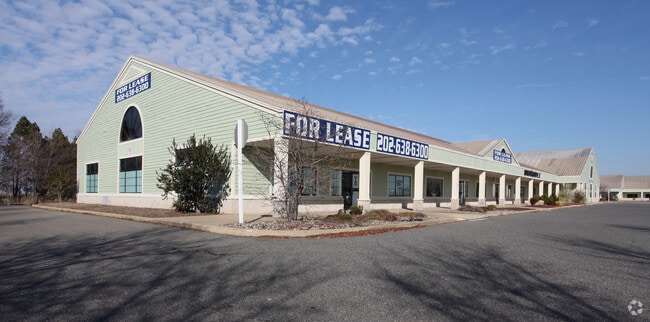
59 Piney Narrows Rd
04-067436
13.987 ACRES N/OF US RT 50 E/OF CHESTER
Regionalshoppingcenterormallwithanchorstore
Queen Annes
WVC
Maryland
AE The base floodplain where base flood elevations are provided. AE Zones are now used on new format FIRMs instead of A1-A30 Zones.
13.98 AC
2025
Queen Anne's County
2025
Baltimore
810800
Baltimore-Columbia-Towson, MD
36,000 SF
NEARBY LISTINGS FOR SALE OR LEASE
DEMOGRAPHICS near 59 Piney Narrows Rd
1 mile
3 mile
5 mile
2025 Total Population
1,302
11,012
20,653
2030 Population
1,401
11,738
21,999
Pop Growth 2025-2030
+ 7.60%
+ 6.59%
+ 6.52%
Average Age
45
44
43
2025 Total Households
570
4,552
8,201
HH Growth 2025-2030
+ 7.54%
+ 6.66%
+ 6.60%
Median Household Inc
$81,018
$104,323
$119,820
Avg Household Size
2.30
2.40
2.50
2025 Avg HH Vehicles
2.00
2.00
2.00
Median Home Value
$552,296
$489,492
$480,053
Median Year Built
1996
1993
1992
Nearby Places
Map Layers
Map Styles
 Street
 Aerial
Layers
 Traffic
 Biking
Places
Listings with unknown addresses are not visible on the map
- Restaurants
- Banks
- Shops
- Fitness
- Groceries
PUBLIC TRANSPORTATION
AIRPORT
Baltimore/Washington International Thurgood Marshall
Drive
Walk
Distance
Baltimore/Washington International Thurgood Marshall
53 min
33.8 mi
Freight Ports
Port of Baltimore
Drive
Walk
Distance
Port of Baltimore
59 min
35.6 mi
SALE & LEASE HISTORY
LISTING DATE
SALE/LEASE

Sep 24, 2016
For Lease
Nearby Properties
Address
Land Use
TOTAL SIZE
Lot Size
Zoning
Address
Land Use
TOTAL SIZE
Lot Size
Zoning
86,117 SF
1.67 AC
WVC
Address
Land Use
TOTAL SIZE
Lot Size
Zoning
47,388 SF
5.61 AC
TC
Address
Land Use
TOTAL SIZE
Lot Size
Zoning
74,465 SF
15.34 AC
SE
Address
Land Use
TOTAL SIZE
Lot Size
Zoning
53,028 SF
3.99 AC
Address
Land Use
TOTAL SIZE
Lot Size
Zoning
93,468 SF
9.53 AC
VC
Address
Land Use
TOTAL SIZE
Lot Size
Zoning
1,504 SF
42.74 AC
WVC
Address
Land Use
TOTAL SIZE
Lot Size
Zoning
45,151 SF
5.97 AC
TC
Address
Land Use
TOTAL SIZE
Lot Size
Zoning
40,500 SF
6.47 AC
WVC
Address
Land Use
TOTAL SIZE
Lot Size
Zoning
65,108 SF
2.72 AC
WVC
Address
Land Use
TOTAL SIZE
Lot Size
Zoning
1,484 SF
3.08 AC
TC
Address
Land Use
TOTAL SIZE
Lot Size
Zoning
33,214 SF
16 AC
SE
Address
Land Use
TOTAL SIZE
Lot Size
Zoning
1,740 SF
100 AC
CS
Address
Land Use
TOTAL SIZE
Lot Size
Zoning
6,000 SF
7.37 AC
CMPD
Address
Land Use
TOTAL SIZE
Lot Size
Zoning
9,470 SF
15.93 AC
SE
Address
Land Use
TOTAL SIZE
Lot Size
Zoning
37,800 SF
6.60 AC
WVC
Address
Land Use
TOTAL SIZE
Lot Size
Zoning
51,660 SF
2.15 AC
TC
Address
Land Use
TOTAL SIZE
Lot Size
Zoning
12,036 SF
1.54 AC
TC
Address
Land Use
TOTAL SIZE
Lot Size
Zoning
14,473 SF
1.73 AC
TC
Address
Land Use
TOTAL SIZE
Lot Size
Zoning
37,202 SF
3.23 AC
TC
Address
Land Use
TOTAL SIZE
Lot Size
Zoning
41,888 SF
4.41 AC
WVC
Address
Land Use
TOTAL SIZE
Lot Size
Zoning
8,040 SF
33.35 AC
SE
Address
Land Use
TOTAL SIZE
Lot Size
Zoning
1,488 SF
12.59 AC
WVC
Address
Land Use
TOTAL SIZE
Lot Size
Zoning
27,736 SF
3.64 AC
TC
Address
Land Use
TOTAL SIZE
Lot Size
Zoning
46,000 SF
4.63 AC
TC
Address
Land Use
TOTAL SIZE
Lot Size
Zoning
3,840 SF
16.32 AC
UR
Address
Land Use
TOTAL SIZE
Lot Size
Zoning
27,846 SF
5.59 AC
TC
Address
Land Use
TOTAL SIZE
Lot Size
Zoning
17,000 SF
5.49 AC
TC
Address
Land Use
TOTAL SIZE
Lot Size
Zoning
5,644 SF
1.85 AC
TC
Address
Land Use
TOTAL SIZE
Lot Size
Zoning
9,092 SF
10 AC
WVC
The World's #1 Commercial Real Estate Marketplace
Connect with us
© 2026 CoStar Group
The information above has been obtained from sources believed reliable. While we do not doubt its accuracy we have not verified it and make no guarantee, warranty or representation about it. It is your responsibility to independently confirm its accuracy and completeness. Any projections, opinions, assumptions, or estimates used are for example only and do not represent the current or future performance of the property. The value of this transaction to you depends on tax and other factors which should be evaluated by your tax, financial, and legal advisors. You and your advisors should conduct a careful, independent investigation of the property to determine to your satisfaction the suitability of the property for your needs.