Property Record
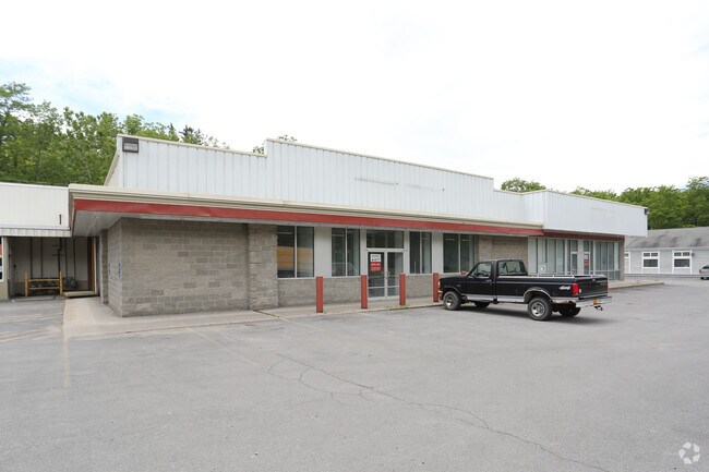
59 W Main St, Dryden, NY 13053


NEARBY LISTINGS FOR SALE OR LEASE
Property Detail
59 W Main St
502401-014-000-0003-008-002-0000
Tompkins
Storesoffices
New York
AE
8.002
36109C0231D
4.65 AC
2025
Ithaca/Elmira
2024
Other Market Areas
002000
Ithaca, NY
6,516 SF
DEMOGRAPHICS near 59 W Main St
1 Mile
3 Mile
5 Mile
2024 Total Population
1,686
3,413
6,014
2029 Population
1,416
2,981
5,326
Pop Growth 2024-2029
(16.01%)
(12.66%)
(11.44%)
Average Age
46
46
45
2024 Total Households
771
1,511
2,596
HH Growth 2024-2029
(17.90%)
(14.30%)
(12.94%)
Median Household Inc
$73,874
$73,409
$75,853
Avg Household Size
2.20
2.20
2.20
2024 Avg HH Vehicles
2.00
2.00
2.00
Median Home Value
$306,500
$285,576
$266,775
Median Year Built
1949
1955
1960
Nearby Places
Map Layers
Map Styles
 Street
 Aerial
- Restaurants
- Banks
- Shops
- Fitness
- Groceries
PUBLIC TRANSPORTATION
AIRPORT
Ithaca Tompkins International
DRIVE
WALK
Distance
Ithaca Tompkins International
14 min
9.1 mi
Freight Ports
Albany, NY Port
DRIVE
WALK
Distance
Albany, NY Port
208 min
161.7 mi
SALE & LEASE HISTORY
LISTING DATE
SALE/LEASE

Sep 19, 2017
For Sale
Sep 15, 2020
For Sale
Oct 24, 2018
For Sale
Jul 06, 2017
For Lease
Nearby Properties
Address
Land Use
TOTAL SIZE
Lot Size
Zoning
Address
Land Use
TOTAL SIZE
Lot Size
Zoning
279,144 SF
50.70 AC
Address
Land Use
TOTAL SIZE
Lot Size
Zoning
6,196 SF
265.41 AC
Address
Land Use
TOTAL SIZE
Lot Size
Zoning
188,452 SF
91.59 AC
Address
Land Use
TOTAL SIZE
Lot Size
Zoning
107,375 SF
20.19 AC
RB
Address
Land Use
TOTAL SIZE
Lot Size
Zoning
55,588 SF
28.05 AC
Address
Land Use
TOTAL SIZE
Lot Size
Zoning
Address
Land Use
TOTAL SIZE
Lot Size
Zoning
6.50 AC
Address
Land Use
TOTAL SIZE
Lot Size
Zoning
Address
Land Use
TOTAL SIZE
Lot Size
Zoning
Address
Land Use
TOTAL SIZE
Lot Size
Zoning
1,800 SF
99.64 AC
RES
Address
Land Use
TOTAL SIZE
Lot Size
Zoning
Address
Land Use
TOTAL SIZE
Lot Size
Zoning
35,184 SF
1.95 AC
Address
Land Use
TOTAL SIZE
Lot Size
Zoning
Address
Land Use
TOTAL SIZE
Lot Size
Zoning
2,356 SF
149.69 AC
Address
Land Use
TOTAL SIZE
Lot Size
Zoning
Address
Land Use
TOTAL SIZE
Lot Size
Zoning
22,980 SF
5.70 AC
51200
Address
Land Use
TOTAL SIZE
Lot Size
Zoning
Address
Land Use
TOTAL SIZE
Lot Size
Zoning
Address
Land Use
TOTAL SIZE
Lot Size
Zoning
11,568 SF
72.10 AC
MH
Address
Land Use
TOTAL SIZE
Lot Size
Zoning
4,500 SF
4.24 AC
COM
Address
Land Use
TOTAL SIZE
Lot Size
Zoning
Address
Land Use
TOTAL SIZE
Lot Size
Zoning
Address
Land Use
TOTAL SIZE
Lot Size
Zoning
Address
Land Use
TOTAL SIZE
Lot Size
Zoning
39,430 SF
12.80 AC
COM
Address
Land Use
TOTAL SIZE
Lot Size
Zoning
Address
Land Use
TOTAL SIZE
Lot Size
Zoning
11,324 SF
2.32 AC
COM
Address
Land Use
TOTAL SIZE
Lot Size
Zoning
Address
Land Use
TOTAL SIZE
Lot Size
Zoning
0.14 AC
Address
Land Use
TOTAL SIZE
Lot Size
Zoning
16,328 SF
2.09 AC
COM
Address
Land Use
TOTAL SIZE
Lot Size
Zoning
12,480 SF
3.80 AC
RES
The World's #1 Commercial Real Estate Marketplace
Connect with us
© 2025 CoStar Group
The information above has been obtained from sources believed reliable. While we do not doubt its accuracy we have not verified it and make no guarantee, warranty or representation about it. It is your responsibility to independently confirm its accuracy and completeness. Any projections, opinions, assumptions, or estimates used are for example only and do not represent the current or future performance of the property. The value of this transaction to you depends on tax and other factors which should be evaluated by your tax, financial, and legal advisors. You and your advisors should conduct a careful, independent investigation of the property to determine to your satisfaction the suitability of the property for your needs.