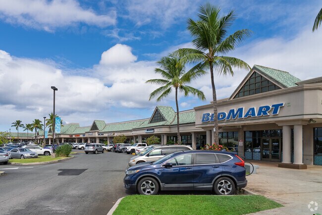
Property Record
590 Farrington Hwy, Kapolei, HI 96707


NEARBY LISTINGS FOR SALE OR LEASE
Property Detail
590 Farrington Hwy
1-9-1-106-016-0000
LOT 13090-B MAP 1050 LCAPP 1069 6.502 AC TOG/E SUBJ/E
Commercialnec
Honolulu
D
Hawaii
15003C0310G
13090
2024
6.50 AC
2025
West Oahu
011500
Hawaii
74,190 SF
Urban Honolulu, HI
DEMOGRAPHICS near 590 Farrington Hwy
1 Mile
3 Mile
5 Mile
2024 Total Population
14,985
52,638
111,766
2029 Population
14,441
50,862
106,825
Pop Growth 2024-2029
(3.63%)
(3.37%)
(4.42%)
Average Age
37
36
37
2024 Total Households
4,503
15,498
31,575
HH Growth 2024-2029
(4.00%)
(3.88%)
(4.90%)
Median Household Inc
$119,580
$114,078
$113,014
Avg Household Size
3.10
3.20
3.30
2024 Avg HH Vehicles
2.00
2.00
2.00
Median Home Value
$734,700
$735,912
$719,065
Median Year Built
2004
2000
1998
Nearby Places
Map Layers
Map Styles
 Street
 Aerial
- Restaurants
- Banks
- Shops
- Fitness
- Groceries
PUBLIC TRANSPORTATION
AIRPORT
Daniel K Inouye International
DRIVE
WALK
Distance
Daniel K Inouye International
24 min
16.5 mi
Freight Ports
Honolulu Harbor, Oahu
DRIVE
WALK
Distance
Honolulu Harbor, Oahu
33 min
20.7 mi
SALE & LEASE HISTORY
LISTING DATE
SALE/LEASE

May 19, 2017
For Lease
Mar 13, 2023
For Sale
Mar 08, 2023
For Lease
Jan 29, 2021
For Lease
Nearby Properties
Address
Land Use
TOTAL SIZE
Lot Size
Zoning
Address
Land Use
TOTAL SIZE
Lot Size
Zoning
1,193,532 SF
9.53 AC
Resort
Address
Land Use
TOTAL SIZE
Lot Size
Zoning
736 AC
F-1
Address
Land Use
TOTAL SIZE
Lot Size
Zoning
1,963,629 SF
10.70 AC
Resort
Address
Land Use
TOTAL SIZE
Lot Size
Zoning
310,432 SF
192.56 AC
BMX-3
Address
Land Use
TOTAL SIZE
Lot Size
Zoning
288,660 SF
10.94 AC
A-2
Address
Land Use
TOTAL SIZE
Lot Size
Zoning
645,869 SF
48.95 AC
AG-1
Address
Land Use
TOTAL SIZE
Lot Size
Zoning
447,096 SF
9.98 AC
A-2
Address
Land Use
TOTAL SIZE
Lot Size
Zoning
294,056 SF
11.69 AC
Resort
Address
Land Use
TOTAL SIZE
Lot Size
Zoning
80,641 SF
227.76 AC
I-2
Address
Land Use
TOTAL SIZE
Lot Size
Zoning
222.44 AC
I-3
Address
Land Use
TOTAL SIZE
Lot Size
Zoning
139.30 AC
F-1
Address
Land Use
TOTAL SIZE
Lot Size
Zoning
222.34 AC
I-3
Address
Land Use
TOTAL SIZE
Lot Size
Zoning
48.66 AC
I-2
Address
Land Use
TOTAL SIZE
Lot Size
Zoning
10 AC
Resort
Address
Land Use
TOTAL SIZE
Lot Size
Zoning
14.70 AC
Resort
Address
Land Use
TOTAL SIZE
Lot Size
Zoning
61,643 SF
116.66 AC
I-2
Address
Land Use
TOTAL SIZE
Lot Size
Zoning
307,171 SF
24.64 AC
I-2
Address
Land Use
TOTAL SIZE
Lot Size
Zoning
229,396 SF
11.31 AC
BMX-3
Address
Land Use
TOTAL SIZE
Lot Size
Zoning
2,225 SF
19.72 AC
AG-1
Address
Land Use
TOTAL SIZE
Lot Size
Zoning
10,182 SF
10.30 AC
Resort
Address
Land Use
TOTAL SIZE
Lot Size
Zoning
46.69 AC
B-2
Address
Land Use
TOTAL SIZE
Lot Size
Zoning
334.93 AC
U/42/40
Address
Land Use
TOTAL SIZE
Lot Size
Zoning
7.22 AC
Resort
Address
Land Use
TOTAL SIZE
Lot Size
Zoning
222,228 SF
7.15 AC
B-2
Address
Land Use
TOTAL SIZE
Lot Size
Zoning
183,343 SF
15.27 AC
BMX-3
Address
Land Use
TOTAL SIZE
Lot Size
Zoning
149,923 SF
13.35 AC
B-2
Address
Land Use
TOTAL SIZE
Lot Size
Zoning
19.38 AC
A-2
Address
Land Use
TOTAL SIZE
Lot Size
Zoning
67.18 AC
AG-1
Address
Land Use
TOTAL SIZE
Lot Size
Zoning
45.60 AC
F-1
The World's #1 Commercial Real Estate Marketplace
Connect with us
© 2025 CoStar Group
The information above has been obtained from sources believed reliable. While we do not doubt its accuracy we have not verified it and make no guarantee, warranty or representation about it. It is your responsibility to independently confirm its accuracy and completeness. Any projections, opinions, assumptions, or estimates used are for example only and do not represent the current or future performance of the property. The value of this transaction to you depends on tax and other factors which should be evaluated by your tax, financial, and legal advisors. You and your advisors should conduct a careful, independent investigation of the property to determine to your satisfaction the suitability of the property for your needs.