Property Record
590 Route 38 E, Maple Shade, NJ 08052


Property Detail
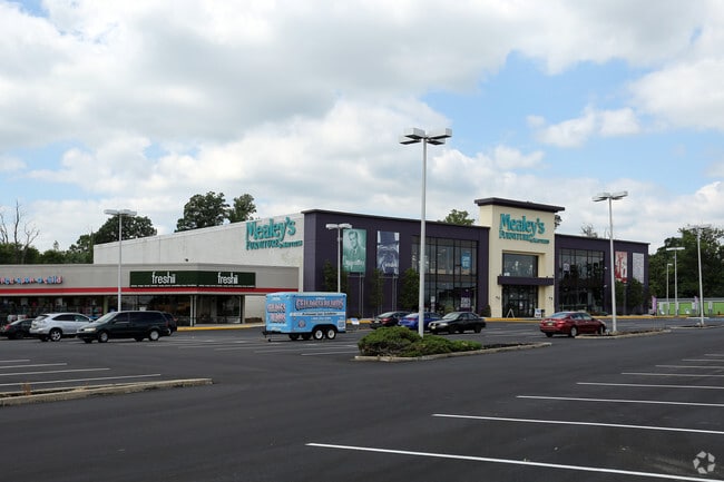
590 Route 38 E
Philadelphia-Camden-Wilmington, PA-NJ-DE-MD
ADDITIONAL LOTS: 68850 SF
19-00189-01-00005
BURLINGTON
Regionalshoppingcenterormallwithanchorstore
New Jersey
B and X Area of moderate flood hazard, usually the area between the limits of the 100-year and 500-year floods.
5
2024
8.67 AC
2025
North Burlington County
700408
Philadelphia
3,314 SF
NEARBY LISTINGS FOR SALE OR LEASE
DEMOGRAPHICS near 590 Route 38 E
1 mile
3 mile
5 mile
2025 Total Population
8,985
82,907
219,094
2030 Population
9,208
84,658
224,112
Pop Growth 2025-2030
+ 2.48%
+ 2.11%
+ 2.29%
Average Age
40
42
42
2025 Total Households
4,342
33,434
85,167
HH Growth 2025-2030
+ 2.67%
+ 2.20%
+ 2.41%
Median Household Inc
$75,507
$103,526
$112,780
Avg Household Size
2.00
2.40
2.50
2025 Avg HH Vehicles
1.00
2.00
2.00
Median Home Value
$405,449
$383,683
$393,005
Median Year Built
1973
1969
1969
Nearby Places
Map Layers
Map Styles
 Street
 Aerial
Layers
 Traffic
 Biking
Places
Listings with unknown addresses are not visible on the map
- Restaurants
- Banks
- Shops
- Fitness
- Groceries
PUBLIC TRANSPORTATION
COMMUTER RAIL
Cherry Hill (Atlantic City Line - NJ Transit Commuter Rail (NJ Transit))
Drive
Walk
Distance
Cherry Hill (Atlantic City Line - NJ Transit Commuter Rail (NJ Transit))
10 min
6.4 mi
Pennsauken Transit Center (Atlantic City Rail Line - NJ TRANSIT RAIL)
Drive
Walk
Distance
Pennsauken Transit Center (Atlantic City Rail Line - NJ TRANSIT RAIL)
11 min
7.1 mi
AIRPORT
Philadelphia International
Drive
Walk
Distance
Philadelphia International
32 min
19.5 mi
Trenton Mercer
Drive
Walk
Distance
Trenton Mercer
47 min
33.4 mi
Freight Ports
Port of Philadelphia
Drive
Walk
Distance
Port of Philadelphia
15 min
9.8 mi
SALE & LEASE HISTORY
LISTING DATE
SALE/LEASE

Jul 19, 2023
For Sale
Nearby Properties
Address
Land Use
TOTAL SIZE
Lot Size
Zoning
Address
Land Use
TOTAL SIZE
Lot Size
Zoning
66.02 AC
Address
Land Use
TOTAL SIZE
Lot Size
Zoning
Address
Land Use
TOTAL SIZE
Lot Size
Zoning
90.41 AC
Address
Land Use
TOTAL SIZE
Lot Size
Zoning
20.13 AC
Address
Land Use
TOTAL SIZE
Lot Size
Zoning
38.76 AC
Address
Land Use
TOTAL SIZE
Lot Size
Zoning
23.82 AC
Address
Land Use
TOTAL SIZE
Lot Size
Zoning
1 SF
42.23 AC
Address
Land Use
TOTAL SIZE
Lot Size
Zoning
Address
Land Use
TOTAL SIZE
Lot Size
Zoning
12.80 AC
R20
Address
Land Use
TOTAL SIZE
Lot Size
Zoning
25,536 SF
18.71 AC
Address
Land Use
TOTAL SIZE
Lot Size
Zoning
6.25 AC
Address
Land Use
TOTAL SIZE
Lot Size
Zoning
43.20 AC
Address
Land Use
TOTAL SIZE
Lot Size
Zoning
27.83 AC
Address
Land Use
TOTAL SIZE
Lot Size
Zoning
999,999,999 SF
21.10 AC
Address
Land Use
TOTAL SIZE
Lot Size
Zoning
Address
Land Use
TOTAL SIZE
Lot Size
Zoning
Address
Land Use
TOTAL SIZE
Lot Size
Zoning
5.35 AC
Address
Land Use
TOTAL SIZE
Lot Size
Zoning
28.96 AC
Address
Land Use
TOTAL SIZE
Lot Size
Zoning
11.29 AC
Address
Land Use
TOTAL SIZE
Lot Size
Zoning
22.45 AC
MD
Address
Land Use
TOTAL SIZE
Lot Size
Zoning
Address
Land Use
TOTAL SIZE
Lot Size
Zoning
15.10 AC
Address
Land Use
TOTAL SIZE
Lot Size
Zoning
Address
Land Use
TOTAL SIZE
Lot Size
Zoning
Address
Land Use
TOTAL SIZE
Lot Size
Zoning
Address
Land Use
TOTAL SIZE
Lot Size
Zoning
26.17 AC
Address
Land Use
TOTAL SIZE
Lot Size
Zoning
27.77 AC
Address
Land Use
TOTAL SIZE
Lot Size
Zoning
Address
Land Use
TOTAL SIZE
Lot Size
Zoning
14.46 AC
Address
Land Use
TOTAL SIZE
Lot Size
Zoning
12.62 AC
C-1
The World's #1 Commercial Real Estate Marketplace
Connect with us
© 2026 CoStar Group
The information above has been obtained from sources believed reliable. While we do not doubt its accuracy we have not verified it and make no guarantee, warranty or representation about it. It is your responsibility to independently confirm its accuracy and completeness. Any projections, opinions, assumptions, or estimates used are for example only and do not represent the current or future performance of the property. The value of this transaction to you depends on tax and other factors which should be evaluated by your tax, financial, and legal advisors. You and your advisors should conduct a careful, independent investigation of the property to determine to your satisfaction the suitability of the property for your needs.