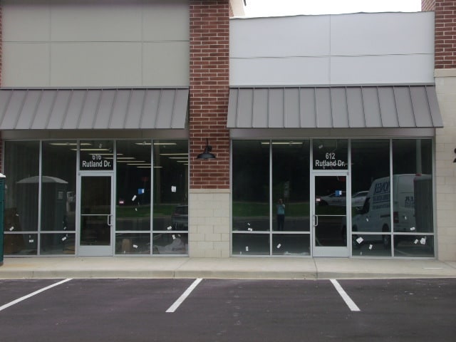
Property Record
590 Rutland Dr Nw, Aiken, SC 29801

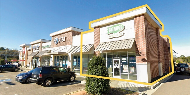
NEARBY LISTINGS FOR SALE OR LEASE
Property Detail
590 Rutland Dr Nw
120-09-05-003
TRACT A CORNER OF RUTLAND DR & LAURENS ST NW
Storebuilding
Aiken
X
South Carolina
45003C0353E
4.91 AC
2025
Outlying Aiken County
2025
Augusta/Richmond County
020303
Augusta-Richmond County, GA-SC
21,464 SF
DEMOGRAPHICS near 590 Rutland Dr Nw
1 Mile
3 Mile
5 Mile
2024 Total Population
3,766
20,585
44,131
2029 Population
4,148
22,424
47,623
Pop Growth 2024-2029
+ 10.14%
+ 8.93%
+ 7.91%
Average Age
43
42
43
2024 Total Households
1,510
8,360
18,811
HH Growth 2024-2029
+ 10.33%
+ 9.09%
+ 7.84%
Median Household Inc
$28,535
$40,324
$52,395
Avg Household Size
2.30
2.20
2.20
2024 Avg HH Vehicles
1.00
2.00
2.00
Median Home Value
$79,901
$130,139
$169,934
Median Year Built
1977
1972
1982
Nearby Places
Map Layers
Map Styles
 Street
 Aerial
- Restaurants
- Banks
- Shops
- Fitness
- Groceries
PUBLIC TRANSPORTATION
AIRPORT
Augusta Regional at Bush Field
DRIVE
WALK
Distance
Augusta Regional at Bush Field
40 min
26.0 mi
Freight Ports
Georgia Ports - Savannah
DRIVE
WALK
Distance
Georgia Ports - Savannah
178 min
135.8 mi
SALE & LEASE HISTORY
LISTING DATE
SALE/LEASE

Feb 27, 2020
For Lease
Nearby Properties
Address
Land Use
TOTAL SIZE
Lot Size
Zoning
Address
Land Use
TOTAL SIZE
Lot Size
Zoning
132,848 SF
19.78 AC
Address
Land Use
TOTAL SIZE
Lot Size
Zoning
30.20 AC
Address
Land Use
TOTAL SIZE
Lot Size
Zoning
48,500 SF
2.70 AC
Address
Land Use
TOTAL SIZE
Lot Size
Zoning
58,848 SF
1.48 AC
Address
Land Use
TOTAL SIZE
Lot Size
Zoning
33,229 SF
0.86 AC
Address
Land Use
TOTAL SIZE
Lot Size
Zoning
44,216 SF
10.69 AC
Address
Land Use
TOTAL SIZE
Lot Size
Zoning
355,597 SF
45.72 AC
Address
Land Use
TOTAL SIZE
Lot Size
Zoning
55,212 SF
0.90 AC
Address
Land Use
TOTAL SIZE
Lot Size
Zoning
28,875 SF
5.89 AC
Address
Land Use
TOTAL SIZE
Lot Size
Zoning
40,432 SF
0.55 AC
Address
Land Use
TOTAL SIZE
Lot Size
Zoning
6.25 AC
Address
Land Use
TOTAL SIZE
Lot Size
Zoning
44,456 SF
0.60 AC
Address
Land Use
TOTAL SIZE
Lot Size
Zoning
44,678 SF
3.80 AC
Address
Land Use
TOTAL SIZE
Lot Size
Zoning
33,975 SF
1.36 AC
Address
Land Use
TOTAL SIZE
Lot Size
Zoning
54,816 SF
3.02 AC
Address
Land Use
TOTAL SIZE
Lot Size
Zoning
Address
Land Use
TOTAL SIZE
Lot Size
Zoning
21,747 SF
10 AC
Address
Land Use
TOTAL SIZE
Lot Size
Zoning
25,599 SF
10 AC
Address
Land Use
TOTAL SIZE
Lot Size
Zoning
32,936 SF
198.34 AC
Address
Land Use
TOTAL SIZE
Lot Size
Zoning
3.39 AC
Address
Land Use
TOTAL SIZE
Lot Size
Zoning
168,980 SF
31.18 AC
Address
Land Use
TOTAL SIZE
Lot Size
Zoning
19,459 SF
0.49 AC
Address
Land Use
TOTAL SIZE
Lot Size
Zoning
27,163 SF
4 AC
Address
Land Use
TOTAL SIZE
Lot Size
Zoning
Address
Land Use
TOTAL SIZE
Lot Size
Zoning
22,342 SF
0.29 AC
Address
Land Use
TOTAL SIZE
Lot Size
Zoning
21.80 AC
Address
Land Use
TOTAL SIZE
Lot Size
Zoning
Address
Land Use
TOTAL SIZE
Lot Size
Zoning
0.33 AC
Address
Land Use
TOTAL SIZE
Lot Size
Zoning
27,536 SF
40.83 AC
Address
Land Use
TOTAL SIZE
Lot Size
Zoning
11,722 SF
5.53 AC
The World's #1 Commercial Real Estate Marketplace
Connect with us
© 2026 CoStar Group
The information above has been obtained from sources believed reliable. While we do not doubt its accuracy we have not verified it and make no guarantee, warranty or representation about it. It is your responsibility to independently confirm its accuracy and completeness. Any projections, opinions, assumptions, or estimates used are for example only and do not represent the current or future performance of the property. The value of this transaction to you depends on tax and other factors which should be evaluated by your tax, financial, and legal advisors. You and your advisors should conduct a careful, independent investigation of the property to determine to your satisfaction the suitability of the property for your needs.