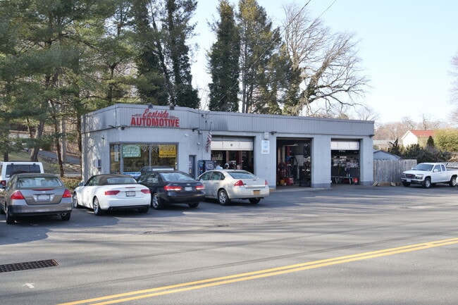
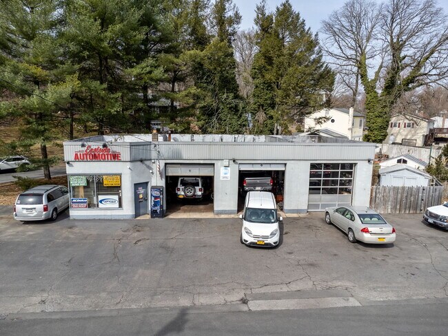
Property Record
590 Washington St, Sparkill, NY 10976
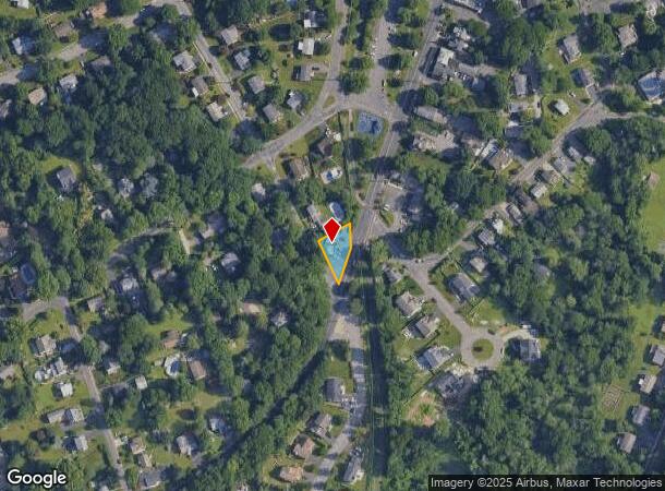
NEARBY LISTINGS FOR SALE OR LEASE
Property Detail
590 Washington St
392489-077-008-0004-030-000-0000
55/66/613/3
Servicestation
Rockland
X
New York
34003C0118H
30.0
2023
0.15 AC
2024
Orangetown
013402
Northern New Jersey
1,845 SF
New York-Jersey City-White Plains, NY-NJ
DEMOGRAPHICS near 590 Washington St
1 Mile
3 Mile
5 Mile
2024 Total Population
5,840
36,602
139,804
2029 Population
5,794
36,510
138,599
Pop Growth 2024-2029
(0.79%)
(0.25%)
(0.86%)
Average Age
43
43
43
2024 Total Households
2,109
12,786
50,572
HH Growth 2024-2029
(0.76%)
(0.33%)
(1.03%)
Median Household Inc
$119,453
$127,911
$140,645
Avg Household Size
2.40
2.70
2.70
2024 Avg HH Vehicles
2.00
2.00
2.00
Median Home Value
$648,329
$675,969
$704,897
Median Year Built
1968
1965
1961
Nearby Places
- Restaurants
- Banks
- Shops
- Fitness
- Groceries
PUBLIC TRANSPORTATION
AIRPORT
Westchester County
DRIVE
WALK
Distance
Westchester County
32 min
21.6 mi
LaGuardia
DRIVE
WALK
Distance
LaGuardia
43 min
25.2 mi
Newark Liberty International
DRIVE
WALK
Distance
Newark Liberty International
39 min
29.0 mi
Freight Ports
NY - Red Hook Container Terminal
DRIVE
WALK
Distance
NY - Red Hook Container Terminal
53 min
31.2 mi
SALE & LEASE HISTORY
LISTING DATE
SALE/LEASE

Mar 25, 2023
For Sale
Nearby Properties
Address
Land Use
TOTAL SIZE
Lot Size
Zoning
Address
Land Use
TOTAL SIZE
Lot Size
Zoning
229.55 AC
P
Address
Land Use
TOTAL SIZE
Lot Size
Zoning
2,736 SF
25.26 AC
Address
Land Use
TOTAL SIZE
Lot Size
Zoning
134.16 AC
RA
Address
Land Use
TOTAL SIZE
Lot Size
Zoning
61.28 AC
Address
Land Use
TOTAL SIZE
Lot Size
Zoning
97,600 SF
136.28 AC
R-40
Address
Land Use
TOTAL SIZE
Lot Size
Zoning
11.68 AC
Address
Land Use
TOTAL SIZE
Lot Size
Zoning
220,594 SF
22.30 AC
R-40
Address
Land Use
TOTAL SIZE
Lot Size
Zoning
237,408 SF
14.97 AC
R-40
Address
Land Use
TOTAL SIZE
Lot Size
Zoning
8.08 AC
C
Address
Land Use
TOTAL SIZE
Lot Size
Zoning
14.31 AC
Address
Land Use
TOTAL SIZE
Lot Size
Zoning
35,631 SF
8.60 AC
LI
Address
Land Use
TOTAL SIZE
Lot Size
Zoning
6.72 AC
C
Address
Land Use
TOTAL SIZE
Lot Size
Zoning
48.19 AC
P
Address
Land Use
TOTAL SIZE
Lot Size
Zoning
191,950 SF
43.03 AC
RA25
Address
Land Use
TOTAL SIZE
Lot Size
Zoning
15.23 AC
C
Address
Land Use
TOTAL SIZE
Lot Size
Zoning
2.80 AC
R10
Address
Land Use
TOTAL SIZE
Lot Size
Zoning
8 AC
AH1CC
Address
Land Use
TOTAL SIZE
Lot Size
Zoning
5.96 AC
Address
Land Use
TOTAL SIZE
Lot Size
Zoning
41.23 AC
P
Address
Land Use
TOTAL SIZE
Lot Size
Zoning
231,978 SF
48.30 AC
R-40
Address
Land Use
TOTAL SIZE
Lot Size
Zoning
191,148 SF
32.26 AC
R-40
Address
Land Use
TOTAL SIZE
Lot Size
Zoning
114,520 SF
6.71 AC
R4
Address
Land Use
TOTAL SIZE
Lot Size
Zoning
75,000 SF
3.58 AC
Address
Land Use
TOTAL SIZE
Lot Size
Zoning
47,432 SF
9.81 AC
RG
Address
Land Use
TOTAL SIZE
Lot Size
Zoning
8.42 AC
LI
Address
Land Use
TOTAL SIZE
Lot Size
Zoning
11.09 AC
Address
Land Use
TOTAL SIZE
Lot Size
Zoning
4,938 SF
119 AC
Address
Land Use
TOTAL SIZE
Lot Size
Zoning
161.33 AC
P
Address
Land Use
TOTAL SIZE
Lot Size
Zoning
23.13 AC
Address
Land Use
TOTAL SIZE
Lot Size
Zoning
88.81 AC
R40
The World's #1 Commercial Real Estate Marketplace
Connect with us
© 2025 CoStar Group
The information above has been obtained from sources believed reliable. While we do not doubt its accuracy we have not verified it and make no guarantee, warranty or representation about it. It is your responsibility to independently confirm its accuracy and completeness. Any projections, opinions, assumptions, or estimates used are for example only and do not represent the current or future performance of the property. The value of this transaction to you depends on tax and other factors which should be evaluated by your tax, financial, and legal advisors. You and your advisors should conduct a careful, independent investigation of the property to determine to your satisfaction the suitability of the property for your needs.