No Photo
Property Record
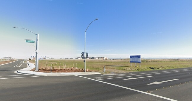
5900 Baseline Rd, Roseville, CA 95747

NEARBY LISTINGS FOR SALE OR LEASE
Property Detail
5900 Baseline Rd
Sacramento--Roseville--Arden-Arcade, CA
Vista Llc Large Lot Sub
499-010-081
LOT 4 KV-SIERRA VISTA LLC LARGE LOT SUB MOR EE-71
Commercialacreage
Placer
X
California
06061C0938H
4
2024
8.58 AC
2025
Roseville/Rocklin
021044
Sacramento
DEMOGRAPHICS near 5900 Baseline Rd
1 Mile
3 Mile
5 Mile
2024 Total Population
2,074
70,966
199,337
2029 Population
2,399
74,824
208,161
Pop Growth 2024-2029
+ 15.67%
+ 5.44%
+ 4.43%
Average Age
39
39
39
2024 Total Households
757
23,989
67,265
HH Growth 2024-2029
+ 15.59%
+ 5.72%
+ 4.64%
Median Household Inc
$159,740
$105,669
$95,568
Avg Household Size
2.70
2.90
2.90
2024 Avg HH Vehicles
2.00
2.00
2.00
Median Home Value
$683,035
$574,255
$494,702
Median Year Built
2010
1998
1993
Nearby Places
Map Layers
Map Styles
 Street
 Aerial
- Restaurants
- Banks
- Shops
- Fitness
- Groceries
PUBLIC TRANSPORTATION
COMMUTER RAIL
Roseville (California Zephyr - Amtrak, Capitol Corridor - Amtrak)
DRIVE
WALK
Distance
Roseville (California Zephyr - Amtrak, Capitol Corridor - Amtrak)
11 min
5.7 mi
AIRPORT
Sacramento International
DRIVE
WALK
Distance
Sacramento International
27 min
18.9 mi
Freight Ports
Port of Stockton
DRIVE
WALK
Distance
Port of Stockton
80 min
67.3 mi
SALE & LEASE HISTORY
LISTING DATE
SALE/LEASE

Oct 16, 2018
For Sale
Feb 26, 2020
For Sale
Nearby Properties
Address
Land Use
TOTAL SIZE
Lot Size
Zoning
Address
Land Use
TOTAL SIZE
Lot Size
Zoning
173,174 SF
8.89 AC
RD-30
Address
Land Use
TOTAL SIZE
Lot Size
Zoning
310,720 SF
16.90 AC
Address
Land Use
TOTAL SIZE
Lot Size
Zoning
345,370 SF
12.80 AC
Address
Land Use
TOTAL SIZE
Lot Size
Zoning
244,048 SF
13.38 AC
RD-30
Address
Land Use
TOTAL SIZE
Lot Size
Zoning
89,259 SF
3.29 AC
Address
Land Use
TOTAL SIZE
Lot Size
Zoning
159,914 SF
6.70 AC
Address
Land Use
TOTAL SIZE
Lot Size
Zoning
141,274 SF
7.06 AC
RD-20
Address
Land Use
TOTAL SIZE
Lot Size
Zoning
126,795 SF
11.75 AC
Address
Land Use
TOTAL SIZE
Lot Size
Zoning
185,342 SF
11.13 AC
RD-20
Address
Land Use
TOTAL SIZE
Lot Size
Zoning
29.68 AC
Address
Land Use
TOTAL SIZE
Lot Size
Zoning
99,935 SF
3.90 AC
Address
Land Use
TOTAL SIZE
Lot Size
Zoning
124,819 SF
13.10 AC
SC
Address
Land Use
TOTAL SIZE
Lot Size
Zoning
25.88 AC
Address
Land Use
TOTAL SIZE
Lot Size
Zoning
Address
Land Use
TOTAL SIZE
Lot Size
Zoning
91,526 SF
7.45 AC
SC
Address
Land Use
TOTAL SIZE
Lot Size
Zoning
48.60 AC
Address
Land Use
TOTAL SIZE
Lot Size
Zoning
53.76 AC
RD-5
Address
Land Use
TOTAL SIZE
Lot Size
Zoning
42,796 SF
14.80 AC
Address
Land Use
TOTAL SIZE
Lot Size
Zoning
64,400 SF
4 AC
Address
Land Use
TOTAL SIZE
Lot Size
Zoning
56,614 SF
4.99 AC
Address
Land Use
TOTAL SIZE
Lot Size
Zoning
36.89 AC
RD-5
Address
Land Use
TOTAL SIZE
Lot Size
Zoning
52,526 SF
6.80 AC
Address
Land Use
TOTAL SIZE
Lot Size
Zoning
86,400 SF
7.17 AC
GC
Address
Land Use
TOTAL SIZE
Lot Size
Zoning
1,000 SF
0.32 AC
RMDL8DC
Address
Land Use
TOTAL SIZE
Lot Size
Zoning
49,052 SF
6.27 AC
RD-20
Address
Land Use
TOTAL SIZE
Lot Size
Zoning
111,607 SF
6.08 AC
RD-20
Address
Land Use
TOTAL SIZE
Lot Size
Zoning
19,790 SF
6.90 AC
Address
Land Use
TOTAL SIZE
Lot Size
Zoning
45,540 SF
4.30 AC
SC
Address
Land Use
TOTAL SIZE
Lot Size
Zoning
31,261 SF
2.94 AC
SC
The World's #1 Commercial Real Estate Marketplace
Connect with us
© 2026 CoStar Group
The information above has been obtained from sources believed reliable. While we do not doubt its accuracy we have not verified it and make no guarantee, warranty or representation about it. It is your responsibility to independently confirm its accuracy and completeness. Any projections, opinions, assumptions, or estimates used are for example only and do not represent the current or future performance of the property. The value of this transaction to you depends on tax and other factors which should be evaluated by your tax, financial, and legal advisors. You and your advisors should conduct a careful, independent investigation of the property to determine to your satisfaction the suitability of the property for your needs.