Property Record
5900 Highway 301, Horn Lake, MS 38637


NEARBY LISTINGS FOR SALE OR LEASE
-
-
View all Horn Lake listings for sale on LoopNet.com
Property Detail
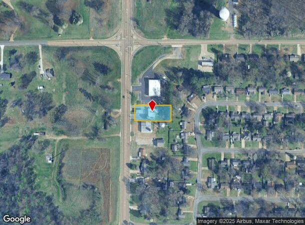
5900 Highway 301
Memphis, TN-MS-AR
Hoyette Austin Lake Subdivision
2083060000000500
6-2-8 PT OF LT C
Realpropertynec
DeSoto
X
Mississippi
28033C0055H
c
2025
0.54 AC
2025
Southaven-Horn Lake
070221
Memphis
2,588 SF
DEMOGRAPHICS near 5900 Highway 301
1 Mile
3 Mile
5 Mile
2024 Total Population
2,732
19,531
54,736
2029 Population
2,958
21,112
59,137
Pop Growth 2024-2029
+ 8.27%
+ 8.09%
+ 8.04%
Average Age
36
37
37
2024 Total Households
929
6,838
20,493
HH Growth 2024-2029
+ 8.29%
+ 8.15%
+ 8.20%
Median Household Inc
$35,869
$54,832
$50,823
Avg Household Size
2.80
2.80
2.60
2024 Avg HH Vehicles
2.00
2.00
2.00
Median Home Value
$103,650
$149,608
$150,703
Median Year Built
1975
1989
1990
Nearby Places
Map Layers
Map Styles
 Street
 Aerial
- Restaurants
- Banks
- Shops
- Fitness
- Groceries
PUBLIC TRANSPORTATION
AIRPORT
Memphis International
DRIVE
WALK
Distance
Memphis International
27 min
13.5 mi
Nearby Properties
Address
Land Use
TOTAL SIZE
Lot Size
Zoning
Address
Land Use
TOTAL SIZE
Lot Size
Zoning
186,757 SF
29 AC
C-4
Address
Land Use
TOTAL SIZE
Lot Size
Zoning
9,684 SF
13.06 AC
R-6
Address
Land Use
TOTAL SIZE
Lot Size
Zoning
15,620 SF
8.68 AC
RM-6
Address
Land Use
TOTAL SIZE
Lot Size
Zoning
9,531 SF
15 AC
RM-6
Address
Land Use
TOTAL SIZE
Lot Size
Zoning
80,022 SF
6.78 AC
PUD
Address
Land Use
TOTAL SIZE
Lot Size
Zoning
66,817 SF
5.91 AC
C-4
Address
Land Use
TOTAL SIZE
Lot Size
Zoning
22,512 SF
7.44 AC
C-4
Address
Land Use
TOTAL SIZE
Lot Size
Zoning
19,826 SF
2.19 AC
PUD
Address
Land Use
TOTAL SIZE
Lot Size
Zoning
6,190 SF
3.78 AC
PUD
Address
Land Use
TOTAL SIZE
Lot Size
Zoning
7,589 SF
23 AC
A-R
Address
Land Use
TOTAL SIZE
Lot Size
Zoning
14,922 SF
2.03 AC
C-4
Address
Land Use
TOTAL SIZE
Lot Size
Zoning
15,707 SF
3.88 AC
C-4
Address
Land Use
TOTAL SIZE
Lot Size
Zoning
22,828 SF
3.28 AC
C-4
Address
Land Use
TOTAL SIZE
Lot Size
Zoning
12,642 SF
1.46 AC
C-1
Address
Land Use
TOTAL SIZE
Lot Size
Zoning
5,922 SF
3.89 AC
RM-6
Address
Land Use
TOTAL SIZE
Lot Size
Zoning
11,092 SF
1.43 AC
C-4
Address
Land Use
TOTAL SIZE
Lot Size
Zoning
10,228 SF
2.37 AC
C-4
Address
Land Use
TOTAL SIZE
Lot Size
Zoning
15,593 SF
0.83 AC
PUD
Address
Land Use
TOTAL SIZE
Lot Size
Zoning
9,913 SF
2.57 AC
C-4
Address
Land Use
TOTAL SIZE
Lot Size
Zoning
18,188 SF
1.91 AC
C-4
Address
Land Use
TOTAL SIZE
Lot Size
Zoning
16,310 SF
1.43 AC
PUD
Address
Land Use
TOTAL SIZE
Lot Size
Zoning
5,085 SF
1.03 AC
PUD
Address
Land Use
TOTAL SIZE
Lot Size
Zoning
4,449 SF
1.02 AC
PUD
Address
Land Use
TOTAL SIZE
Lot Size
Zoning
4.50 AC
RM-6
Address
Land Use
TOTAL SIZE
Lot Size
Zoning
3,260 SF
1.15 AC
PUD
Address
Land Use
TOTAL SIZE
Lot Size
Zoning
3,458 SF
3.37 AC
C-1
Address
Land Use
TOTAL SIZE
Lot Size
Zoning
3,407 SF
1.48 AC
C-4
Address
Land Use
TOTAL SIZE
Lot Size
Zoning
4 AC
RM-6
Address
Land Use
TOTAL SIZE
Lot Size
Zoning
11,645 SF
1.59 AC
C-4
Address
Land Use
TOTAL SIZE
Lot Size
Zoning
9,228 SF
1.43 AC
C-4
The World's #1 Commercial Real Estate Marketplace
Connect with us
© 2026 CoStar Group
The information above has been obtained from sources believed reliable. While we do not doubt its accuracy we have not verified it and make no guarantee, warranty or representation about it. It is your responsibility to independently confirm its accuracy and completeness. Any projections, opinions, assumptions, or estimates used are for example only and do not represent the current or future performance of the property. The value of this transaction to you depends on tax and other factors which should be evaluated by your tax, financial, and legal advisors. You and your advisors should conduct a careful, independent investigation of the property to determine to your satisfaction the suitability of the property for your needs.