Property Record
5900 Sugarloaf Pkwy, Lawrenceville, GA 30043


NEARBY LISTINGS FOR SALE OR LEASE
Property Detail
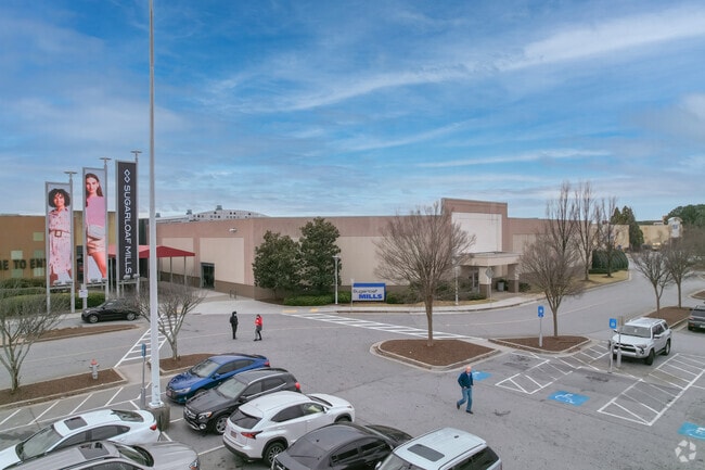
5900 Sugarloaf Pkwy
Atlanta-Sandy Springs-Roswell, GA
Discover Mills
7-081-005
TRACT M-3 ATKINSON RD
Regionalshoppingcenterormallwithanchorstore
Gwinnett
X
Georgia
13135C0071F
81
2025
112.95 AC
2025
Gwinnett Mall/Duluth
050560
Atlanta
1,589,112 SF
DEMOGRAPHICS near 5900 Sugarloaf Pkwy
1 Mile
3 Mile
5 Mile
2024 Total Population
9,973
85,189
242,130
2029 Population
10,740
88,958
252,714
Pop Growth 2024-2029
+ 7.69%
+ 4.42%
+ 4.37%
Average Age
38
37
37
2024 Total Households
3,474
30,207
85,108
HH Growth 2024-2029
+ 7.57%
+ 4.50%
+ 4.49%
Median Household Inc
$55,961
$69,555
$67,522
Avg Household Size
2.80
2.80
2.80
2024 Avg HH Vehicles
2.00
2.00
2.00
Median Home Value
$387,646
$308,402
$289,471
Median Year Built
2006
1995
1994
Nearby Places
Map Layers
Map Styles
 Street
 Aerial
- Restaurants
- Banks
- Shops
- Fitness
- Groceries
SALE & LEASE HISTORY
LISTING DATE
SALE/LEASE

Jul 28, 2025
For Lease
Jul 02, 2019
For Lease
Dec 02, 2021
For Lease
Aug 05, 2025
For Lease
Nearby Properties
Address
Land Use
TOTAL SIZE
Lot Size
Zoning
Address
Land Use
TOTAL SIZE
Lot Size
Zoning
1,457,980 SF
98.78 AC
MUR
Address
Land Use
TOTAL SIZE
Lot Size
Zoning
594,977 SF
47.90 AC
RM13
Address
Land Use
TOTAL SIZE
Lot Size
Zoning
482,658 SF
17.05 AC
MUR
Address
Land Use
TOTAL SIZE
Lot Size
Zoning
563,525 SF
47.80 AC
RM13
Address
Land Use
TOTAL SIZE
Lot Size
Zoning
628,779 SF
97.15 AC
M1
Address
Land Use
TOTAL SIZE
Lot Size
Zoning
441,836 SF
35.71 AC
RM13
Address
Land Use
TOTAL SIZE
Lot Size
Zoning
684,224 SF
77.07 AC
OI
Address
Land Use
TOTAL SIZE
Lot Size
Zoning
461,985 SF
56.76 AC
RM10
Address
Land Use
TOTAL SIZE
Lot Size
Zoning
365,821 SF
17.08 AC
RM24
Address
Land Use
TOTAL SIZE
Lot Size
Zoning
404,176 SF
32.67 AC
M2
Address
Land Use
TOTAL SIZE
Lot Size
Zoning
393,913 SF
25.93 AC
RM13
Address
Land Use
TOTAL SIZE
Lot Size
Zoning
444,605 SF
37.43 AC
RM
Address
Land Use
TOTAL SIZE
Lot Size
Zoning
348,681 SF
35.52 AC
RM10
Address
Land Use
TOTAL SIZE
Lot Size
Zoning
440,998 SF
35.04 AC
RM
Address
Land Use
TOTAL SIZE
Lot Size
Zoning
584,576 SF
38.60 AC
RM13
Address
Land Use
TOTAL SIZE
Lot Size
Zoning
280,454 SF
19.97 AC
MUR
Address
Land Use
TOTAL SIZE
Lot Size
Zoning
471,807 SF
69.50 AC
R100
Address
Land Use
TOTAL SIZE
Lot Size
Zoning
275,136 SF
44.76 AC
RM13
Address
Land Use
TOTAL SIZE
Lot Size
Zoning
285,038 SF
1.93 AC
MUR
Address
Land Use
TOTAL SIZE
Lot Size
Zoning
340,573 SF
22.12 AC
RM13
Address
Land Use
TOTAL SIZE
Lot Size
Zoning
314,338 SF
28.83 AC
RM13
Address
Land Use
TOTAL SIZE
Lot Size
Zoning
587,415 SF
4.32 AC
HRR
Address
Land Use
TOTAL SIZE
Lot Size
Zoning
316,443 SF
30.15 AC
RM13
Address
Land Use
TOTAL SIZE
Lot Size
Zoning
304,276 SF
14.90 AC
MUR
Address
Land Use
TOTAL SIZE
Lot Size
Zoning
315,806 SF
13.03 AC
MUR
Address
Land Use
TOTAL SIZE
Lot Size
Zoning
336,554 SF
30.40 AC
RM
Address
Land Use
TOTAL SIZE
Lot Size
Zoning
303,275 SF
19.80 AC
RM13
Address
Land Use
TOTAL SIZE
Lot Size
Zoning
262,476 SF
20.51 AC
RM13
Address
Land Use
TOTAL SIZE
Lot Size
Zoning
377,960 SF
29.70 AC
RM13
The World's #1 Commercial Real Estate Marketplace
Connect with us
© 2025 CoStar Group
The information above has been obtained from sources believed reliable. While we do not doubt its accuracy we have not verified it and make no guarantee, warranty or representation about it. It is your responsibility to independently confirm its accuracy and completeness. Any projections, opinions, assumptions, or estimates used are for example only and do not represent the current or future performance of the property. The value of this transaction to you depends on tax and other factors which should be evaluated by your tax, financial, and legal advisors. You and your advisors should conduct a careful, independent investigation of the property to determine to your satisfaction the suitability of the property for your needs.