Property Record
5901 Zerker Rd, Shafter, CA 93263
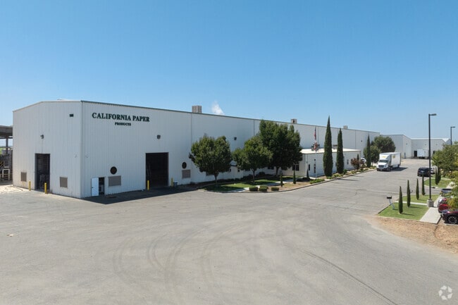

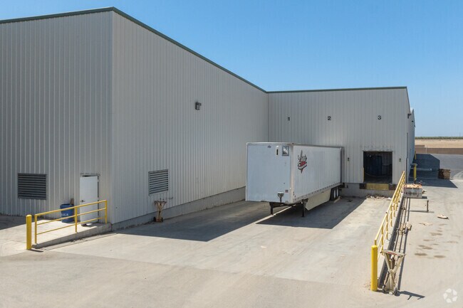
Property Detail
5901 Zerker Rd
091-171-37-00-9
PARCEL MAP 11199 , LOT PTN
Lightindustrial
Kern
B and X Area of moderate flood hazard, usually the area between the limits of the 100-year and 500-year floods.
California
2024
21.15 AC
2025
NW Outlying Kern County
003900
Bakersfield
94,661 SF
Bakersfield-Delano, CA
NEARBY LISTINGS FOR SALE OR LEASE
DEMOGRAPHICS near 5901 Zerker Rd
1 mile
3 mile
5 mile
2025 Total Population
4
216
2,283
2030 Population
4
212
2,267
Pop Growth 2025-2030
0.00%
(1.85%)
(0.70%)
Average Age
0
37
35
2025 Total Households
1
24
446
HH Growth 2025-2030
0.00%
+ 4.17%
+ 1.79%
Median Household Inc
$0
$58,333
$116,755
Avg Household Size
.00
3.40
3.60
2025 Avg HH Vehicles
2.00
2.00
3.00
Median Home Value
$450,000
$593,750
$446,308
Median Year Built
2011
1971
2005
Nearby Places
Map Layers
Map Styles
 Street
 Aerial
Layers
 Traffic
 Biking
Places
Listings with unknown addresses are not visible on the map
- Restaurants
- Banks
- Shops
- Fitness
- Groceries
PUBLIC TRANSPORTATION
AIRPORT
Meadows Field
Drive
Walk
Distance
Meadows Field
19 min
9.6 mi
Freight Ports
The Port of Hueneme
Drive
Walk
Distance
The Port of Hueneme
166 min
134.3 mi
Nearby Properties
Address
Land Use
TOTAL SIZE
Lot Size
Zoning
Address
Land Use
TOTAL SIZE
Lot Size
Zoning
2,129,000 SF
154.70 AC
M-1
Address
Land Use
TOTAL SIZE
Lot Size
Zoning
622,678 SF
68.11 AC
I
Address
Land Use
TOTAL SIZE
Lot Size
Zoning
1,004,880 SF
71.87 AC
I
Address
Land Use
TOTAL SIZE
Lot Size
Zoning
72.24 AC
I
Address
Land Use
TOTAL SIZE
Lot Size
Zoning
171,564 SF
78.74 AC
M-2
Address
Land Use
TOTAL SIZE
Lot Size
Zoning
1,004,800 SF
57.77 AC
I
Address
Land Use
TOTAL SIZE
Lot Size
Zoning
1,695 SF
78.08 AC
M2
Address
Land Use
TOTAL SIZE
Lot Size
Zoning
4,640 SF
34.72 AC
G-C
Address
Land Use
TOTAL SIZE
Lot Size
Zoning
82,841 SF
484.49 AC
A
Address
Land Use
TOTAL SIZE
Lot Size
Zoning
135,048 SF
34.98 AC
M
Address
Land Use
TOTAL SIZE
Lot Size
Zoning
56,000 SF
19.04 AC
A
Address
Land Use
TOTAL SIZE
Lot Size
Zoning
64,710 SF
59.09 AC
BP4
Address
Land Use
TOTAL SIZE
Lot Size
Zoning
15.33 AC
Address
Land Use
TOTAL SIZE
Lot Size
Zoning
158,175 SF
25.22 AC
AG
Address
Land Use
TOTAL SIZE
Lot Size
Zoning
4.67 AC
Address
Land Use
TOTAL SIZE
Lot Size
Zoning
19.71 AC
A
Address
Land Use
TOTAL SIZE
Lot Size
Zoning
29,600 SF
3.77 AC
M-2
Address
Land Use
TOTAL SIZE
Lot Size
Zoning
466.60 AC
Address
Land Use
TOTAL SIZE
Lot Size
Zoning
15,998 SF
15.37 AC
CH PD
Address
Land Use
TOTAL SIZE
Lot Size
Zoning
1,200 SF
519.50 AC
A
Address
Land Use
TOTAL SIZE
Lot Size
Zoning
Address
Land Use
TOTAL SIZE
Lot Size
Zoning
626.28 AC
A
Address
Land Use
TOTAL SIZE
Lot Size
Zoning
160 AC
A
Address
Land Use
TOTAL SIZE
Lot Size
Zoning
115,483 SF
14.39 AC
M3
Address
Land Use
TOTAL SIZE
Lot Size
Zoning
311.57 AC
Address
Land Use
TOTAL SIZE
Lot Size
Zoning
720 SF
139.09 AC
A
Address
Land Use
TOTAL SIZE
Lot Size
Zoning
22,538 SF
4.42 AC
GC
Address
Land Use
TOTAL SIZE
Lot Size
Zoning
0.73 AC
CH PD
The World's #1 Commercial Real Estate Marketplace
Connect with us
© 2026 CoStar Group
The information above has been obtained from sources believed reliable. While we do not doubt its accuracy we have not verified it and make no guarantee, warranty or representation about it. It is your responsibility to independently confirm its accuracy and completeness. Any projections, opinions, assumptions, or estimates used are for example only and do not represent the current or future performance of the property. The value of this transaction to you depends on tax and other factors which should be evaluated by your tax, financial, and legal advisors. You and your advisors should conduct a careful, independent investigation of the property to determine to your satisfaction the suitability of the property for your needs.