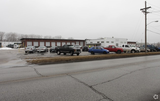
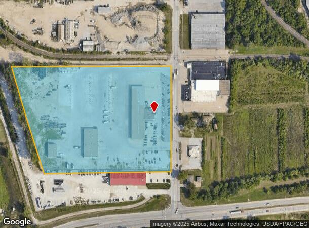
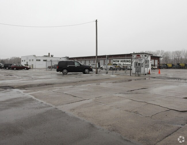
Property Record
5902 N 16Th St, Omaha, NE 68110
NEARBY LISTINGS FOR SALE OR LEASE
Property Detail
5902 N 16Th St
Omaha, NE-IA
Forbes Sub Sw 1/4 34-16-13
3291-0003-11
FORBES SUB SW 1/4 34-16-13 LOT 18 BLOCK 0 -EX N 48 FT- E OF RR RWY LOT 17 & E OF RR RWY LOT 18
Warehouse
Douglas
X
Nebraska
31055C0229H
18,17
2024
11.82 AC
2025
Northeast Omaha
000400
Omaha/Council Bluffs
44,220 SF
DEMOGRAPHICS near 5902 N 16Th St
1 Mile
3 Mile
5 Mile
2024 Total Population
7,855
57,242
177,605
2029 Population
8,119
58,585
181,072
Pop Growth 2024-2029
+ 3.36%
+ 2.35%
+ 1.95%
Average Age
36
36
37
2024 Total Households
2,874
20,117
71,820
HH Growth 2024-2029
+ 3.34%
+ 2.40%
+ 2.13%
Median Household Inc
$33,511
$37,513
$47,376
Avg Household Size
2.60
2.60
2.30
2024 Avg HH Vehicles
2.00
2.00
2.00
Median Home Value
$96,158
$109,074
$158,573
Median Year Built
1947
1954
1955
Nearby Places
Map Layers
Map Styles
 Street
 Aerial
- Restaurants
- Banks
- Shops
- Fitness
- Groceries
PUBLIC TRANSPORTATION
COMMUTER RAIL
Omaha Amtrak Station (California Zephyr - Amtrak)
DRIVE
WALK
Distance
Omaha Amtrak Station (California Zephyr - Amtrak)
10 min
6.0 mi
Omaha Amtrak Station (California Zephyr - Amtrak)
DRIVE
WALK
Distance
Omaha Amtrak Station (California Zephyr - Amtrak)
11 min
6.2 mi
AIRPORT
Eppley Airfield
DRIVE
WALK
Distance
Eppley Airfield
9 min
3.7 mi
Freight Ports
Tulsa Port Of Catoosa
DRIVE
WALK
Distance
Tulsa Port Of Catoosa
467 min
422.4 mi
Nearby Properties
Address
Land Use
TOTAL SIZE
Lot Size
Zoning
Address
Land Use
TOTAL SIZE
Lot Size
Zoning
189,720 SF
1.22 AC
CBD
Address
Land Use
TOTAL SIZE
Lot Size
Zoning
254,548 SF
1.67 AC
Address
Land Use
TOTAL SIZE
Lot Size
Zoning
200,501 SF
1.78 AC
DS
Address
Land Use
TOTAL SIZE
Lot Size
Zoning
39.68 AC
Address
Land Use
TOTAL SIZE
Lot Size
Zoning
18.12 AC
Address
Land Use
TOTAL SIZE
Lot Size
Zoning
540,097 SF
20.98 AC
GI
Address
Land Use
TOTAL SIZE
Lot Size
Zoning
184,154 SF
9.93 AC
Address
Land Use
TOTAL SIZE
Lot Size
Zoning
69,554 SF
3.45 AC
Address
Land Use
TOTAL SIZE
Lot Size
Zoning
200,000 SF
11.49 AC
GI
Address
Land Use
TOTAL SIZE
Lot Size
Zoning
164,320 SF
6.88 AC
Address
Land Use
TOTAL SIZE
Lot Size
Zoning
107,617 SF
0.92 AC
Address
Land Use
TOTAL SIZE
Lot Size
Zoning
142,451 SF
19.14 AC
Address
Land Use
TOTAL SIZE
Lot Size
Zoning
2.11 AC
Address
Land Use
TOTAL SIZE
Lot Size
Zoning
178,896 SF
16.92 AC
Address
Land Use
TOTAL SIZE
Lot Size
Zoning
2.23 AC
Address
Land Use
TOTAL SIZE
Lot Size
Zoning
113,216 SF
12.93 AC
GI
Address
Land Use
TOTAL SIZE
Lot Size
Zoning
58,945 SF
3.97 AC
Address
Land Use
TOTAL SIZE
Lot Size
Zoning
Address
Land Use
TOTAL SIZE
Lot Size
Zoning
111,770 SF
2.65 AC
Address
Land Use
TOTAL SIZE
Lot Size
Zoning
149,796 SF
13.08 AC
GI
Address
Land Use
TOTAL SIZE
Lot Size
Zoning
139,424 SF
5.06 AC
Address
Land Use
TOTAL SIZE
Lot Size
Zoning
97,422 SF
4.06 AC
Address
Land Use
TOTAL SIZE
Lot Size
Zoning
383,283 SF
11.94 AC
GI
Address
Land Use
TOTAL SIZE
Lot Size
Zoning
198,000 SF
14.90 AC
GI
Address
Land Use
TOTAL SIZE
Lot Size
Zoning
1.78 AC
Address
Land Use
TOTAL SIZE
Lot Size
Zoning
246,595 SF
17.53 AC
HI
Address
Land Use
TOTAL SIZE
Lot Size
Zoning
1.90 AC
Address
Land Use
TOTAL SIZE
Lot Size
Zoning
4.76 AC
Address
Land Use
TOTAL SIZE
Lot Size
Zoning
90,000 SF
7.64 AC
GI
The World's #1 Commercial Real Estate Marketplace
Connect with us
© 2026 CoStar Group
The information above has been obtained from sources believed reliable. While we do not doubt its accuracy we have not verified it and make no guarantee, warranty or representation about it. It is your responsibility to independently confirm its accuracy and completeness. Any projections, opinions, assumptions, or estimates used are for example only and do not represent the current or future performance of the property. The value of this transaction to you depends on tax and other factors which should be evaluated by your tax, financial, and legal advisors. You and your advisors should conduct a careful, independent investigation of the property to determine to your satisfaction the suitability of the property for your needs.