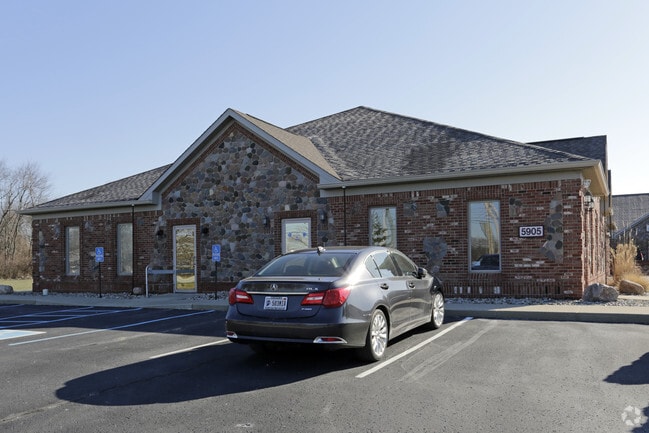
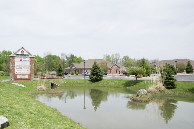
Property Record
5905 S Emerson Ave, Indianapolis, IN 46237

Current Lease Availabilities
NEARBY LISTINGS FOR SALE OR LEASE
Property Detail
5905 S Emerson Ave
49-15-03-160-006.000-300
Na
Officebuilding
PT SW1/4 SW1/4 S3 T14 R4 BEG 595 N & 145.4 E OFSW COR S 154.2 E 158.07 N 158.1 W158.12 TO BEG .567AC
X
Marion
18097C0262G
Indiana
2023
0.57 AC
2024
Beech Grove/SE County
390411
Indianapolis
5,607 SF
Indianapolis-Carmel-Anderson, IN
DEMOGRAPHICS near 5905 S Emerson Ave
1 Mile
3 Mile
5 Mile
2024 Total Population
9,043
79,007
191,386
2029 Population
8,897
77,534
189,990
Pop Growth 2024-2029
(1.61%)
(1.86%)
(0.73%)
Average Age
41
38
37
2024 Total Households
3,703
30,594
74,293
HH Growth 2024-2029
(1.73%)
(1.92%)
(0.67%)
Median Household Inc
$71,413
$68,138
$63,973
Avg Household Size
2.40
2.50
2.50
2024 Avg HH Vehicles
2.00
2.00
2.00
Median Home Value
$198,712
$191,618
$185,890
Median Year Built
1984
1983
1977
Nearby Places
- Restaurants
- Banks
- Shops
- Fitness
- Groceries
PUBLIC TRANSPORTATION
COMMUTER RAIL
DRIVE
WALK
Distance
14 min
8.4 mi
AIRPORT
Indianapolis International
DRIVE
WALK
Distance
Indianapolis International
32 min
19.3 mi
Nearby Properties
Address
Land Use
TOTAL SIZE
Lot Size
Zoning
Address
Land Use
TOTAL SIZE
Lot Size
Zoning
31,217 SF
105.06 AC
ZO01
Address
Land Use
TOTAL SIZE
Lot Size
Zoning
5,846 SF
43.64 AC
ZO01
Address
Land Use
TOTAL SIZE
Lot Size
Zoning
3,586 SF
30.28 AC
ZO01
Address
Land Use
TOTAL SIZE
Lot Size
Zoning
19,927 SF
28.82 AC
ZO01
Address
Land Use
TOTAL SIZE
Lot Size
Zoning
6,786 SF
45.81 AC
Address
Land Use
TOTAL SIZE
Lot Size
Zoning
1,362 SF
6.66 AC
ZO01
Address
Land Use
TOTAL SIZE
Lot Size
Zoning
5,401 SF
21.94 AC
ZO01
Address
Land Use
TOTAL SIZE
Lot Size
Zoning
110,598 SF
22.82 AC
ZO01
Address
Land Use
TOTAL SIZE
Lot Size
Zoning
405,664 SF
35.56 AC
ZO01
Address
Land Use
TOTAL SIZE
Lot Size
Zoning
352,000 SF
22.72 AC
ZO01
Address
Land Use
TOTAL SIZE
Lot Size
Zoning
3,202 SF
18.62 AC
ZO01
Address
Land Use
TOTAL SIZE
Lot Size
Zoning
37,718 SF
11.77 AC
ZO01
Address
Land Use
TOTAL SIZE
Lot Size
Zoning
1,660 SF
15.01 AC
ZO01
Address
Land Use
TOTAL SIZE
Lot Size
Zoning
1,960 SF
23.76 AC
Address
Land Use
TOTAL SIZE
Lot Size
Zoning
88,694 SF
11.81 AC
ZO01
Address
Land Use
TOTAL SIZE
Lot Size
Zoning
95,987 SF
7.54 AC
ZO01
Address
Land Use
TOTAL SIZE
Lot Size
Zoning
44,294 SF
11.05 AC
ZO01
Address
Land Use
TOTAL SIZE
Lot Size
Zoning
405 SF
23.81 AC
ZO01
Address
Land Use
TOTAL SIZE
Lot Size
Zoning
2,486 SF
13.75 AC
ZO01
Address
Land Use
TOTAL SIZE
Lot Size
Zoning
233,818 SF
26.42 AC
ZO01
Address
Land Use
TOTAL SIZE
Lot Size
Zoning
41,675 SF
8.94 AC
ZO01
Address
Land Use
TOTAL SIZE
Lot Size
Zoning
45,791 SF
11.39 AC
ZO01
Address
Land Use
TOTAL SIZE
Lot Size
Zoning
4,179 SF
28.11 AC
ZO01
Address
Land Use
TOTAL SIZE
Lot Size
Zoning
6,459 SF
11.06 AC
ZO01
Address
Land Use
TOTAL SIZE
Lot Size
Zoning
4,212 SF
16 AC
Address
Land Use
TOTAL SIZE
Lot Size
Zoning
208,224 SF
23.41 AC
ZO01
Address
Land Use
TOTAL SIZE
Lot Size
Zoning
354,398 SF
18.36 AC
ZO01
Address
Land Use
TOTAL SIZE
Lot Size
Zoning
120,500 SF
10.32 AC
ZO01
Address
Land Use
TOTAL SIZE
Lot Size
Zoning
4,872 SF
12.37 AC
Address
Land Use
TOTAL SIZE
Lot Size
Zoning
1,575 SF
10.24 AC
The World's #1 Commercial Real Estate Marketplace
Connect with us
© 2025 CoStar Group
The information above has been obtained from sources believed reliable. While we do not doubt its accuracy we have not verified it and make no guarantee, warranty or representation about it. It is your responsibility to independently confirm its accuracy and completeness. Any projections, opinions, assumptions, or estimates used are for example only and do not represent the current or future performance of the property. The value of this transaction to you depends on tax and other factors which should be evaluated by your tax, financial, and legal advisors. You and your advisors should conduct a careful, independent investigation of the property to determine to your satisfaction the suitability of the property for your needs.