Property Record
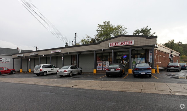
5909 Central Ave, Capitol Heights, MD 20743


Property Detail
5909 Central Ave
18-2033363
UOTS 1.50.51.52.53 .54.55 & 56 IMP ON 55
Storebuilding
Prince Georges
LTOE
Maryland
B and X Area of moderate flood hazard, usually the area between the limits of the 100-year and 500-year floods.
1
2023
0.37 AC
2025
Landover/Largo/Captl Hts
802700
Washington, DC
5,890 SF
Washington-Arlington-Alexandria, DC-VA-MD-WV
NEARBY LISTINGS FOR SALE OR LEASE
DEMOGRAPHICS near 5909 Central Ave
1 mile
3 mile
5 mile
2025 Total Population
30,095
165,445
510,835
2030 Population
31,735
171,279
532,060
Pop Growth 2025-2030
+ 5.45%
+ 3.53%
+ 4.15%
Average Age
38
40
38
2025 Total Households
11,456
66,152
209,649
HH Growth 2025-2030
+ 6.01%
+ 3.90%
+ 4.91%
Median Household Inc
$69,070
$71,236
$84,614
Avg Household Size
2.50
2.40
2.30
2025 Avg HH Vehicles
1.00
1.00
1.00
Median Home Value
$335,404
$337,310
$351,299
Median Year Built
1962
1964
1966
Nearby Places
Map Layers
Map Styles
 Street
 Aerial
Layers
 Traffic
 Biking
Places
Listings with unknown addresses are not visible on the map
- Restaurants
- Banks
- Shops
- Fitness
- Groceries
PUBLIC TRANSPORTATION
COMMUTER RAIL
Drive
Walk
Distance
11 min
5.3 mi
Union Station (Red Line - Washington Metropolitan Area Transit Authority Metrorail (Metrorail))
Drive
Walk
Distance
Union Station (Red Line - Washington Metropolitan Area Transit Authority Metrorail (Metrorail))
11 min
5.4 mi
AIRPORT
Ronald Reagan Washington Ntl
Drive
Walk
Distance
Ronald Reagan Washington Ntl
22 min
10.6 mi
Baltimore/Washington International Thurgood Marshall
Drive
Walk
Distance
Baltimore/Washington International Thurgood Marshall
43 min
28.9 mi
Washington Dulles International
Drive
Walk
Distance
Washington Dulles International
56 min
34.2 mi
Freight Ports
Port of Baltimore
Drive
Walk
Distance
Port of Baltimore
52 min
35.2 mi
Nearby Properties
Address
Land Use
TOTAL SIZE
Lot Size
Zoning
Address
Land Use
TOTAL SIZE
Lot Size
Zoning
169.85 AC
R-2;RA-1;U
Address
Land Use
TOTAL SIZE
Lot Size
Zoning
2,131,229 SF
144.34 AC
AG
Address
Land Use
TOTAL SIZE
Lot Size
Zoning
36.52 AC
HE-2;HE-3;
Address
Land Use
TOTAL SIZE
Lot Size
Zoning
236,535 SF
12.54 AC
R-2
Address
Land Use
TOTAL SIZE
Lot Size
Zoning
176.56 AC
HE-3;UNZON
Address
Land Use
TOTAL SIZE
Lot Size
Zoning
241,725 SF
4.71 AC
MU-7B;PDR-
Address
Land Use
TOTAL SIZE
Lot Size
Zoning
62.03 AC
UNZONED
Address
Land Use
TOTAL SIZE
Lot Size
Zoning
229,238 SF
1.51 AC
MU-7B
Address
Land Use
TOTAL SIZE
Lot Size
Zoning
12.60 AC
LTOC
Address
Land Use
TOTAL SIZE
Lot Size
Zoning
821,240 SF
48.32 AC
IH
Address
Land Use
TOTAL SIZE
Lot Size
Zoning
192,440 SF
7.67 AC
R-2;RA-1
Address
Land Use
TOTAL SIZE
Lot Size
Zoning
107,130 SF
2.98 AC
R-2;RA-1
Address
Land Use
TOTAL SIZE
Lot Size
Zoning
419,689 SF
66.84 AC
PDR-1;PDR-
Address
Land Use
TOTAL SIZE
Lot Size
Zoning
132,000 SF
RA-1
Address
Land Use
TOTAL SIZE
Lot Size
Zoning
262,236 SF
15.26 AC
MU-8B
Address
Land Use
TOTAL SIZE
Lot Size
Zoning
379,168 SF
18.94 AC
RMF20
Address
Land Use
TOTAL SIZE
Lot Size
Zoning
181,530 SF
4.72 AC
R-2
Address
Land Use
TOTAL SIZE
Lot Size
Zoning
62,797 SF
0.55 AC
R2
Address
Land Use
TOTAL SIZE
Lot Size
Zoning
92,511 SF
1.48 AC
RA-1
Address
Land Use
TOTAL SIZE
Lot Size
Zoning
25.33 AC
UNZONED
Address
Land Use
TOTAL SIZE
Lot Size
Zoning
10.63 AC
RMF20
Address
Land Use
TOTAL SIZE
Lot Size
Zoning
123,950 SF
4.65 AC
R-2
Address
Land Use
TOTAL SIZE
Lot Size
Zoning
22.19 AC
UNZONED
Address
Land Use
TOTAL SIZE
Lot Size
Zoning
206,118 SF
0.82 AC
RA-1
Address
Land Use
TOTAL SIZE
Lot Size
Zoning
99,269 SF
4.73 AC
RA-1
Address
Land Use
TOTAL SIZE
Lot Size
Zoning
142,636 SF
3.69 AC
RA-1
Address
Land Use
TOTAL SIZE
Lot Size
Zoning
13.21 AC
RMF48
Address
Land Use
TOTAL SIZE
Lot Size
Zoning
115,788 SF
1.77 AC
MU-4;RA-1
Address
Land Use
TOTAL SIZE
Lot Size
Zoning
29.49 AC
RSFA
Address
Land Use
TOTAL SIZE
Lot Size
Zoning
162,221 SF
1.12 AC
R-2
The World's #1 Commercial Real Estate Marketplace
Connect with us
© 2026 CoStar Group
The information above has been obtained from sources believed reliable. While we do not doubt its accuracy we have not verified it and make no guarantee, warranty or representation about it. It is your responsibility to independently confirm its accuracy and completeness. Any projections, opinions, assumptions, or estimates used are for example only and do not represent the current or future performance of the property. The value of this transaction to you depends on tax and other factors which should be evaluated by your tax, financial, and legal advisors. You and your advisors should conduct a careful, independent investigation of the property to determine to your satisfaction the suitability of the property for your needs.