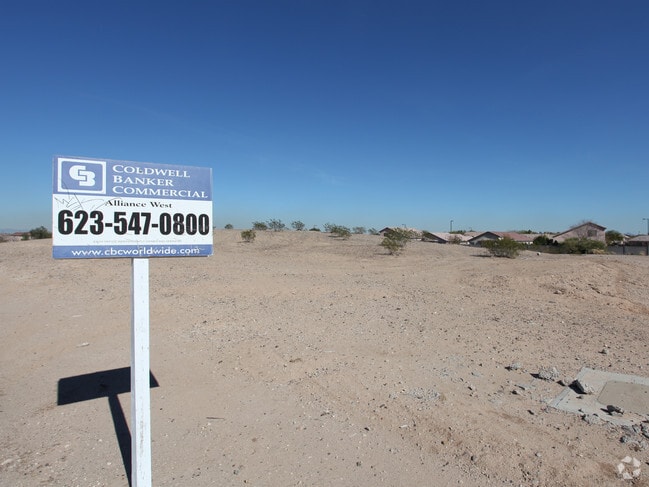
Property Record
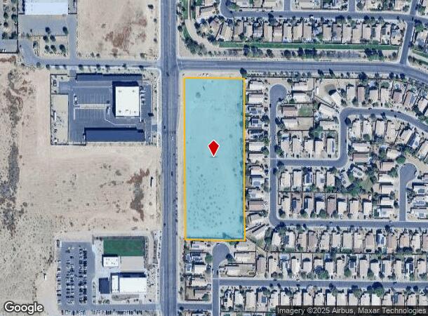
5909 N Litchfield Rd, Litchfield Park, AZ 85340

NEARBY LISTINGS FOR SALE OR LEASE
Property Detail
5909 N Litchfield Rd
501-62-012B
TH PT NW4 SEC 15 COM NW COR SEC TH S 88D 34M E 345.07F TH S 55.01F TO POB TH CONT S 750.89F TH N 88D 34M W 290.06F TO PNT 55F E OF W LN SEC TH N 750.89F TH S 88D 34M E 290.06F TO POB EX TH PT LY WI-IN RD PER MOD MCR 543/37
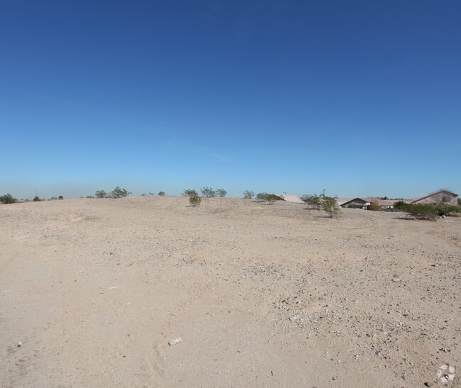
Commercialacreage
Maricopa
X
Arizona
04013C1690M
4.83 AC
2025
Loop 303/Surprise
2025
Phoenix
061055
Phoenix-Mesa-Scottsdale, AZ
DEMOGRAPHICS near 5909 N Litchfield Rd
1 Mile
3 Mile
5 Mile
2024 Total Population
8,260
56,524
151,003
2029 Population
8,997
61,779
165,166
Pop Growth 2024-2029
+ 8.92%
+ 9.30%
+ 9.38%
Average Age
36
37
39
2024 Total Households
2,455
18,608
51,549
HH Growth 2024-2029
+ 9.04%
+ 9.30%
+ 9.56%
Median Household Inc
$105,591
$100,027
$87,297
Avg Household Size
3.20
2.90
2.80
2024 Avg HH Vehicles
2.00
2.00
2.00
Median Home Value
$409,197
$419,276
$382,297
Median Year Built
2004
2004
2002
Nearby Places
Map Layers
Map Styles
 Street
 Aerial
- Restaurants
- Banks
- Shops
- Fitness
- Groceries
PUBLIC TRANSPORTATION
AIRPORT
Phoenix Sky Harbor International
DRIVE
WALK
Distance
Phoenix Sky Harbor International
38 min
27.0 mi
Freight Ports
Port of San Diego
DRIVE
WALK
Distance
Port of San Diego
382 min
341.6 mi
Nearby Properties
Address
Land Use
TOTAL SIZE
Lot Size
Zoning
Address
Land Use
TOTAL SIZE
Lot Size
Zoning
71.40 AC
Address
Land Use
TOTAL SIZE
Lot Size
Zoning
Address
Land Use
TOTAL SIZE
Lot Size
Zoning
1,188,764 SF
631.19 AC
AP
Address
Land Use
TOTAL SIZE
Lot Size
Zoning
1,433,378 SF
317.58 AC
AP
Address
Land Use
TOTAL SIZE
Lot Size
Zoning
73.09 AC
Address
Land Use
TOTAL SIZE
Lot Size
Zoning
1,201,280 SF
74.43 AC
PAD
Address
Land Use
TOTAL SIZE
Lot Size
Zoning
52.99 AC
Address
Land Use
TOTAL SIZE
Lot Size
Zoning
1,200,140 SF
76.91 AC
Address
Land Use
TOTAL SIZE
Lot Size
Zoning
510,342 SF
51.45 AC
LUKEAFB
Address
Land Use
TOTAL SIZE
Lot Size
Zoning
1,253,382 SF
74.13 AC
Address
Land Use
TOTAL SIZE
Lot Size
Zoning
401,714 SF
100.01 AC
PAD
Address
Land Use
TOTAL SIZE
Lot Size
Zoning
25.69 AC
Address
Land Use
TOTAL SIZE
Lot Size
Zoning
570,080 SF
36.76 AC
Address
Land Use
TOTAL SIZE
Lot Size
Zoning
844,524 SF
130.66 AC
LUKEAFB
Address
Land Use
TOTAL SIZE
Lot Size
Zoning
351,775 SF
53.72 AC
AP
Address
Land Use
TOTAL SIZE
Lot Size
Zoning
663,367 SF
38.83 AC
Address
Land Use
TOTAL SIZE
Lot Size
Zoning
634,560 SF
36.84 AC
PAD
Address
Land Use
TOTAL SIZE
Lot Size
Zoning
599,070 SF
38.33 AC
Address
Land Use
TOTAL SIZE
Lot Size
Zoning
563,781 SF
34.84 AC
PAD
Address
Land Use
TOTAL SIZE
Lot Size
Zoning
295,014 SF
37.63 AC
PAD
Address
Land Use
TOTAL SIZE
Lot Size
Zoning
282,993 SF
14.16 AC
PF
Address
Land Use
TOTAL SIZE
Lot Size
Zoning
278,670 SF
40.72 AC
Address
Land Use
TOTAL SIZE
Lot Size
Zoning
198,109 SF
79 AC
R-43
Address
Land Use
TOTAL SIZE
Lot Size
Zoning
353,155 SF
16.80 AC
M-H
Address
Land Use
TOTAL SIZE
Lot Size
Zoning
340,061 SF
15.50 AC
M-H
Address
Land Use
TOTAL SIZE
Lot Size
Zoning
106,351 SF
20 AC
PAD
Address
Land Use
TOTAL SIZE
Lot Size
Zoning
113,020 SF
16.37 AC
R-43
Address
Land Use
TOTAL SIZE
Lot Size
Zoning
109,856 SF
25.18 AC
R-43
Address
Land Use
TOTAL SIZE
Lot Size
Zoning
326,018 SF
21.03 AC
Address
Land Use
TOTAL SIZE
Lot Size
Zoning
102,431 SF
17.63 AC
R-10
The World's #1 Commercial Real Estate Marketplace
Connect with us
© 2025 CoStar Group
The information above has been obtained from sources believed reliable. While we do not doubt its accuracy we have not verified it and make no guarantee, warranty or representation about it. It is your responsibility to independently confirm its accuracy and completeness. Any projections, opinions, assumptions, or estimates used are for example only and do not represent the current or future performance of the property. The value of this transaction to you depends on tax and other factors which should be evaluated by your tax, financial, and legal advisors. You and your advisors should conduct a careful, independent investigation of the property to determine to your satisfaction the suitability of the property for your needs.