Property Record
591 Metacom Ave, Bristol, RI 02809
NEARBY LISTINGS FOR SALE OR LEASE
Property Detail
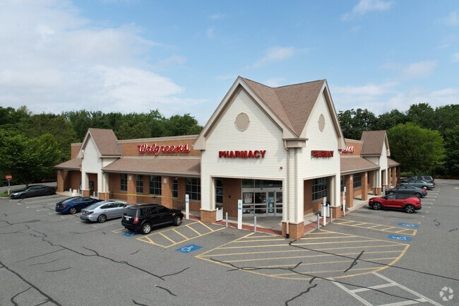
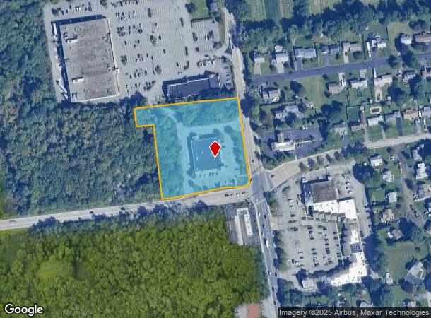
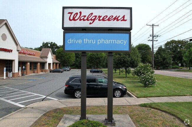
591 Metacom Ave
BRIS-000098-000000-000006
Bristol
Commercialbuilding
Rhode Island
X
6
44001C0011H
2.72 AC
2025
Bristol County
2025
Providence
030902
Providence-Warwick, RI-MA
14,547 SF
DEMOGRAPHICS near 591 Metacom Ave
1 Mile
3 Mile
5 Mile
2024 Total Population
6,945
33,851
79,325
2029 Population
6,933
33,645
78,694
Pop Growth 2024-2029
(0.17%)
(0.61%)
(0.80%)
Average Age
45
44
43
2024 Total Households
2,682
13,812
32,513
HH Growth 2024-2029
(0.11%)
(0.60%)
(0.87%)
Median Household Inc
$94,248
$92,771
$86,841
Avg Household Size
2.40
2.20
2.30
2024 Avg HH Vehicles
2.00
2.00
2.00
Median Home Value
$375,141
$399,664
$400,753
Median Year Built
1978
1961
1958
Nearby Places
Map Layers
Map Styles
 Street
 Aerial
- Restaurants
- Banks
- Shops
- Fitness
- Groceries
PUBLIC TRANSPORTATION
AIRPORT
Rhode Island Tf Green International
DRIVE
WALK
Distance
Rhode Island Tf Green International
38 min
22.2 mi
Freight Ports
Port of New Bedford Harbor
DRIVE
WALK
Distance
Port of New Bedford Harbor
34 min
23.7 mi
SALE & LEASE HISTORY
LISTING DATE
SALE/LEASE

Nov 05, 2018
For Sale
Jun 02, 2017
For Sale
Apr 03, 2018
For Sale
Nearby Properties
Address
Land Use
TOTAL SIZE
Lot Size
Zoning
Address
Land Use
TOTAL SIZE
Lot Size
Zoning
113,253 SF
85.69 AC
HPC
Address
Land Use
TOTAL SIZE
Lot Size
Zoning
17,500 SF
7.12 AC
EI
Address
Land Use
TOTAL SIZE
Lot Size
Zoning
159,363 SF
14.19 AC
R-10
Address
Land Use
TOTAL SIZE
Lot Size
Zoning
17,500 SF
5.92 AC
WF
Address
Land Use
TOTAL SIZE
Lot Size
Zoning
2,080 SF
11.01 AC
R-15
Address
Land Use
TOTAL SIZE
Lot Size
Zoning
18,236 SF
10.24 AC
LB
Address
Land Use
TOTAL SIZE
Lot Size
Zoning
140,460 SF
12.50 AC
R10
Address
Land Use
TOTAL SIZE
Lot Size
Zoning
1.97 AC
R10
Address
Land Use
TOTAL SIZE
Lot Size
Zoning
4.40 AC
B
Address
Land Use
TOTAL SIZE
Lot Size
Zoning
44.10 AC
R-40
Address
Land Use
TOTAL SIZE
Lot Size
Zoning
4,152 SF
1.71 AC
W
Address
Land Use
TOTAL SIZE
Lot Size
Zoning
63,730 SF
12.97 AC
M
Address
Land Use
TOTAL SIZE
Lot Size
Zoning
38,176 SF
0.97 AC
R-6
Address
Land Use
TOTAL SIZE
Lot Size
Zoning
35.50 AC
R-40
Address
Land Use
TOTAL SIZE
Lot Size
Zoning
49.31 AC
R-40
Address
Land Use
TOTAL SIZE
Lot Size
Zoning
27,264 SF
0.26 AC
LB
Address
Land Use
TOTAL SIZE
Lot Size
Zoning
2.88 AC
B
Address
Land Use
TOTAL SIZE
Lot Size
Zoning
36,324 SF
24 AC
R-40
Address
Land Use
TOTAL SIZE
Lot Size
Zoning
61,332 SF
6.43 AC
R-6
Address
Land Use
TOTAL SIZE
Lot Size
Zoning
80,232 SF
1.32 AC
M
Address
Land Use
TOTAL SIZE
Lot Size
Zoning
29,058 SF
21.97 AC
R40
Address
Land Use
TOTAL SIZE
Lot Size
Zoning
4.80 AC
GB
Address
Land Use
TOTAL SIZE
Lot Size
Zoning
4,398 SF
2.91 AC
R40
Address
Land Use
TOTAL SIZE
Lot Size
Zoning
120,540 SF
6.33 AC
M
Address
Land Use
TOTAL SIZE
Lot Size
Zoning
5,028 SF
5.31 AC
R-40
Address
Land Use
TOTAL SIZE
Lot Size
Zoning
4,818 SF
60.80 AC
R-40
Address
Land Use
TOTAL SIZE
Lot Size
Zoning
68,144 SF
7.74 AC
M
Address
Land Use
TOTAL SIZE
Lot Size
Zoning
11,562 SF
7.08 AC
R-6
Address
Land Use
TOTAL SIZE
Lot Size
Zoning
4,144 SF
8.90 AC
R-40
Address
Land Use
TOTAL SIZE
Lot Size
Zoning
10,937 SF
1.02 AC
R-6
The World's #1 Commercial Real Estate Marketplace
Connect with us
© 2026 CoStar Group
The information above has been obtained from sources believed reliable. While we do not doubt its accuracy we have not verified it and make no guarantee, warranty or representation about it. It is your responsibility to independently confirm its accuracy and completeness. Any projections, opinions, assumptions, or estimates used are for example only and do not represent the current or future performance of the property. The value of this transaction to you depends on tax and other factors which should be evaluated by your tax, financial, and legal advisors. You and your advisors should conduct a careful, independent investigation of the property to determine to your satisfaction the suitability of the property for your needs.