Property Record
591 State St, Combined Locks, WI 54113


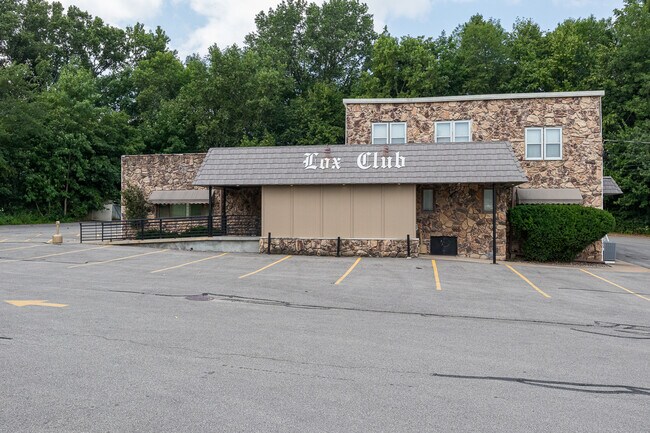
Property Detail
591 State St
Appleton, WI
ASSRS PLAT PRT GOV LOT 4 & PRT LOT D GOV LOT 4 & PRT LOT C GOV LOT 5: BEG SE COR LOT F GOV LOT 4 S79D W58.42FT S62D W82.87FT N49D W31.14FT N71D W121.44FT N9D W TO N/L LOT F EXT W ELY ALG N/L TO W/L STATE ST SLY TO BEG & PRT VAC ST SEC24 T21N R18E
23-0-0196-00
Outagamie
Commercialnec
Wisconsin
B and X Area of moderate flood hazard, usually the area between the limits of the 100-year and 500-year floods.
4
2023
0.54 AC
2023
Outagamie County
012000
Green Bay
NEARBY LISTINGS FOR SALE OR LEASE
DEMOGRAPHICS near 591 State St
1 mile
3 mile
5 mile
2025 Total Population
7,410
51,438
96,638
2030 Population
7,509
52,832
99,232
Pop Growth 2025-2030
+ 1.34%
+ 2.71%
+ 2.68%
Average Age
41
40
40
2025 Total Households
2,950
20,312
38,499
HH Growth 2025-2030
+ 1.36%
+ 2.67%
+ 2.80%
Median Household Inc
$73,720
$84,165
$86,072
Avg Household Size
2.40
2.50
2.40
2025 Avg HH Vehicles
2.00
2.00
2.00
Median Home Value
$225,650
$259,443
$267,132
Median Year Built
1972
1986
1984
Nearby Places
Map Layers
Map Styles
 Street
 Aerial
Transit
 Traffic
 Biking
Places
Listings with unknown addresses are not visible on the map
- Restaurants
- Banks
- Shops
- Fitness
- Groceries
PUBLIC TRANSPORTATION
AIRPORT
Appleton International
Drive
Walk
Distance
Appleton International
26 min
18.1 mi
Green Bay/Austin Straubel International
Drive
Walk
Distance
Green Bay/Austin Straubel International
31 min
21.0 mi
Freight Ports
Port Milwaukee
Drive
Walk
Distance
Port Milwaukee
136 min
115.2 mi
SALE & LEASE HISTORY
LISTING DATE
SALE/LEASE

Aug 13, 2021
For Sale
Nearby Properties
Address
Land Use
TOTAL SIZE
Lot Size
Zoning
Address
Land Use
TOTAL SIZE
Lot Size
Zoning
30.30 AC
Address
Land Use
TOTAL SIZE
Lot Size
Zoning
18.75 AC
Address
Land Use
TOTAL SIZE
Lot Size
Zoning
31.46 AC
Address
Land Use
TOTAL SIZE
Lot Size
Zoning
6.02 AC
Address
Land Use
TOTAL SIZE
Lot Size
Zoning
17.29 AC
Address
Land Use
TOTAL SIZE
Lot Size
Zoning
Address
Land Use
TOTAL SIZE
Lot Size
Zoning
Address
Land Use
TOTAL SIZE
Lot Size
Zoning
Address
Land Use
TOTAL SIZE
Lot Size
Zoning
59,010 SF
13.09 AC
Address
Land Use
TOTAL SIZE
Lot Size
Zoning
5.10 AC
Address
Land Use
TOTAL SIZE
Lot Size
Zoning
32.39 AC
Address
Land Use
TOTAL SIZE
Lot Size
Zoning
45.88 AC
Address
Land Use
TOTAL SIZE
Lot Size
Zoning
68.39 AC
Address
Land Use
TOTAL SIZE
Lot Size
Zoning
16.82 AC
Address
Land Use
TOTAL SIZE
Lot Size
Zoning
8.90 AC
Address
Land Use
TOTAL SIZE
Lot Size
Zoning
19.01 AC
Address
Land Use
TOTAL SIZE
Lot Size
Zoning
5.63 AC
Address
Land Use
TOTAL SIZE
Lot Size
Zoning
Address
Land Use
TOTAL SIZE
Lot Size
Zoning
11.67 AC
Address
Land Use
TOTAL SIZE
Lot Size
Zoning
Address
Land Use
TOTAL SIZE
Lot Size
Zoning
12.56 AC
Address
Land Use
TOTAL SIZE
Lot Size
Zoning
3.08 AC
Address
Land Use
TOTAL SIZE
Lot Size
Zoning
83,664 SF
10.06 AC
Address
Land Use
TOTAL SIZE
Lot Size
Zoning
Address
Land Use
TOTAL SIZE
Lot Size
Zoning
4.09 AC
Address
Land Use
TOTAL SIZE
Lot Size
Zoning
2.58 AC
Address
Land Use
TOTAL SIZE
Lot Size
Zoning
14.52 AC
Address
Land Use
TOTAL SIZE
Lot Size
Zoning
Address
Land Use
TOTAL SIZE
Lot Size
Zoning
29.92 AC
Address
Land Use
TOTAL SIZE
Lot Size
Zoning
15.81 AC
The World's #1 Commercial Real Estate Marketplace
Connect with us
© 2026 CoStar Group
The information above has been obtained from sources believed reliable. While we do not doubt its accuracy we have not verified it and make no guarantee, warranty or representation about it. It is your responsibility to independently confirm its accuracy and completeness. Any projections, opinions, assumptions, or estimates used are for example only and do not represent the current or future performance of the property. The value of this transaction to you depends on tax and other factors which should be evaluated by your tax, financial, and legal advisors. You and your advisors should conduct a careful, independent investigation of the property to determine to your satisfaction the suitability of the property for your needs.