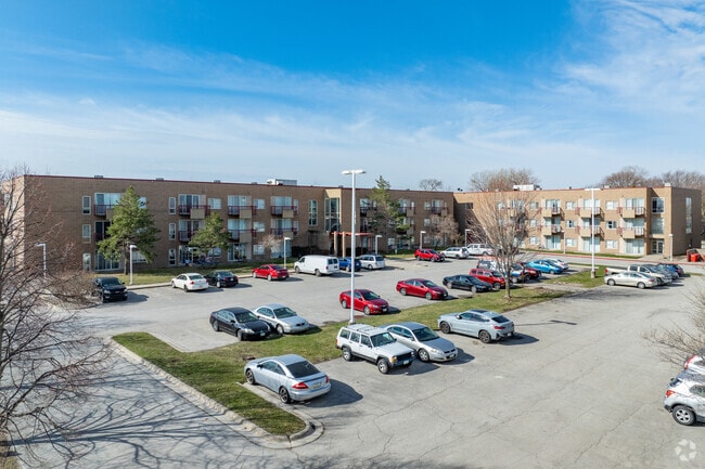
Property Record
5910 Lincoln Way, Ames, IA 50014


NEARBY LISTINGS FOR SALE OR LEASE
Property Detail
5910 Lincoln Way
088325121100001
Prairie Creek Estates First Addition
Apartment
BEG NE COR, W 383.3' S 454.65', E 383.3', N 456' TO POB,EX HWY & N 70'THEREOF 3.80A
X
Boone
19015C0250D
Iowa
2025
3.80 AC
2025
Fort Dodge/Ames
020100
Other Market Areas
72,810 SF
Ames, IA
DEMOGRAPHICS near 5910 Lincoln Way
1 Mile
3 Mile
5 Mile
2024 Total Population
6,050
30,376
64,395
2029 Population
6,185
31,164
66,321
Pop Growth 2024-2029
+ 2.23%
+ 2.59%
+ 2.99%
Average Age
29
29
33
2024 Total Households
1,888
11,322
25,805
HH Growth 2024-2029
+ 2.97%
+ 2.99%
+ 3.41%
Median Household Inc
$63,635
$48,725
$57,455
Avg Household Size
2.30
2.20
2.10
2024 Avg HH Vehicles
2.00
2.00
2.00
Median Home Value
$266,709
$267,112
$252,455
Median Year Built
1994
1995
1990
Nearby Places
Map Layers
Map Styles
 Street
 Aerial
- Restaurants
- Banks
- Shops
- Fitness
- Groceries
SALE & LEASE HISTORY
LISTING DATE
SALE/LEASE

Sep 24, 2016
For Sale
Aug 27, 2022
For Sale
Nearby Properties
Address
Land Use
TOTAL SIZE
Lot Size
Zoning
Address
Land Use
TOTAL SIZE
Lot Size
Zoning
289,606 SF
1.77 AC
CSC
Address
Land Use
TOTAL SIZE
Lot Size
Zoning
45,250 SF
12.69 AC
Address
Land Use
TOTAL SIZE
Lot Size
Zoning
45,627 SF
8.91 AC
RH
Address
Land Use
TOTAL SIZE
Lot Size
Zoning
82,734 SF
1.42 AC
CSC
Address
Land Use
TOTAL SIZE
Lot Size
Zoning
6,090 SF
20.72 AC
F-PRD
Address
Land Use
TOTAL SIZE
Lot Size
Zoning
133,668 SF
3.71 AC
RH
Address
Land Use
TOTAL SIZE
Lot Size
Zoning
20,619 SF
2.44 AC
RH
Address
Land Use
TOTAL SIZE
Lot Size
Zoning
105,550 SF
0.62 AC
CSC
Address
Land Use
TOTAL SIZE
Lot Size
Zoning
97,767 SF
0.05 AC
CSC
Address
Land Use
TOTAL SIZE
Lot Size
Zoning
88,584 SF
0.57 AC
Address
Land Use
TOTAL SIZE
Lot Size
Zoning
100,588 SF
7.65 AC
HOC
Address
Land Use
TOTAL SIZE
Lot Size
Zoning
22,864 SF
2.13 AC
RH
Address
Land Use
TOTAL SIZE
Lot Size
Zoning
30,207 SF
4.81 AC
Address
Land Use
TOTAL SIZE
Lot Size
Zoning
20,340 SF
5.66 AC
RH
Address
Land Use
TOTAL SIZE
Lot Size
Zoning
13,200 SF
8.28 AC
Address
Land Use
TOTAL SIZE
Lot Size
Zoning
72,459 SF
3.06 AC
CCR
Address
Land Use
TOTAL SIZE
Lot Size
Zoning
43,805 SF
4.65 AC
HOC
Address
Land Use
TOTAL SIZE
Lot Size
Zoning
31,254 SF
3.51 AC
F-PRD
Address
Land Use
TOTAL SIZE
Lot Size
Zoning
93,977 SF
0.48 AC
Address
Land Use
TOTAL SIZE
Lot Size
Zoning
41,412 SF
3.31 AC
Address
Land Use
TOTAL SIZE
Lot Size
Zoning
35,356 SF
3.16 AC
CCN
Address
Land Use
TOTAL SIZE
Lot Size
Zoning
19,656 SF
4.86 AC
RH
Address
Land Use
TOTAL SIZE
Lot Size
Zoning
12,960 SF
15.64 AC
C-1
Address
Land Use
TOTAL SIZE
Lot Size
Zoning
588 SF
3.04 AC
HOC
Address
Land Use
TOTAL SIZE
Lot Size
Zoning
16,018 SF
3.19 AC
Address
Land Use
TOTAL SIZE
Lot Size
Zoning
7,938 SF
3.86 AC
CCN
Address
Land Use
TOTAL SIZE
Lot Size
Zoning
19,259 SF
12.38 AC
C
Address
Land Use
TOTAL SIZE
Lot Size
Zoning
64,670 SF
0.82 AC
Address
Land Use
TOTAL SIZE
Lot Size
Zoning
31,623 SF
2.42 AC
Address
Land Use
TOTAL SIZE
Lot Size
Zoning
18,604 SF
1.71 AC
The World's #1 Commercial Real Estate Marketplace
Connect with us
© 2026 CoStar Group
The information above has been obtained from sources believed reliable. While we do not doubt its accuracy we have not verified it and make no guarantee, warranty or representation about it. It is your responsibility to independently confirm its accuracy and completeness. Any projections, opinions, assumptions, or estimates used are for example only and do not represent the current or future performance of the property. The value of this transaction to you depends on tax and other factors which should be evaluated by your tax, financial, and legal advisors. You and your advisors should conduct a careful, independent investigation of the property to determine to your satisfaction the suitability of the property for your needs.