Property Record
5911 King Rd, Loomis, CA 95650
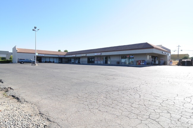

Property Detail
5911 King Rd
044-200-015
PAR B & C PMOR 16 96
Storemultistory
Placer
CG
California
B and X Area of moderate flood hazard, usually the area between the limits of the 100-year and 500-year floods.
0.77 AC
2024
Auburn/Loomis
2025
Sacramento
021203
Sacramento-Roseville-Folsom, CA
10,000 SF
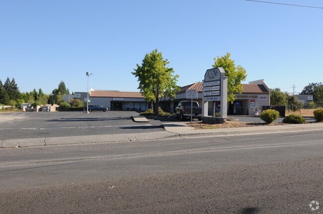
NEARBY LISTINGS FOR SALE OR LEASE
DEMOGRAPHICS near 5911 King Rd
1 mile
3 mile
5 mile
2025 Total Population
4,745
25,287
105,556
2030 Population
4,911
26,597
110,757
Pop Growth 2025-2030
+ 3.50%
+ 5.18%
+ 4.93%
Average Age
41
43
43
2025 Total Households
1,712
9,248
38,780
HH Growth 2025-2030
+ 3.50%
+ 5.21%
+ 4.83%
Median Household Inc
$111,337
$132,199
$121,789
Avg Household Size
2.80
2.70
2.70
2025 Avg HH Vehicles
2.00
2.00
2.00
Median Home Value
$703,989
$776,106
$761,219
Median Year Built
1983
1992
1998
Nearby Places
Map Layers
Map Styles
 Street
 Aerial
Transit
 Traffic
 Biking
Places
Listings with unknown addresses are not visible on the map
- Restaurants
- Banks
- Shops
- Fitness
- Groceries
PUBLIC TRANSPORTATION
COMMUTER RAIL
Drive
Walk
Distance
8 min
4.3 mi
Drive
Walk
Distance
15 min
8.6 mi
AIRPORT
Sacramento International
Drive
Walk
Distance
Sacramento International
42 min
32.0 mi
Nearby Properties
Address
Land Use
TOTAL SIZE
Lot Size
Zoning
Address
Land Use
TOTAL SIZE
Lot Size
Zoning
182,547 SF
10.19 AC
Address
Land Use
TOTAL SIZE
Lot Size
Zoning
246,349 SF
9.89 AC
Address
Land Use
TOTAL SIZE
Lot Size
Zoning
154,696 SF
10.80 AC
Address
Land Use
TOTAL SIZE
Lot Size
Zoning
194,087 SF
15.82 AC
Address
Land Use
TOTAL SIZE
Lot Size
Zoning
159,029 SF
17.62 AC
Address
Land Use
TOTAL SIZE
Lot Size
Zoning
136,101 SF
10 AC
Address
Land Use
TOTAL SIZE
Lot Size
Zoning
69,240 SF
4.10 AC
Address
Land Use
TOTAL SIZE
Lot Size
Zoning
1,992 SF
44.99 AC
RAB100
Address
Land Use
TOTAL SIZE
Lot Size
Zoning
73,756 SF
6.60 AC
Address
Land Use
TOTAL SIZE
Lot Size
Zoning
6,167 SF
12.20 AC
Address
Land Use
TOTAL SIZE
Lot Size
Zoning
100,348 SF
12.50 AC
Address
Land Use
TOTAL SIZE
Lot Size
Zoning
103,299 SF
9.60 AC
Address
Land Use
TOTAL SIZE
Lot Size
Zoning
39,055 SF
4.40 AC
Address
Land Use
TOTAL SIZE
Lot Size
Zoning
89,928 SF
6 AC
CG
Address
Land Use
TOTAL SIZE
Lot Size
Zoning
63,608 SF
5.20 AC
CG
Address
Land Use
TOTAL SIZE
Lot Size
Zoning
44,050 SF
3.90 AC
Address
Land Use
TOTAL SIZE
Lot Size
Zoning
34,066 SF
2.90 AC
Address
Land Use
TOTAL SIZE
Lot Size
Zoning
29,380 SF
4.70 AC
Address
Land Use
TOTAL SIZE
Lot Size
Zoning
19,604 SF
3.08 AC
Address
Land Use
TOTAL SIZE
Lot Size
Zoning
85,435 SF
2.75 AC
Address
Land Use
TOTAL SIZE
Lot Size
Zoning
78,000 SF
1.60 AC
Address
Land Use
TOTAL SIZE
Lot Size
Zoning
20,800 SF
2.10 AC
Address
Land Use
TOTAL SIZE
Lot Size
Zoning
35,146 SF
4 AC
Address
Land Use
TOTAL SIZE
Lot Size
Zoning
49,312 SF
15.40 AC
Address
Land Use
TOTAL SIZE
Lot Size
Zoning
25,368 SF
1.08 AC
RH
Address
Land Use
TOTAL SIZE
Lot Size
Zoning
38,150 SF
2.90 AC
Address
Land Use
TOTAL SIZE
Lot Size
Zoning
16,429 SF
9.50 AC
Address
Land Use
TOTAL SIZE
Lot Size
Zoning
25,379 SF
3.10 AC
Address
Land Use
TOTAL SIZE
Lot Size
Zoning
39,825 SF
3.10 AC
Address
Land Use
TOTAL SIZE
Lot Size
Zoning
26,095 SF
2 AC
The World's #1 Commercial Real Estate Marketplace
Connect with us
© 2026 CoStar Group
The information above has been obtained from sources believed reliable. While we do not doubt its accuracy we have not verified it and make no guarantee, warranty or representation about it. It is your responsibility to independently confirm its accuracy and completeness. Any projections, opinions, assumptions, or estimates used are for example only and do not represent the current or future performance of the property. The value of this transaction to you depends on tax and other factors which should be evaluated by your tax, financial, and legal advisors. You and your advisors should conduct a careful, independent investigation of the property to determine to your satisfaction the suitability of the property for your needs.