Property Record
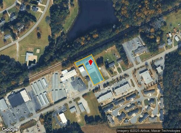
5912 Us Highway 301 S, Four Oaks, NC 27524
NEARBY LISTINGS FOR SALE OR LEASE
-
-
View all Four Oaks listings for sale on LoopNet.com
Property Detail
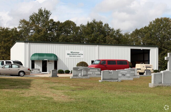
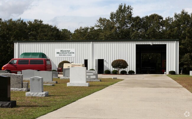
5912 Us Highway 301 S
08I11012N
LOT 1 61/200 1671.06
Warehouse
Johnston
X
North Carolina
3720166000K
1
2025
0.97 AC
2025
Johnston County
041205
Raleigh/Durham
4,000 SF
Raleigh, NC
DEMOGRAPHICS near 5912 Us Highway 301 S
1 Mile
3 Mile
5 Mile
2024 Total Population
2,001
6,214
13,362
2029 Population
2,405
7,507
16,240
Pop Growth 2024-2029
+ 20.19%
+ 20.81%
+ 21.54%
Average Age
41
40
40
2024 Total Households
779
2,389
5,178
HH Growth 2024-2029
+ 20.15%
+ 20.85%
+ 21.61%
Median Household Inc
$55,952
$56,354
$54,704
Avg Household Size
2.50
2.50
2.50
2024 Avg HH Vehicles
2.00
2.00
2.00
Median Home Value
$230,067
$233,990
$227,954
Median Year Built
1982
1985
1985
Nearby Places
Map Layers
Map Styles
 Street
 Aerial
- Restaurants
- Banks
- Shops
- Fitness
- Groceries
PUBLIC TRANSPORTATION
AIRPORT
Fayetteville Regional/Grannis Field
DRIVE
WALK
Distance
Fayetteville Regional/Grannis Field
56 min
44.1 mi
Raleigh-Durham International
DRIVE
WALK
Distance
Raleigh-Durham International
61 min
46.9 mi
Nearby Properties
Address
Land Use
TOTAL SIZE
Lot Size
Zoning
Address
Land Use
TOTAL SIZE
Lot Size
Zoning
705,050 SF
129.75 AC
IND
Address
Land Use
TOTAL SIZE
Lot Size
Zoning
122,012 SF
30.94 AC
IND
Address
Land Use
TOTAL SIZE
Lot Size
Zoning
24,142 SF
37.47 AC
RES
Address
Land Use
TOTAL SIZE
Lot Size
Zoning
17,808 SF
27.29 AC
RES
Address
Land Use
TOTAL SIZE
Lot Size
Zoning
2,234 SF
12.86 AC
IND
Address
Land Use
TOTAL SIZE
Lot Size
Zoning
2,304 SF
27.39 AC
COM
Address
Land Use
TOTAL SIZE
Lot Size
Zoning
58,006 SF
18.31 AC
IND
Address
Land Use
TOTAL SIZE
Lot Size
Zoning
480 SF
4.37 AC
RES
Address
Land Use
TOTAL SIZE
Lot Size
Zoning
11,838 SF
27.65 AC
COM
Address
Land Use
TOTAL SIZE
Lot Size
Zoning
18,810 SF
5.20 AC
IND
Address
Land Use
TOTAL SIZE
Lot Size
Zoning
29,520 SF
4.11 AC
COM
Address
Land Use
TOTAL SIZE
Lot Size
Zoning
84.82 AC
RES
Address
Land Use
TOTAL SIZE
Lot Size
Zoning
9,600 SF
2.10 AC
COM
Address
Land Use
TOTAL SIZE
Lot Size
Zoning
464.68 AC
RAG
Address
Land Use
TOTAL SIZE
Lot Size
Zoning
15,420 SF
2.21 AC
IND
Address
Land Use
TOTAL SIZE
Lot Size
Zoning
4,508 SF
1.16 AC
COM
Address
Land Use
TOTAL SIZE
Lot Size
Zoning
2,650 SF
2.32 AC
COM
Address
Land Use
TOTAL SIZE
Lot Size
Zoning
82.64 AC
RAG
Address
Land Use
TOTAL SIZE
Lot Size
Zoning
12,036 SF
3.27 AC
COM
Address
Land Use
TOTAL SIZE
Lot Size
Zoning
9,217 SF
2 AC
COM
Address
Land Use
TOTAL SIZE
Lot Size
Zoning
6,561 SF
2.33 AC
IND
Address
Land Use
TOTAL SIZE
Lot Size
Zoning
188.57 AC
RAG
Address
Land Use
TOTAL SIZE
Lot Size
Zoning
6,792 SF
1.23 AC
COM
Address
Land Use
TOTAL SIZE
Lot Size
Zoning
11,121 SF
6.08 AC
COM
Address
Land Use
TOTAL SIZE
Lot Size
Zoning
8,271 SF
1.95 AC
COM
Address
Land Use
TOTAL SIZE
Lot Size
Zoning
44 AC
RES
Address
Land Use
TOTAL SIZE
Lot Size
Zoning
54.56 AC
IND
Address
Land Use
TOTAL SIZE
Lot Size
Zoning
1,112 SF
299.77 AC
RAG
Address
Land Use
TOTAL SIZE
Lot Size
Zoning
7,396 SF
1.01 AC
COM
Address
Land Use
TOTAL SIZE
Lot Size
Zoning
7,662 SF
2.52 AC
RAG
The World's #1 Commercial Real Estate Marketplace
Connect with us
© 2025 CoStar Group
The information above has been obtained from sources believed reliable. While we do not doubt its accuracy we have not verified it and make no guarantee, warranty or representation about it. It is your responsibility to independently confirm its accuracy and completeness. Any projections, opinions, assumptions, or estimates used are for example only and do not represent the current or future performance of the property. The value of this transaction to you depends on tax and other factors which should be evaluated by your tax, financial, and legal advisors. You and your advisors should conduct a careful, independent investigation of the property to determine to your satisfaction the suitability of the property for your needs.