Property Record
5913 Jefferson Pike, Frederick, MD 21703


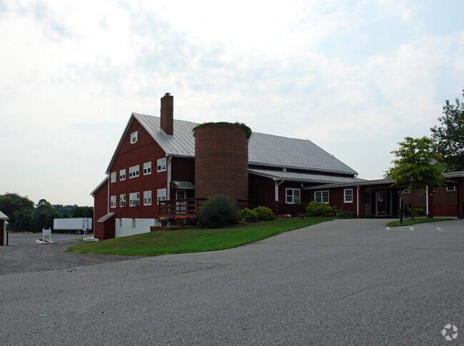
Property Detail
5913 Jefferson Pike
23-438852
LT 1 SECT 1 21.10 AC S/S RT 180 NR FEAGAVILLE
Religious
Frederick
A
Maryland
C and X Area of minimal flood hazard, usually depicted on FIRMs as above the 500-year flood level.
1
2024
21.10 AC
2025
Frederick
751004
Washington, DC
45,798 SF
Washington-Arlington-Alexandria, DC-VA-MD-WV
NEARBY LISTINGS FOR SALE OR LEASE
DEMOGRAPHICS near 5913 Jefferson Pike
1 mile
3 mile
5 mile
2025 Total Population
6,076
72,576
122,149
2030 Population
6,655
78,320
132,466
Pop Growth 2025-2030
+ 9.53%
+ 7.91%
+ 8.45%
Average Age
38
37
39
2025 Total Households
2,427
26,931
46,625
HH Growth 2025-2030
+ 9.77%
+ 8.17%
+ 8.65%
Median Household Inc
$106,823
$95,540
$98,600
Avg Household Size
2.50
2.60
2.50
2025 Avg HH Vehicles
2.00
2.00
2.00
Median Home Value
$369,924
$374,264
$401,896
Median Year Built
1998
1991
1990
Nearby Places
Map Layers
Map Styles
 Street
 Aerial
Layers
 Traffic
 Biking
Places
Listings with unknown addresses are not visible on the map
- Restaurants
- Banks
- Shops
- Fitness
- Groceries
PUBLIC TRANSPORTATION
COMMUTER RAIL
Drive
Walk
Distance
9 min
5.0 mi
Drive
Walk
Distance
12 min
6.0 mi
AIRPORT
Hagerstown Regional/Richard A Henson Field
Drive
Walk
Distance
Hagerstown Regional/Richard A Henson Field
45 min
32.2 mi
Washington Dulles International
Drive
Walk
Distance
Washington Dulles International
64 min
40.0 mi
Freight Ports
Port of Baltimore
Drive
Walk
Distance
Port of Baltimore
65 min
52.4 mi
Nearby Properties
Address
Land Use
TOTAL SIZE
Lot Size
Zoning
Address
Land Use
TOTAL SIZE
Lot Size
Zoning
3,545,442 SF
1.22 AC
IST
Address
Land Use
TOTAL SIZE
Lot Size
Zoning
551,652 SF
27.47 AC
M1
Address
Land Use
TOTAL SIZE
Lot Size
Zoning
407,190 SF
43.36 AC
IST
Address
Land Use
TOTAL SIZE
Lot Size
Zoning
668,533 SF
45.39 AC
MXD
Address
Land Use
TOTAL SIZE
Lot Size
Zoning
285,071 SF
16.34 AC
PND
Address
Land Use
TOTAL SIZE
Lot Size
Zoning
372,920 SF
15.54 AC
PUD
Address
Land Use
TOTAL SIZE
Lot Size
Zoning
458,419 SF
25.94 AC
IST
Address
Land Use
TOTAL SIZE
Lot Size
Zoning
196,471 SF
7.49 AC
Address
Land Use
TOTAL SIZE
Lot Size
Zoning
175,074 SF
20.26 AC
IST
Address
Land Use
TOTAL SIZE
Lot Size
Zoning
252,725 SF
46.49 AC
IE
Address
Land Use
TOTAL SIZE
Lot Size
Zoning
281,360 SF
21.16 AC
MXD
Address
Land Use
TOTAL SIZE
Lot Size
Zoning
232,532 SF
11.15 AC
PND
Address
Land Use
TOTAL SIZE
Lot Size
Zoning
214,291 SF
88.13 AC
IST
Address
Land Use
TOTAL SIZE
Lot Size
Zoning
134,300 SF
12.62 AC
PUD
Address
Land Use
TOTAL SIZE
Lot Size
Zoning
129,448 SF
19.81 AC
PUD
Address
Land Use
TOTAL SIZE
Lot Size
Zoning
268,693 SF
14.33 AC
R20
Address
Land Use
TOTAL SIZE
Lot Size
Zoning
327,022 SF
15.61 AC
PUD
Address
Land Use
TOTAL SIZE
Lot Size
Zoning
185,639 SF
22.94 AC
ORI
Address
Land Use
TOTAL SIZE
Lot Size
Zoning
169,802 SF
11.76 AC
PUD
Address
Land Use
TOTAL SIZE
Lot Size
Zoning
228,787 SF
15.63 AC
Address
Land Use
TOTAL SIZE
Lot Size
Zoning
229,420 SF
10.65 AC
GC
Address
Land Use
TOTAL SIZE
Lot Size
Zoning
219,044 SF
10.34 AC
R20
Address
Land Use
TOTAL SIZE
Lot Size
Zoning
220,148 SF
20.11 AC
GC
Address
Land Use
TOTAL SIZE
Lot Size
Zoning
103,258 SF
10.46 AC
MXD
Address
Land Use
TOTAL SIZE
Lot Size
Zoning
277,348 SF
19.52 AC
GC
Address
Land Use
TOTAL SIZE
Lot Size
Zoning
100,946 SF
12.12 AC
PND
Address
Land Use
TOTAL SIZE
Lot Size
Zoning
214,090 SF
10.71 AC
R16
Address
Land Use
TOTAL SIZE
Lot Size
Zoning
108,999 SF
10.73 AC
IST
Address
Land Use
TOTAL SIZE
Lot Size
Zoning
170,940 SF
10.02 AC
LI
Address
Land Use
TOTAL SIZE
Lot Size
Zoning
290,501 SF
13.31 AC
R8
The World's #1 Commercial Real Estate Marketplace
Connect with us
© 2026 CoStar Group
The information above has been obtained from sources believed reliable. While we do not doubt its accuracy we have not verified it and make no guarantee, warranty or representation about it. It is your responsibility to independently confirm its accuracy and completeness. Any projections, opinions, assumptions, or estimates used are for example only and do not represent the current or future performance of the property. The value of this transaction to you depends on tax and other factors which should be evaluated by your tax, financial, and legal advisors. You and your advisors should conduct a careful, independent investigation of the property to determine to your satisfaction the suitability of the property for your needs.