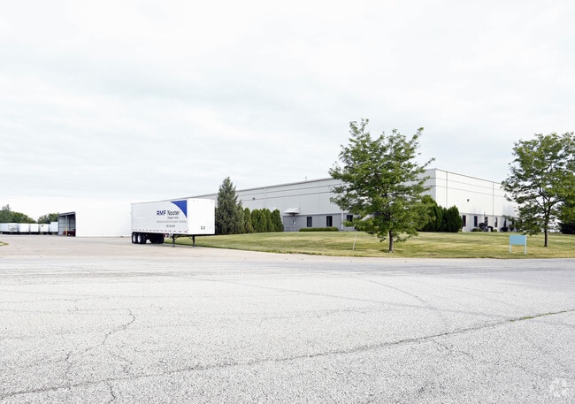
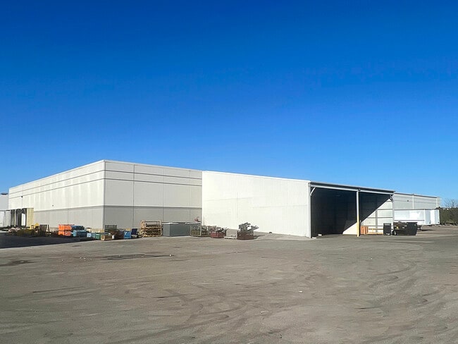
Property Record
5915 Jason St, Toledo, OH 43611

Property Detail
5915 Jason St
22-88924
NORTH CROSS PLAT THREE LOT 15
Warehouse
Lucas
10-IL
Ohio
B and X Area of moderate flood hazard, usually the area between the limits of the 100-year and 500-year floods.
15
2025
8 AC
2025
North Toledo
005602
Toledo
61,940 SF
Toledo, OH
NEARBY LISTINGS FOR SALE OR LEASE
DEMOGRAPHICS near 5915 Jason St
1 mile
3 mile
5 mile
2025 Total Population
3,817
25,226
99,757
2030 Population
3,741
24,951
99,932
Pop Growth 2025-2030
(1.99%)
(1.09%)
+ 0.18%
Average Age
40
41
39
2025 Total Households
1,539
10,519
41,511
HH Growth 2025-2030
(1.95%)
(1.13%)
+ 0.10%
Median Household Inc
$93,981
$58,304
$47,508
Avg Household Size
2.50
2.30
2.30
2025 Avg HH Vehicles
2.00
2.00
2.00
Median Home Value
$163,594
$131,656
$111,509
Median Year Built
1969
1960
1954
Nearby Places
Map Layers
Map Styles
 Street
 Aerial
Layers
 Traffic
 Biking
Places
Listings with unknown addresses are not visible on the map
- Restaurants
- Banks
- Shops
- Fitness
- Groceries
PUBLIC TRANSPORTATION
AIRPORT
Eugene F Kranz Toledo Express
Drive
Walk
Distance
Eugene F Kranz Toledo Express
39 min
29.2 mi
Freight Ports
Port of Baltimore
Drive
Walk
Distance
Port of Baltimore
1 min
400.5 mi
SALE & LEASE HISTORY
LISTING DATE
SALE/LEASE

Sep 25, 2016
For Lease
May 17, 2023
For Sale
Nearby Properties
Address
Land Use
TOTAL SIZE
Lot Size
Zoning
Address
Land Use
TOTAL SIZE
Lot Size
Zoning
286,525 SF
105.33 AC
10-RS6
Address
Land Use
TOTAL SIZE
Lot Size
Zoning
169.42 AC
10-IG
Address
Land Use
TOTAL SIZE
Lot Size
Zoning
Address
Land Use
TOTAL SIZE
Lot Size
Zoning
169.42 AC
10-IG
Address
Land Use
TOTAL SIZE
Lot Size
Zoning
28.51 AC
10-IG
Address
Land Use
TOTAL SIZE
Lot Size
Zoning
450,000 SF
37.30 AC
Address
Land Use
TOTAL SIZE
Lot Size
Zoning
230,400 SF
18 AC
10-CR
Address
Land Use
TOTAL SIZE
Lot Size
Zoning
90,113 SF
8.12 AC
21-PO
Address
Land Use
TOTAL SIZE
Lot Size
Zoning
175,978 SF
10.02 AC
10-IL
Address
Land Use
TOTAL SIZE
Lot Size
Zoning
302,338 SF
13.97 AC
Address
Land Use
TOTAL SIZE
Lot Size
Zoning
106.75 AC
AC = AG
Address
Land Use
TOTAL SIZE
Lot Size
Zoning
92,888 SF
20.24 AC
10-IL
Address
Land Use
TOTAL SIZE
Lot Size
Zoning
159,798 SF
8.32 AC
10-IL
Address
Land Use
TOTAL SIZE
Lot Size
Zoning
123,258 SF
23.59 AC
Address
Land Use
TOTAL SIZE
Lot Size
Zoning
86.45 AC
10-IG
Address
Land Use
TOTAL SIZE
Lot Size
Zoning
191,297 SF
28.74 AC
10-CRSO
Address
Land Use
TOTAL SIZE
Lot Size
Zoning
48,427 SF
20.29 AC
Address
Land Use
TOTAL SIZE
Lot Size
Zoning
Address
Land Use
TOTAL SIZE
Lot Size
Zoning
389,812 SF
62.25 AC
10-IG
Address
Land Use
TOTAL SIZE
Lot Size
Zoning
53,306 SF
2 AC
10-CO
Address
Land Use
TOTAL SIZE
Lot Size
Zoning
70,404 SF
8.07 AC
10-RS6
Address
Land Use
TOTAL SIZE
Lot Size
Zoning
123,125 SF
18.93 AC
Address
Land Use
TOTAL SIZE
Lot Size
Zoning
80,897 SF
3.36 AC
10-MX
Address
Land Use
TOTAL SIZE
Lot Size
Zoning
22.56 AC
10-IG
Address
Land Use
TOTAL SIZE
Lot Size
Zoning
42,780 SF
1 AC
10-CO
Address
Land Use
TOTAL SIZE
Lot Size
Zoning
44,780 SF
9.95 AC
10-RS6
Address
Land Use
TOTAL SIZE
Lot Size
Zoning
69,056 SF
6 AC
10-MX
Address
Land Use
TOTAL SIZE
Lot Size
Zoning
202,584 SF
15.12 AC
10-IG
Address
Land Use
TOTAL SIZE
Lot Size
Zoning
5,416 SF
87.73 AC
MHP
Address
Land Use
TOTAL SIZE
Lot Size
Zoning
3,391,887 SF
10-IG
The World's #1 Commercial Real Estate Marketplace
Connect with us
© 2026 CoStar Group
The information above has been obtained from sources believed reliable. While we do not doubt its accuracy we have not verified it and make no guarantee, warranty or representation about it. It is your responsibility to independently confirm its accuracy and completeness. Any projections, opinions, assumptions, or estimates used are for example only and do not represent the current or future performance of the property. The value of this transaction to you depends on tax and other factors which should be evaluated by your tax, financial, and legal advisors. You and your advisors should conduct a careful, independent investigation of the property to determine to your satisfaction the suitability of the property for your needs.