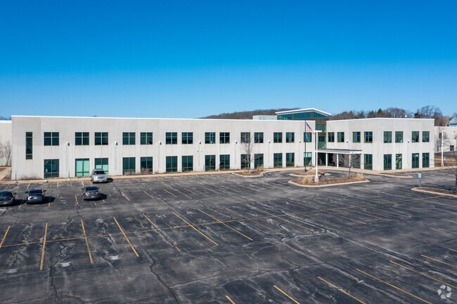
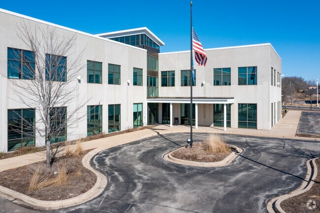
Property Record
5915 S Moorland Rd, New Berlin, WI 53151

NEARBY LISTINGS FOR SALE OR LEASE
Property Detail
5915 S Moorland Rd
Milwaukee-Waukesha-West Allis, WI
Westridge Business Park
NBC-1285-993-003
LOT 1 CSM 10839 DOC #3807886 REC 01/12/2011. ALL OF LOTS 1 & 2 OF CSM 10373, BEING PT OF THE SW .25 AND THE NW .25 OF THE NE .25 THE SE .25 OF THE NW .25 AND THE NW .25 OF THE SE .25 OF SEC 34 T6N R20E EASE DOCS #3480731 #3480732 #3480734 REC 05/14/2
Commercialnec
Waukesha
X
Wisconsin
55133C0353H
1,2
2024
34.90 AC
2024
SE/Muskego
201506
Milwaukee/Madison
464,768 SF
DEMOGRAPHICS near 5915 S Moorland Rd
1 Mile
3 Mile
5 Mile
2024 Total Population
328
31,854
89,285
2029 Population
340
32,538
90,264
Pop Growth 2024-2029
+ 3.66%
+ 2.15%
+ 1.10%
Average Age
44
44
44
2024 Total Households
134
12,702
37,073
HH Growth 2024-2029
+ 2.99%
+ 2.09%
+ 1.04%
Median Household Inc
$107,143
$99,526
$93,722
Avg Household Size
2.40
2.50
2.40
2024 Avg HH Vehicles
2.00
2.00
2.00
Median Home Value
$422,222
$333,356
$325,099
Median Year Built
1992
1979
1980
Nearby Places
Map Layers
Map Styles
 Street
 Aerial
- Restaurants
- Banks
- Shops
- Fitness
- Groceries
PUBLIC TRANSPORTATION
AIRPORT
General Mitchell International
DRIVE
WALK
Distance
General Mitchell International
23 min
13.1 mi
Freight Ports
Port Milwaukee
DRIVE
WALK
Distance
Port Milwaukee
22 min
15.0 mi
SALE & LEASE HISTORY
LISTING DATE
SALE/LEASE

Sep 01, 2020
For Lease
May 09, 2018
For Lease
May 01, 2017
For Lease
Nearby Properties
Address
Land Use
TOTAL SIZE
Lot Size
Zoning
Address
Land Use
TOTAL SIZE
Lot Size
Zoning
139,164 SF
25.94 AC
O2
Address
Land Use
TOTAL SIZE
Lot Size
Zoning
17.68 AC
Address
Land Use
TOTAL SIZE
Lot Size
Zoning
33.26 AC
Address
Land Use
TOTAL SIZE
Lot Size
Zoning
370,169 SF
23.69 AC
RM1
Address
Land Use
TOTAL SIZE
Lot Size
Zoning
Address
Land Use
TOTAL SIZE
Lot Size
Zoning
174,869 SF
17.40 AC
RM1
Address
Land Use
TOTAL SIZE
Lot Size
Zoning
15.24 AC
Address
Land Use
TOTAL SIZE
Lot Size
Zoning
154,897 SF
17.51 AC
O2
Address
Land Use
TOTAL SIZE
Lot Size
Zoning
52,000 SF
12.76 AC
I1
Address
Land Use
TOTAL SIZE
Lot Size
Zoning
74,309 SF
10.28 AC
O2
Address
Land Use
TOTAL SIZE
Lot Size
Zoning
Address
Land Use
TOTAL SIZE
Lot Size
Zoning
217,472 SF
21.27 AC
M1
Address
Land Use
TOTAL SIZE
Lot Size
Zoning
146,270 SF
18 AC
O2
Address
Land Use
TOTAL SIZE
Lot Size
Zoning
139,706 SF
16.50 AC
M1
Address
Land Use
TOTAL SIZE
Lot Size
Zoning
171,506 SF
11.85 AC
M1
Address
Land Use
TOTAL SIZE
Lot Size
Zoning
164,440 SF
11.63 AC
M1
Address
Land Use
TOTAL SIZE
Lot Size
Zoning
172,772 SF
13.53 AC
M1
Address
Land Use
TOTAL SIZE
Lot Size
Zoning
97,217 SF
18.38 AC
M1
Address
Land Use
TOTAL SIZE
Lot Size
Zoning
93,776 SF
7.94 AC
M1
Address
Land Use
TOTAL SIZE
Lot Size
Zoning
Address
Land Use
TOTAL SIZE
Lot Size
Zoning
56,052 SF
8.46 AC
O2
Address
Land Use
TOTAL SIZE
Lot Size
Zoning
122,604 SF
11.12 AC
M1
Address
Land Use
TOTAL SIZE
Lot Size
Zoning
8.76 AC
B1
Address
Land Use
TOTAL SIZE
Lot Size
Zoning
45,576 SF
9.22 AC
B1
Address
Land Use
TOTAL SIZE
Lot Size
Zoning
15.88 AC
Address
Land Use
TOTAL SIZE
Lot Size
Zoning
200,160 SF
11.44 AC
M1
Address
Land Use
TOTAL SIZE
Lot Size
Zoning
119,787 SF
10.44 AC
M1
Address
Land Use
TOTAL SIZE
Lot Size
Zoning
Address
Land Use
TOTAL SIZE
Lot Size
Zoning
100,939 SF
8.97 AC
M1
The World's #1 Commercial Real Estate Marketplace
Connect with us
© 2025 CoStar Group
The information above has been obtained from sources believed reliable. While we do not doubt its accuracy we have not verified it and make no guarantee, warranty or representation about it. It is your responsibility to independently confirm its accuracy and completeness. Any projections, opinions, assumptions, or estimates used are for example only and do not represent the current or future performance of the property. The value of this transaction to you depends on tax and other factors which should be evaluated by your tax, financial, and legal advisors. You and your advisors should conduct a careful, independent investigation of the property to determine to your satisfaction the suitability of the property for your needs.