Property Record
5916 W Highway 290, Dripping Springs, TX 78620


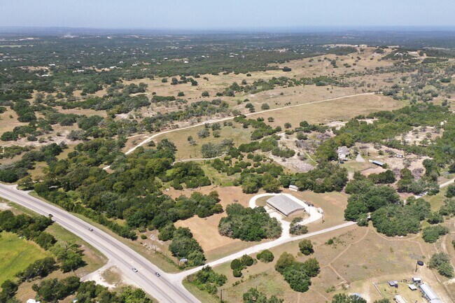
Property Detail
5916 W Highway 290
Austin-Round Rock-San Marcos, TX
K-BAR-MAC, LOT 1, ACRES 10.00
R32977
HAYS
Commercialnec
Texas
A Areas with a 1% annual chance of flooding and a 26% chance of flooding over the life of a 30-year mortgage.
1
2024
10 AC
2025
Hays County
010817
Austin
NEARBY LISTINGS FOR SALE OR LEASE
DEMOGRAPHICS near 5916 W Highway 290
1 mile
3 mile
5 mile
2025 Total Population
220
1,538
5,132
2030 Population
252
1,770
5,983
Pop Growth 2025-2030
+ 14.55%
+ 15.08%
+ 16.58%
Average Age
44
44
43
2025 Total Households
85
590
1,931
HH Growth 2025-2030
+ 15.29%
+ 16.10%
+ 17.50%
Median Household Inc
$130,682
$125,880
$131,674
Avg Household Size
2.60
2.60
2.60
2025 Avg HH Vehicles
2.00
2.00
2.00
Median Home Value
$840,908
$831,275
$836,513
Median Year Built
2002
2002
2004
Nearby Places
Map Layers
Map Styles
 Street
 Aerial
Transit
 Traffic
 Biking
Places
Listings with unknown addresses are not visible on the map
- Restaurants
- Banks
- Shops
- Fitness
- Groceries
PUBLIC TRANSPORTATION
AIRPORT
Austin-Bergstrom International
Drive
Walk
Distance
Austin-Bergstrom International
55 min
36.6 mi
SALE & LEASE HISTORY
LISTING DATE
SALE/LEASE

Oct 17, 2023
For Sale
Jan 02, 2023
For Sale
Nearby Properties
Address
Land Use
TOTAL SIZE
Lot Size
Zoning
Address
Land Use
TOTAL SIZE
Lot Size
Zoning
888 SF
5.93 AC
Address
Land Use
TOTAL SIZE
Lot Size
Zoning
6,298 SF
4.16 AC
Address
Land Use
TOTAL SIZE
Lot Size
Zoning
3,000 SF
10.40 AC
Address
Land Use
TOTAL SIZE
Lot Size
Zoning
344,392 SF
18.21 AC
Address
Land Use
TOTAL SIZE
Lot Size
Zoning
19,069 SF
104.04 AC
Address
Land Use
TOTAL SIZE
Lot Size
Zoning
Address
Land Use
TOTAL SIZE
Lot Size
Zoning
5,000 SF
28.01 AC
Address
Land Use
TOTAL SIZE
Lot Size
Zoning
4,630 SF
3.50 AC
Address
Land Use
TOTAL SIZE
Lot Size
Zoning
6,456 SF
7.36 AC
Address
Land Use
TOTAL SIZE
Lot Size
Zoning
14,990 SF
2.84 AC
Address
Land Use
TOTAL SIZE
Lot Size
Zoning
4,160 SF
59.64 AC
Address
Land Use
TOTAL SIZE
Lot Size
Zoning
11.45 AC
Address
Land Use
TOTAL SIZE
Lot Size
Zoning
3,200 SF
11.50 AC
Address
Land Use
TOTAL SIZE
Lot Size
Zoning
8,960 SF
4.04 AC
Address
Land Use
TOTAL SIZE
Lot Size
Zoning
9,000 SF
1.29 AC
Address
Land Use
TOTAL SIZE
Lot Size
Zoning
5,208 SF
5 AC
Address
Land Use
TOTAL SIZE
Lot Size
Zoning
4,506 SF
25.08 AC
Address
Land Use
TOTAL SIZE
Lot Size
Zoning
2,788 SF
6.89 AC
Address
Land Use
TOTAL SIZE
Lot Size
Zoning
Address
Land Use
TOTAL SIZE
Lot Size
Zoning
3,532 SF
19.28 AC
Address
Land Use
TOTAL SIZE
Lot Size
Zoning
4,837 SF
36.67 AC
Address
Land Use
TOTAL SIZE
Lot Size
Zoning
3,131 SF
5 AC
Address
Land Use
TOTAL SIZE
Lot Size
Zoning
105,070 SF
14.97 AC
Address
Land Use
TOTAL SIZE
Lot Size
Zoning
Address
Land Use
TOTAL SIZE
Lot Size
Zoning
1,373 SF
4 AC
Address
Land Use
TOTAL SIZE
Lot Size
Zoning
1,888 SF
43.53 AC
Address
Land Use
TOTAL SIZE
Lot Size
Zoning
Address
Land Use
TOTAL SIZE
Lot Size
Zoning
3,784 SF
14.07 AC
Address
Land Use
TOTAL SIZE
Lot Size
Zoning
1,120 SF
10.21 AC
Address
Land Use
TOTAL SIZE
Lot Size
Zoning
10,302 SF
0.50 AC
The World's #1 Commercial Real Estate Marketplace
Connect with us
© 2026 CoStar Group
The information above has been obtained from sources believed reliable. While we do not doubt its accuracy we have not verified it and make no guarantee, warranty or representation about it. It is your responsibility to independently confirm its accuracy and completeness. Any projections, opinions, assumptions, or estimates used are for example only and do not represent the current or future performance of the property. The value of this transaction to you depends on tax and other factors which should be evaluated by your tax, financial, and legal advisors. You and your advisors should conduct a careful, independent investigation of the property to determine to your satisfaction the suitability of the property for your needs.