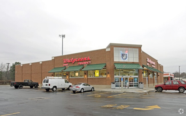
Property Record
5917 High St W, Portsmouth, VA 23703
NEARBY LISTINGS FOR SALE OR LEASE
Property Detail
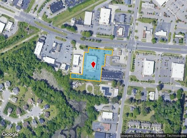
5917 High St W
0816-0022
Commercial District 7
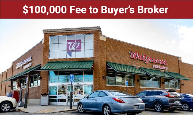
Drugstorepharmacycvswalgreens
PARCEL 2, 1.762 AC
X
Portsmouth
5155290057D
Virginia
2024
1.76 AC
2025
Churchland
213101
Hampton Roads
14,392 SF
Virginia Beach-Norfolk-Newport News, VA-NC
DEMOGRAPHICS near 5917 High St W
1 Mile
3 Mile
5 Mile
2024 Total Population
11,749
66,992
135,349
2029 Population
11,799
68,712
139,109
Pop Growth 2024-2029
+ 0.43%
+ 2.57%
+ 2.78%
Average Age
38
39
38
2024 Total Households
4,708
26,471
52,564
HH Growth 2024-2029
+ 0.40%
+ 2.62%
+ 2.76%
Median Household Inc
$67,581
$78,934
$72,758
Avg Household Size
2.40
2.50
2.50
2024 Avg HH Vehicles
2.00
2.00
2.00
Median Home Value
$255,876
$260,668
$256,402
Median Year Built
1974
1981
1978
Nearby Places
Map Layers
Map Styles
 Street
 Aerial
- Restaurants
- Banks
- Shops
- Fitness
- Groceries
PUBLIC TRANSPORTATION
COMMUTER RAIL
DRIVE
WALK
Distance
17 min
9.9 mi
AIRPORT
Norfolk International
DRIVE
WALK
Distance
Norfolk International
28 min
14.4 mi
Newport News/Williamsburg International
DRIVE
WALK
Distance
Newport News/Williamsburg International
38 min
26.1 mi
Freight Ports
Virginia Port Authority - Portsmouth
DRIVE
WALK
Distance
Virginia Port Authority - Portsmouth
14 min
6.5 mi
Nearby Properties
Address
Land Use
TOTAL SIZE
Lot Size
Zoning
Address
Land Use
TOTAL SIZE
Lot Size
Zoning
453,332 SF
44 SF
IN
Address
Land Use
TOTAL SIZE
Lot Size
Zoning
579.33 AC
IN
Address
Land Use
TOTAL SIZE
Lot Size
Zoning
187.26 AC
C
Address
Land Use
TOTAL SIZE
Lot Size
Zoning
20,400 SF
557.10 AC
IN
Address
Land Use
TOTAL SIZE
Lot Size
Zoning
2,400 SF
125.24 AC
HEAVY INDU
Address
Land Use
TOTAL SIZE
Lot Size
Zoning
13.52 AC
MIXED USE
Address
Land Use
TOTAL SIZE
Lot Size
Zoning
285,162 SF
101.91 AC
R10S: RESI
Address
Land Use
TOTAL SIZE
Lot Size
Zoning
203,610 SF
89.39 AC
GR
Address
Land Use
TOTAL SIZE
Lot Size
Zoning
160,677 SF
29.47 AC
IN
Address
Land Use
TOTAL SIZE
Lot Size
Zoning
8,891 SF
41.46 AC
LIGHT INDU
Address
Land Use
TOTAL SIZE
Lot Size
Zoning
31,635 SF
10.36 AC
MIXED USE
Address
Land Use
TOTAL SIZE
Lot Size
Zoning
6,446 SF
8.76 AC
MIXED USE
Address
Land Use
TOTAL SIZE
Lot Size
Zoning
278,978 SF
26.63 AC
LIGHT INDU
Address
Land Use
TOTAL SIZE
Lot Size
Zoning
97,411 SF
17.90 AC
GENERAL CO
Address
Land Use
TOTAL SIZE
Lot Size
Zoning
22,723 SF
10.97 AC
GENERAL CO
Address
Land Use
TOTAL SIZE
Lot Size
Zoning
287,348 SF
20.21 AC
URM
Address
Land Use
TOTAL SIZE
Lot Size
Zoning
43,917 SF
5.72 AC
MIXED USE
Address
Land Use
TOTAL SIZE
Lot Size
Zoning
101,959 SF
12.65 AC
LIGHT INDU
Address
Land Use
TOTAL SIZE
Lot Size
Zoning
15,746 SF
24.70 AC
GENERAL CO
Address
Land Use
TOTAL SIZE
Lot Size
Zoning
73,039 SF
11.68 AC
RMF1: MULT
Address
Land Use
TOTAL SIZE
Lot Size
Zoning
41,440 SF
6.60 AC
LIGHT INDU
Address
Land Use
TOTAL SIZE
Lot Size
Zoning
183,100 SF
25.30 AC
GR
Address
Land Use
TOTAL SIZE
Lot Size
Zoning
121,200 SF
9.81 AC
PUD: PLANN
Address
Land Use
TOTAL SIZE
Lot Size
Zoning
235,968 SF
13.25 AC
RMF1: MULT
Address
Land Use
TOTAL SIZE
Lot Size
Zoning
222,810 SF
42.16 AC
MULTI: MUL
Address
Land Use
TOTAL SIZE
Lot Size
Zoning
165,034 SF
13.12 AC
URM
Address
Land Use
TOTAL SIZE
Lot Size
Zoning
224,077 SF
27.30 AC
B2: GENERA
The World's #1 Commercial Real Estate Marketplace
Connect with us
© 2025 CoStar Group
The information above has been obtained from sources believed reliable. While we do not doubt its accuracy we have not verified it and make no guarantee, warranty or representation about it. It is your responsibility to independently confirm its accuracy and completeness. Any projections, opinions, assumptions, or estimates used are for example only and do not represent the current or future performance of the property. The value of this transaction to you depends on tax and other factors which should be evaluated by your tax, financial, and legal advisors. You and your advisors should conduct a careful, independent investigation of the property to determine to your satisfaction the suitability of the property for your needs.