Property Record
592 Main St, Palmetto, GA 30268


NEARBY LISTINGS FOR SALE OR LEASE
-
-
View all Palmetto listings for sale on LoopNet.com
Property Detail
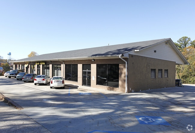
592 Main St
07-3614-0068-026-1
Fulton
Storebuilding
Georgia
X
68
13121C0443F
0.93 AC
2024
S Fulton/Union City
2025
Atlanta
010401
Atlanta-Sandy Springs-Roswell, GA
19,495 SF
DEMOGRAPHICS near 592 Main St
1 Mile
3 Mile
5 Mile
2024 Total Population
3,796
9,797
33,660
2029 Population
3,993
10,543
35,885
Pop Growth 2024-2029
+ 5.19%
+ 7.61%
+ 6.61%
Average Age
39
39
40
2024 Total Households
1,434
3,536
11,938
HH Growth 2024-2029
+ 5.37%
+ 7.58%
+ 6.63%
Median Household Inc
$54,816
$64,842
$77,567
Avg Household Size
2.70
2.70
2.80
2024 Avg HH Vehicles
2.00
2.00
2.00
Median Home Value
$156,676
$277,670
$302,855
Median Year Built
1991
1996
2001
Nearby Places
Map Layers
Map Styles
 Street
 Aerial
- Restaurants
- Banks
- Shops
- Fitness
- Groceries
PUBLIC TRANSPORTATION
AIRPORT
Hartsfield - Jackson Atlanta International
DRIVE
WALK
Distance
Hartsfield - Jackson Atlanta International
32 min
21.1 mi
Nearby Properties
Address
Land Use
TOTAL SIZE
Lot Size
Zoning
Address
Land Use
TOTAL SIZE
Lot Size
Zoning
1,000,200 SF
78.26 AC
R1
Address
Land Use
TOTAL SIZE
Lot Size
Zoning
79.51 AC
AG1
Address
Land Use
TOTAL SIZE
Lot Size
Zoning
374,881 SF
91.05 AC
M1
Address
Land Use
TOTAL SIZE
Lot Size
Zoning
1,094,400 SF
111.68 AC
M1
Address
Land Use
TOTAL SIZE
Lot Size
Zoning
981,874 SF
83.45 AC
AG1
Address
Land Use
TOTAL SIZE
Lot Size
Zoning
1,351,440 SF
86.29 AC
M1
Address
Land Use
TOTAL SIZE
Lot Size
Zoning
1,054,500 SF
101.73 AC
M1
Address
Land Use
TOTAL SIZE
Lot Size
Zoning
1,064,460 SF
23.50 AC
M2
Address
Land Use
TOTAL SIZE
Lot Size
Zoning
685,260 SF
56.60 AC
M1
Address
Land Use
TOTAL SIZE
Lot Size
Zoning
48.74 AC
M1
Address
Land Use
TOTAL SIZE
Lot Size
Zoning
300,000 SF
66.47 AC
R1
Address
Land Use
TOTAL SIZE
Lot Size
Zoning
374,881 SF
34.73 AC
M1
Address
Land Use
TOTAL SIZE
Lot Size
Zoning
74.16 AC
R1
Address
Land Use
TOTAL SIZE
Lot Size
Zoning
139,164 SF
48.66 AC
R2
Address
Land Use
TOTAL SIZE
Lot Size
Zoning
201,600 SF
18 AC
M1
Address
Land Use
TOTAL SIZE
Lot Size
Zoning
255,000 SF
20.68 AC
M1
Address
Land Use
TOTAL SIZE
Lot Size
Zoning
39.33 AC
M2
Address
Land Use
TOTAL SIZE
Lot Size
Zoning
45,256 SF
20.15 AC
M
Address
Land Use
TOTAL SIZE
Lot Size
Zoning
Address
Land Use
TOTAL SIZE
Lot Size
Zoning
102.42 AC
AG1
Address
Land Use
TOTAL SIZE
Lot Size
Zoning
29,800 SF
16.70 AC
R2
Address
Land Use
TOTAL SIZE
Lot Size
Zoning
2,979 SF
132 AC
C3
Address
Land Use
TOTAL SIZE
Lot Size
Zoning
86.10 AC
AG1
Address
Land Use
TOTAL SIZE
Lot Size
Zoning
12,008 SF
12.19 AC
RL
Address
Land Use
TOTAL SIZE
Lot Size
Zoning
436,508 SF
16.03 AC
R7
Address
Land Use
TOTAL SIZE
Lot Size
Zoning
14.98 AC
AG1
Address
Land Use
TOTAL SIZE
Lot Size
Zoning
40,360 SF
12.29 AC
R2
Address
Land Use
TOTAL SIZE
Lot Size
Zoning
7,252 SF
1.69 AC
Address
Land Use
TOTAL SIZE
Lot Size
Zoning
21,824 SF
0.64 AC
R2
Address
Land Use
TOTAL SIZE
Lot Size
Zoning
22,354 SF
3.88 AC
C3
The World's #1 Commercial Real Estate Marketplace
Connect with us
© 2026 CoStar Group
The information above has been obtained from sources believed reliable. While we do not doubt its accuracy we have not verified it and make no guarantee, warranty or representation about it. It is your responsibility to independently confirm its accuracy and completeness. Any projections, opinions, assumptions, or estimates used are for example only and do not represent the current or future performance of the property. The value of this transaction to you depends on tax and other factors which should be evaluated by your tax, financial, and legal advisors. You and your advisors should conduct a careful, independent investigation of the property to determine to your satisfaction the suitability of the property for your needs.