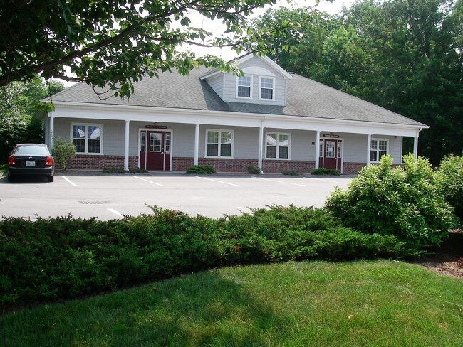
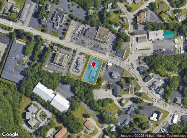
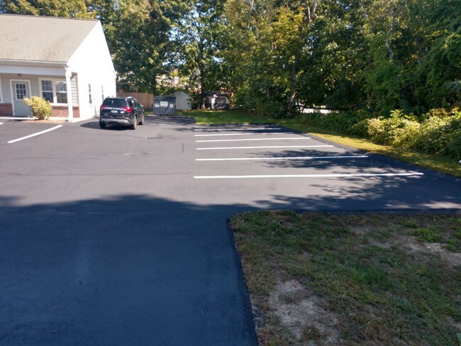
Property Record
592 Putnam Pike, Greenville, RI 02828
NEARBY LISTINGS FOR SALE OR LEASE
Property Detail
592 Putnam Pike
SMIT-000007-000000-000012
Providence
Commercialbuilding
Rhode Island
X
12
44007C0281G
0.83 AC
2025
Smithfield
2025
Providence
012702
Providence-Warwick, RI-MA
5,824 SF
DEMOGRAPHICS near 592 Putnam Pike
1 Mile
3 Mile
5 Mile
2024 Total Population
6,668
24,138
69,121
2029 Population
6,758
24,346
69,405
Pop Growth 2024-2029
+ 1.35%
+ 0.86%
+ 0.41%
Average Age
46
44
43
2024 Total Households
2,550
9,272
27,607
HH Growth 2024-2029
+ 1.41%
+ 0.85%
+ 0.38%
Median Household Inc
$93,809
$100,322
$88,421
Avg Household Size
2.50
2.40
2.30
2024 Avg HH Vehicles
2.00
2.00
2.00
Median Home Value
$378,460
$375,375
$347,103
Median Year Built
1975
1971
1972
Nearby Places
Map Layers
Map Styles
 Street
 Aerial
- Restaurants
- Banks
- Shops
- Fitness
- Groceries
PUBLIC TRANSPORTATION
COMMUTER RAIL
Providence (Providence/Stoughton Line - Massachusetts Bay Transportation Authority Commuter Rail (Purple Line))
DRIVE
WALK
Distance
Providence (Providence/Stoughton Line - Massachusetts Bay Transportation Authority Commuter Rail (Purple Line))
15 min
8.7 mi
DRIVE
WALK
Distance
16 min
9.2 mi
AIRPORT
Rhode Island Tf Green International
DRIVE
WALK
Distance
Rhode Island Tf Green International
27 min
16.0 mi
Worcester Regional
DRIVE
WALK
Distance
Worcester Regional
60 min
40.5 mi
SALE & LEASE HISTORY
LISTING DATE
SALE/LEASE

Oct 03, 2017
For Lease
Nearby Properties
Address
Land Use
TOTAL SIZE
Lot Size
Zoning
Address
Land Use
TOTAL SIZE
Lot Size
Zoning
89.07 AC
PD
Address
Land Use
TOTAL SIZE
Lot Size
Zoning
53.18 AC
C
Address
Land Use
TOTAL SIZE
Lot Size
Zoning
123.25 AC
R40
Address
Land Use
TOTAL SIZE
Lot Size
Zoning
1,792 SF
28.46 AC
Address
Land Use
TOTAL SIZE
Lot Size
Zoning
166,368 SF
10.74 AC
R20
Address
Land Use
TOTAL SIZE
Lot Size
Zoning
31.11 AC
R20M
Address
Land Use
TOTAL SIZE
Lot Size
Zoning
Address
Land Use
TOTAL SIZE
Lot Size
Zoning
22,868 SF
12.22 AC
R20
Address
Land Use
TOTAL SIZE
Lot Size
Zoning
124,397 SF
13.66 AC
C
Address
Land Use
TOTAL SIZE
Lot Size
Zoning
89,788 SF
11.25 AC
R20
Address
Land Use
TOTAL SIZE
Lot Size
Zoning
72,531 SF
11.70 AC
R20
Address
Land Use
TOTAL SIZE
Lot Size
Zoning
9.59 AC
MU
Address
Land Use
TOTAL SIZE
Lot Size
Zoning
20 AC
R20M
Address
Land Use
TOTAL SIZE
Lot Size
Zoning
87,649 SF
8 AC
R20
Address
Land Use
TOTAL SIZE
Lot Size
Zoning
78,346 SF
10.75 AC
PD
Address
Land Use
TOTAL SIZE
Lot Size
Zoning
85,130 SF
4.40 AC
R20
Address
Land Use
TOTAL SIZE
Lot Size
Zoning
44,381 SF
12.20 AC
R20
Address
Land Use
TOTAL SIZE
Lot Size
Zoning
96,723 SF
21.69 AC
PD
Address
Land Use
TOTAL SIZE
Lot Size
Zoning
1 AC
PD
Address
Land Use
TOTAL SIZE
Lot Size
Zoning
3.69 AC
C
Address
Land Use
TOTAL SIZE
Lot Size
Zoning
60,658 SF
11.40 AC
MU
Address
Land Use
TOTAL SIZE
Lot Size
Zoning
45,183 SF
9.75 AC
R80
Address
Land Use
TOTAL SIZE
Lot Size
Zoning
10.18 AC
R20M
Address
Land Use
TOTAL SIZE
Lot Size
Zoning
26,780 SF
3 AC
R20
Address
Land Use
TOTAL SIZE
Lot Size
Zoning
33,340 SF
5 AC
PD
Address
Land Use
TOTAL SIZE
Lot Size
Zoning
30,275 SF
1.42 AC
MU
Address
Land Use
TOTAL SIZE
Lot Size
Zoning
1.81 AC
V
Address
Land Use
TOTAL SIZE
Lot Size
Zoning
36,973 SF
4.71 AC
R20
Address
Land Use
TOTAL SIZE
Lot Size
Zoning
46,530 SF
2.75 AC
R20M
The World's #1 Commercial Real Estate Marketplace
Connect with us
© 2026 CoStar Group
The information above has been obtained from sources believed reliable. While we do not doubt its accuracy we have not verified it and make no guarantee, warranty or representation about it. It is your responsibility to independently confirm its accuracy and completeness. Any projections, opinions, assumptions, or estimates used are for example only and do not represent the current or future performance of the property. The value of this transaction to you depends on tax and other factors which should be evaluated by your tax, financial, and legal advisors. You and your advisors should conduct a careful, independent investigation of the property to determine to your satisfaction the suitability of the property for your needs.