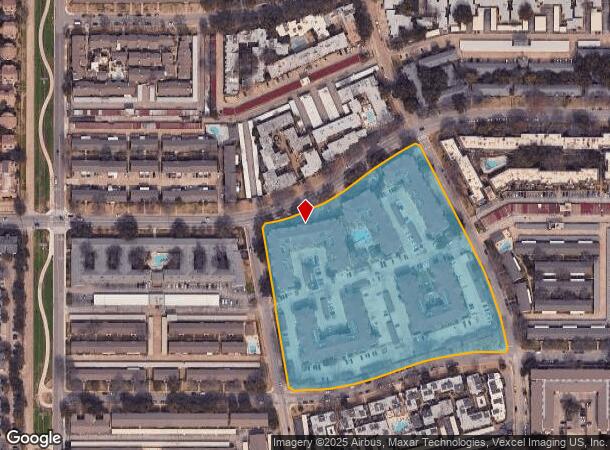
Property Record
5920 E University Blvd, Dallas, TX 75206

NEARBY LISTINGS FOR SALE OR LEASE
Property Detail
5920 E University Blvd
Dallas-Fort Worth-Arlington, TX
Sswh Universtiy
00540600020010000
SSWH UNIVERSTIY BLK 2/5406 LT 1 ACS 9.675 INT202100358026 DD11302021 CO-DC 5406 002 00100 7DA5406 002
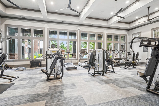
Apartment
Dallas
X
Texas
48113C0335K
1
2024
9.68 AC
2025
Northeast Dallas
007914
Dallas/Ft Worth
252,841 SF
DEMOGRAPHICS near 5920 E University Blvd
1 Mile
3 Mile
5 Mile
2024 Total Population
25,435
174,781
448,901
2029 Population
25,578
175,410
451,182
Pop Growth 2024-2029
+ 0.56%
+ 0.36%
+ 0.51%
Average Age
36
37
38
2024 Total Households
13,774
82,672
219,148
HH Growth 2024-2029
+ 0.65%
+ 0.47%
+ 0.63%
Median Household Inc
$76,303
$83,507
$75,298
Avg Household Size
1.80
2.00
2.00
2024 Avg HH Vehicles
1.00
2.00
2.00
Median Home Value
$526,326
$744,864
$514,758
Median Year Built
1986
1983
1985
Nearby Places
Map Layers
Map Styles
 Street
 Aerial
- Restaurants
- Banks
- Shops
- Fitness
- Groceries
PUBLIC TRANSPORTATION
COMMUTER RAIL
DRIVE
WALK
Distance
10 min
6.0 mi
DRIVE
WALK
Distance
14 min
7.6 mi
AIRPORT
Dallas Love Field
DRIVE
WALK
Distance
Dallas Love Field
14 min
5.9 mi
Dallas-Fort Worth International
DRIVE
WALK
Distance
Dallas-Fort Worth International
34 min
25.2 mi
Nearby Properties
Address
Land Use
TOTAL SIZE
Lot Size
Zoning
Address
Land Use
TOTAL SIZE
Lot Size
Zoning
1,634,356 SF
92.90 AC
Z421
Address
Land Use
TOTAL SIZE
Lot Size
Zoning
4,157,377 SF
76.79 AC
Z248
Address
Land Use
TOTAL SIZE
Lot Size
Zoning
858,872 SF
23.90 AC
Z421
Address
Land Use
TOTAL SIZE
Lot Size
Zoning
299,170 SF
9.71 AC
Z97
Address
Land Use
TOTAL SIZE
Lot Size
Zoning
2,186,362 SF
48.27 AC
Z239
Address
Land Use
TOTAL SIZE
Lot Size
Zoning
502,529 SF
3.08 AC
Z239
Address
Land Use
TOTAL SIZE
Lot Size
Zoning
100 SF
27.05 AC
Z421
Address
Land Use
TOTAL SIZE
Lot Size
Zoning
226,331 SF
1.12 AC
Address
Land Use
TOTAL SIZE
Lot Size
Zoning
77.76 AC
Z239
Address
Land Use
TOTAL SIZE
Lot Size
Zoning
1,086,919 SF
5.85 AC
Z239
Address
Land Use
TOTAL SIZE
Lot Size
Zoning
812,701 SF
3.73 AC
Address
Land Use
TOTAL SIZE
Lot Size
Zoning
545,752 SF
1.33 AC
Z239
Address
Land Use
TOTAL SIZE
Lot Size
Zoning
875,990 SF
4.30 AC
Z239
Address
Land Use
TOTAL SIZE
Lot Size
Zoning
763,340 SF
8.31 AC
Z165
Address
Land Use
TOTAL SIZE
Lot Size
Zoning
447,418 SF
5.69 AC
Z236
Address
Land Use
TOTAL SIZE
Lot Size
Zoning
446,593 SF
0.93 AC
Address
Land Use
TOTAL SIZE
Lot Size
Zoning
146,302 SF
5.66 AC
Z60
Address
Land Use
TOTAL SIZE
Lot Size
Zoning
814,976 SF
8.72 AC
Z151
Address
Land Use
TOTAL SIZE
Lot Size
Zoning
662,911 SF
4.36 AC
Z239
Address
Land Use
TOTAL SIZE
Lot Size
Zoning
801,209 SF
1.57 AC
Z239
Address
Land Use
TOTAL SIZE
Lot Size
Zoning
595,955 SF
1.42 AC
Z239
Address
Land Use
TOTAL SIZE
Lot Size
Zoning
395,377 SF
14.61 AC
Z163
Address
Land Use
TOTAL SIZE
Lot Size
Zoning
601,951 SF
2.10 AC
Z239
Address
Land Use
TOTAL SIZE
Lot Size
Zoning
474,563 SF
2.42 AC
Z239
Address
Land Use
TOTAL SIZE
Lot Size
Zoning
749,138 SF
2.17 AC
Z239
Address
Land Use
TOTAL SIZE
Lot Size
Zoning
735,000 SF
2.05 AC
Z239
Address
Land Use
TOTAL SIZE
Lot Size
Zoning
835,301 SF
9.29 AC
Z239
Address
Land Use
TOTAL SIZE
Lot Size
Zoning
674,474 SF
18.81 AC
Z164
Address
Land Use
TOTAL SIZE
Lot Size
Zoning
776,707 SF
8.47 AC
Address
Land Use
TOTAL SIZE
Lot Size
Zoning
240,205 SF
1.24 AC
The World's #1 Commercial Real Estate Marketplace
Connect with us
© 2026 CoStar Group
The information above has been obtained from sources believed reliable. While we do not doubt its accuracy we have not verified it and make no guarantee, warranty or representation about it. It is your responsibility to independently confirm its accuracy and completeness. Any projections, opinions, assumptions, or estimates used are for example only and do not represent the current or future performance of the property. The value of this transaction to you depends on tax and other factors which should be evaluated by your tax, financial, and legal advisors. You and your advisors should conduct a careful, independent investigation of the property to determine to your satisfaction the suitability of the property for your needs.