Property Record
5920 Edmund Hwy, Lexington, SC 29073
NEARBY LISTINGS FOR SALE OR LEASE
-
-
View all Lexington listings for sale on LoopNet.com
Property Detail
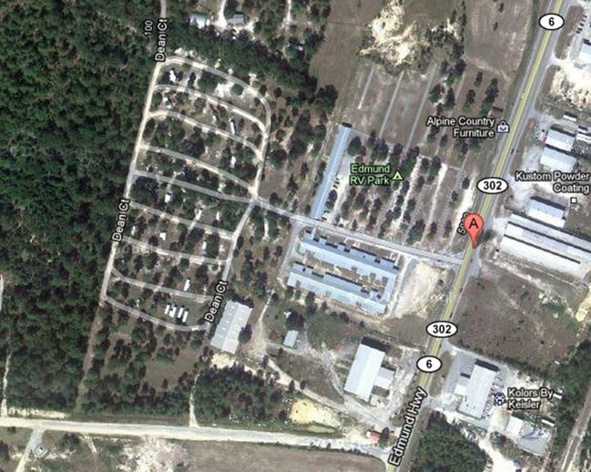
5920 Edmund Hwy
Columbia, SC
Edmund Business Park
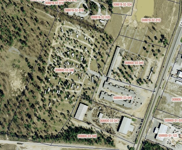
008800-03-046
LOT 8 LAND SWAP WITH 8700-2-102
Mobilehomepark
Lexington
X
South Carolina
45063C0380J
8
2025
12.68 AC
2024
Outlying Lexington County
020906
Columbia
DEMOGRAPHICS near 5920 Edmund Hwy
1 Mile
3 Mile
5 Mile
2024 Total Population
952
9,259
39,019
2029 Population
1,042
10,228
42,946
Pop Growth 2024-2029
+ 9.45%
+ 10.47%
+ 10.06%
Average Age
39
36
37
2024 Total Households
361
3,390
14,403
HH Growth 2024-2029
+ 9.70%
+ 10.62%
+ 10.21%
Median Household Inc
$49,807
$58,781
$58,288
Avg Household Size
2.60
2.70
2.70
2024 Avg HH Vehicles
2.00
2.00
2.00
Median Home Value
$138,461
$169,936
$156,749
Median Year Built
1996
2003
1998
Nearby Places
Map Layers
Map Styles
 Street
 Aerial
- Restaurants
- Banks
- Shops
- Fitness
- Groceries
PUBLIC TRANSPORTATION
AIRPORT
Columbia Metro
DRIVE
WALK
Distance
Columbia Metro
19 min
8.4 mi
Freight Ports
North Charleston Terminal
DRIVE
WALK
Distance
North Charleston Terminal
127 min
110.1 mi
SALE & LEASE HISTORY
LISTING DATE
SALE/LEASE

May 05, 2017
For Sale
Nearby Properties
Address
Land Use
TOTAL SIZE
Lot Size
Zoning
Address
Land Use
TOTAL SIZE
Lot Size
Zoning
459.64 AC
R
Address
Land Use
TOTAL SIZE
Lot Size
Zoning
600 SF
234.68 AC
ID
Address
Land Use
TOTAL SIZE
Lot Size
Zoning
297.10 AC
LR
Address
Land Use
TOTAL SIZE
Lot Size
Zoning
9,000 SF
1.42 AC
Address
Land Use
TOTAL SIZE
Lot Size
Zoning
305.90 AC
RD
Address
Land Use
TOTAL SIZE
Lot Size
Zoning
184.92 AC
RD
Address
Land Use
TOTAL SIZE
Lot Size
Zoning
2,000 SF
1.07 AC
ID
Address
Land Use
TOTAL SIZE
Lot Size
Zoning
12,000 SF
3.26 AC
ID
Address
Land Use
TOTAL SIZE
Lot Size
Zoning
4,102 SF
1.36 AC
Address
Land Use
TOTAL SIZE
Lot Size
Zoning
2,992 SF
87.27 AC
RD
Address
Land Use
TOTAL SIZE
Lot Size
Zoning
203.63 AC
RD
Address
Land Use
TOTAL SIZE
Lot Size
Zoning
26.86 AC
LR
Address
Land Use
TOTAL SIZE
Lot Size
Zoning
122.56 AC
RD
Address
Land Use
TOTAL SIZE
Lot Size
Zoning
600 SF
5.06 AC
RD
Address
Land Use
TOTAL SIZE
Lot Size
Zoning
5,400 SF
3.04 AC
ID
Address
Land Use
TOTAL SIZE
Lot Size
Zoning
14,000 SF
2.66 AC
ID
Address
Land Use
TOTAL SIZE
Lot Size
Zoning
1,200 SF
5 AC
RD
Address
Land Use
TOTAL SIZE
Lot Size
Zoning
11,940 SF
2.35 AC
ID
Address
Land Use
TOTAL SIZE
Lot Size
Zoning
14.32 AC
RD
Address
Land Use
TOTAL SIZE
Lot Size
Zoning
6,776 SF
1.35 AC
ID
Address
Land Use
TOTAL SIZE
Lot Size
Zoning
26.87 AC
ID
Address
Land Use
TOTAL SIZE
Lot Size
Zoning
154.76 AC
RD
Address
Land Use
TOTAL SIZE
Lot Size
Zoning
4,630 SF
0.87 AC
ID
Address
Land Use
TOTAL SIZE
Lot Size
Zoning
1,157 SF
2 AC
ID
Address
Land Use
TOTAL SIZE
Lot Size
Zoning
3,600 SF
1.42 AC
ID
Address
Land Use
TOTAL SIZE
Lot Size
Zoning
3,111 SF
0.92 AC
ID
Address
Land Use
TOTAL SIZE
Lot Size
Zoning
5,000 SF
0.86 AC
ID
Address
Land Use
TOTAL SIZE
Lot Size
Zoning
3,400 SF
0.51 AC
C1
Address
Land Use
TOTAL SIZE
Lot Size
Zoning
3,600 SF
1.38 AC
ID
Address
Land Use
TOTAL SIZE
Lot Size
Zoning
7,950 SF
53.08 AC
RD
The World's #1 Commercial Real Estate Marketplace
Connect with us
© 2026 CoStar Group
The information above has been obtained from sources believed reliable. While we do not doubt its accuracy we have not verified it and make no guarantee, warranty or representation about it. It is your responsibility to independently confirm its accuracy and completeness. Any projections, opinions, assumptions, or estimates used are for example only and do not represent the current or future performance of the property. The value of this transaction to you depends on tax and other factors which should be evaluated by your tax, financial, and legal advisors. You and your advisors should conduct a careful, independent investigation of the property to determine to your satisfaction the suitability of the property for your needs.