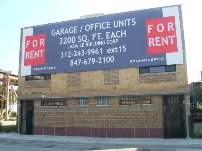
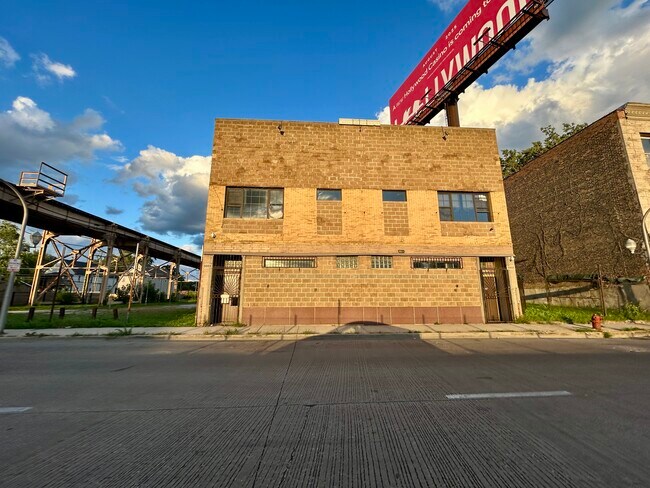
Property Record
5923 S Wentworth Ave, Chicago, IL 60621
Current Lease Availabilities
NEARBY LISTINGS FOR SALE OR LEASE
Property Detail
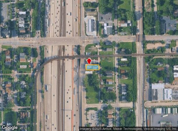
5923 S Wentworth Ave
Chicago-Naperville-Elgin, IL-IN-WI
Resubdivision Of Henry Berdels
20-16-404-007-0000
(RESUBDIVISION) OF HENRY (BERDELS) SUB OF WEST PT LT8 IN SCHOOL TRUSTEES SUB OF SEC 16-38-14
Miscresidentialimprovement
Cook
X
Illinois
17031C0520J
8
2023
0.14 AC
2024
South Chicago
834600
Chicago
5,760 SF
DEMOGRAPHICS near 5923 S Wentworth Ave
1 Mile
3 Mile
5 Mile
2024 Total Population
25,856
290,768
677,642
2029 Population
25,274
279,947
646,843
Pop Growth 2024-2029
(2.25%)
(3.72%)
(4.55%)
Average Age
35
38
39
2024 Total Households
10,353
120,088
264,475
HH Growth 2024-2029
(2.53%)
(3.84%)
(4.55%)
Median Household Inc
$22,634
$34,356
$42,577
Avg Household Size
2.40
2.30
2.40
2024 Avg HH Vehicles
1.00
1.00
1.00
Median Home Value
$171,693
$212,717
$213,289
Median Year Built
1959
1949
1949
Nearby Places
- Restaurants
- Banks
- Shops
- Fitness
- Groceries
PUBLIC TRANSPORTATION
TRANSIT/SUBWAY
63Rd Street Station (Red Line - Chicago Transit Authority "L" Trains (The "L"))
DRIVE
WALK
Distance
63Rd Street Station (Red Line - Chicago Transit Authority "L" Trains (The "L"))
7 min
9 min
0.5 mi
Garfield Station (Red Line) (Red Line - Chicago Transit Authority "L" Trains (The "L"))
DRIVE
WALK
Distance
Garfield Station (Red Line) (Red Line - Chicago Transit Authority "L" Trains (The "L"))
7 min
12 min
0.6 mi
COMMUTER RAIL
63Rd Street Station (Metra Electric Line - Northeast Illinois Regional Commuter Railroad (Metra), South Shore Line - Northeast Illinois Regional Commuter Railroad (Metra))
DRIVE
WALK
Distance
63Rd Street Station (Metra Electric Line - Northeast Illinois Regional Commuter Railroad (Metra), South Shore Line - Northeast Illinois Regional Commuter Railroad (Metra))
5 min
2.6 mi
59Th Street (University Of Chicago) Station (Metra Electric Line - Northeast Illinois Regional Commuter Railroad (Metra))
DRIVE
WALK
Distance
59Th Street (University Of Chicago) Station (Metra Electric Line - Northeast Illinois Regional Commuter Railroad (Metra))
6 min
2.7 mi
AIRPORT
Chicago Midway International
DRIVE
WALK
Distance
Chicago Midway International
14 min
6.9 mi
Chicago O'Hare International
DRIVE
WALK
Distance
Chicago O'Hare International
37 min
24.0 mi
Freight Ports
Port Milwaukee
DRIVE
WALK
Distance
Port Milwaukee
115 min
92.2 mi
Nearby Properties
Address
Land Use
TOTAL SIZE
Lot Size
Zoning
Address
Land Use
TOTAL SIZE
Lot Size
Zoning
134,800 SF
2.53 AC
PD 1273
Address
Land Use
TOTAL SIZE
Lot Size
Zoning
1,302,463 SF
3.14 AC
PD 1211
Address
Land Use
TOTAL SIZE
Lot Size
Zoning
3.14 AC
PD 1211
Address
Land Use
TOTAL SIZE
Lot Size
Zoning
0.91 AC
PD 1177
Address
Land Use
TOTAL SIZE
Lot Size
Zoning
2.65 AC
PD 38
Address
Land Use
TOTAL SIZE
Lot Size
Zoning
304,685 SF
1.11 AC
PD 1218
Address
Land Use
TOTAL SIZE
Lot Size
Zoning
7,200 SF
0.22 AC
B3-3
Address
Land Use
TOTAL SIZE
Lot Size
Zoning
156,800 SF
2.65 AC
PD 38
Address
Land Use
TOTAL SIZE
Lot Size
Zoning
PD 43
Address
Land Use
TOTAL SIZE
Lot Size
Zoning
451,349 SF
1.62 AC
PD 1062
Address
Land Use
TOTAL SIZE
Lot Size
Zoning
283,180 SF
1.41 AC
M2-3
Address
Land Use
TOTAL SIZE
Lot Size
Zoning
0.73 AC
PD 1072
Address
Land Use
TOTAL SIZE
Lot Size
Zoning
1.65 AC
B2-3
Address
Land Use
TOTAL SIZE
Lot Size
Zoning
PD 43
Address
Land Use
TOTAL SIZE
Lot Size
Zoning
769,600 SF
PD 282
Address
Land Use
TOTAL SIZE
Lot Size
Zoning
78,000 SF
0.62 AC
RM-5
Address
Land Use
TOTAL SIZE
Lot Size
Zoning
7.47 AC
RT-4
Address
Land Use
TOTAL SIZE
Lot Size
Zoning
134,655 SF
2.40 AC
B3-3
Address
Land Use
TOTAL SIZE
Lot Size
Zoning
283,228 SF
14.47 AC
PMD 8
Address
Land Use
TOTAL SIZE
Lot Size
Zoning
130,785 SF
2.27 AC
PD 1174
Address
Land Use
TOTAL SIZE
Lot Size
Zoning
156,249 SF
0.57 AC
B3-5
Address
Land Use
TOTAL SIZE
Lot Size
Zoning
293,461 SF
1.19 AC
PD 282
Address
Land Use
TOTAL SIZE
Lot Size
Zoning
13,700 SF
0.33 AC
B3-2
Address
Land Use
TOTAL SIZE
Lot Size
Zoning
117,557 SF
2.69 AC
B3-3
Address
Land Use
TOTAL SIZE
Lot Size
Zoning
168,120 SF
8.06 AC
PMD 8
Address
Land Use
TOTAL SIZE
Lot Size
Zoning
258,000 SF
13.22 AC
PMD 8
Address
Land Use
TOTAL SIZE
Lot Size
Zoning
260,481 SF
12.93 AC
PD 463
Address
Land Use
TOTAL SIZE
Lot Size
Zoning
214,720 SF
0.92 AC
RM-6.5
Address
Land Use
TOTAL SIZE
Lot Size
Zoning
184,487 SF
0.66 AC
RM-5,RS-3
Address
Land Use
TOTAL SIZE
Lot Size
Zoning
743,663 SF
7.14 AC
RT-4
The World's #1 Commercial Real Estate Marketplace
Connect with us
© 2025 CoStar Group
The information above has been obtained from sources believed reliable. While we do not doubt its accuracy we have not verified it and make no guarantee, warranty or representation about it. It is your responsibility to independently confirm its accuracy and completeness. Any projections, opinions, assumptions, or estimates used are for example only and do not represent the current or future performance of the property. The value of this transaction to you depends on tax and other factors which should be evaluated by your tax, financial, and legal advisors. You and your advisors should conduct a careful, independent investigation of the property to determine to your satisfaction the suitability of the property for your needs.