Property Record
5923 Sw 20Th Dr, Bushnell, FL 33513
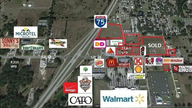

Current Lease Availabilities
Property Detail
5923 Sw 20Th Dr
N07-014
THAT PART OF SECT 7 DESC AS FOLLOWS: THE E 762.65 FT OF THE S 549.75 FT OF SE 1/4 LYING E OF I75 R/W LESS CR 48 R/W AND LESS E 50 FT THEREOF;
Officebuilding
Sumter
A Areas with a 1% annual chance of flooding and a 26% chance of flooding over the life of a 30-year mortgage.
Florida
2025
8.25 AC
2025
Florida Central North Area
910402
Other Market Areas
15,848 SF
The Villages, FL
NEARBY LISTINGS FOR SALE OR LEASE
DEMOGRAPHICS near 5923 Sw 20Th Dr
1 mile
3 mile
5 mile
2025 Total Population
685
5,973
8,103
2030 Population
765
6,733
9,130
Pop Growth 2025-2030
+ 11.68%
+ 12.72%
+ 12.67%
Average Age
53
44
44
2025 Total Households
343
2,470
3,285
HH Growth 2025-2030
+ 9.91%
+ 12.35%
+ 12.33%
Median Household Inc
$48,749
$58,783
$61,389
Avg Household Size
2.00
2.30
2.30
2025 Avg HH Vehicles
1.00
2.00
2.00
Median Home Value
$77,297
$229,420
$260,021
Median Year Built
1987
1986
1986
Nearby Places
Map Layers
Map Styles
 Street
 Aerial
Layers
 Traffic
 Biking
Places
Listings with unknown addresses are not visible on the map
- Restaurants
- Banks
- Shops
- Fitness
- Groceries
Nearby Properties
Address
Land Use
TOTAL SIZE
Lot Size
Zoning
Address
Land Use
TOTAL SIZE
Lot Size
Zoning
350,420 SF
105.71 AC
Address
Land Use
TOTAL SIZE
Lot Size
Zoning
155,747 SF
24.74 AC
Address
Land Use
TOTAL SIZE
Lot Size
Zoning
283,305 SF
81.71 AC
Address
Land Use
TOTAL SIZE
Lot Size
Zoning
82,870 SF
8.96 AC
Address
Land Use
TOTAL SIZE
Lot Size
Zoning
62,294 SF
8.65 AC
Address
Land Use
TOTAL SIZE
Lot Size
Zoning
28,060 SF
2.84 AC
Address
Land Use
TOTAL SIZE
Lot Size
Zoning
9,421 SF
2.45 AC
Address
Land Use
TOTAL SIZE
Lot Size
Zoning
19,465 SF
17.77 AC
Address
Land Use
TOTAL SIZE
Lot Size
Zoning
26,980 SF
19.25 AC
Address
Land Use
TOTAL SIZE
Lot Size
Zoning
29,886 SF
4.37 AC
Address
Land Use
TOTAL SIZE
Lot Size
Zoning
27,468 SF
5.16 AC
Address
Land Use
TOTAL SIZE
Lot Size
Zoning
13,195 SF
1.68 AC
Address
Land Use
TOTAL SIZE
Lot Size
Zoning
19,040 SF
3.92 AC
Address
Land Use
TOTAL SIZE
Lot Size
Zoning
43,332 SF
5.28 AC
Address
Land Use
TOTAL SIZE
Lot Size
Zoning
57,500 SF
17.65 AC
Address
Land Use
TOTAL SIZE
Lot Size
Zoning
13,282 SF
1.30 AC
Address
Land Use
TOTAL SIZE
Lot Size
Zoning
5,905 SF
2.30 AC
Address
Land Use
TOTAL SIZE
Lot Size
Zoning
12,220 SF
11.40 AC
Address
Land Use
TOTAL SIZE
Lot Size
Zoning
26,678 SF
5 AC
Address
Land Use
TOTAL SIZE
Lot Size
Zoning
10,111 SF
3.30 AC
Address
Land Use
TOTAL SIZE
Lot Size
Zoning
30,660 SF
7.68 AC
Address
Land Use
TOTAL SIZE
Lot Size
Zoning
4,131 SF
1.51 AC
Address
Land Use
TOTAL SIZE
Lot Size
Zoning
3,523 SF
2.06 AC
Address
Land Use
TOTAL SIZE
Lot Size
Zoning
5,084 SF
2.09 AC
Address
Land Use
TOTAL SIZE
Lot Size
Zoning
17,900 SF
3.91 AC
Address
Land Use
TOTAL SIZE
Lot Size
Zoning
22,813 SF
3.44 AC
Address
Land Use
TOTAL SIZE
Lot Size
Zoning
12,600 SF
1.86 AC
Address
Land Use
TOTAL SIZE
Lot Size
Zoning
6,930 SF
0.70 AC
Address
Land Use
TOTAL SIZE
Lot Size
Zoning
6,413 SF
1.68 AC
The World's #1 Commercial Real Estate Marketplace
Connect with us
© 2026 CoStar Group
The information above has been obtained from sources believed reliable. While we do not doubt its accuracy we have not verified it and make no guarantee, warranty or representation about it. It is your responsibility to independently confirm its accuracy and completeness. Any projections, opinions, assumptions, or estimates used are for example only and do not represent the current or future performance of the property. The value of this transaction to you depends on tax and other factors which should be evaluated by your tax, financial, and legal advisors. You and your advisors should conduct a careful, independent investigation of the property to determine to your satisfaction the suitability of the property for your needs.