Property Record
5925 Plantation Dr, Hillsboro, MO 63050

NEARBY LISTINGS FOR SALE OR LEASE
-
-
View all Hillsboro listings for sale on LoopNet.com
Property Detail
5925 Plantation Dr
St. Louis, MO-IL
Raintree Plantation
12-9.0-29.0-3-002-071.01
RAINTREE PLANTATION SEC 11 GOLF COURSE
Golfcourse
Jefferson
X
Missouri
29099C0213F
18,19
2024
10.24 AC
2025
Jefferson County
700502
St. Louis
DEMOGRAPHICS near 5925 Plantation Dr
1 Mile
3 Mile
5 Mile
2024 Total Population
1,959
6,436
13,718
2029 Population
2,025
6,648
14,202
Pop Growth 2024-2029
+ 3.37%
+ 3.29%
+ 3.53%
Average Age
43
41
41
2024 Total Households
729
2,336
5,134
HH Growth 2024-2029
+ 3.43%
+ 3.42%
+ 3.66%
Median Household Inc
$103,972
$86,266
$73,065
Avg Household Size
2.70
2.60
2.50
2024 Avg HH Vehicles
3.00
3.00
3.00
Median Home Value
$268,437
$254,856
$249,209
Median Year Built
2002
1996
1991
Nearby Places
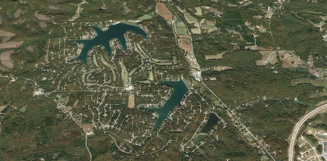
Map Layers
Map Styles
 Street
 Aerial
- Restaurants
- Banks
- Shops
- Fitness
- Groceries
SALE & LEASE HISTORY
LISTING DATE
SALE/LEASE

Oct 06, 2016
For Sale
Nearby Properties
Address
Land Use
TOTAL SIZE
Lot Size
Zoning
Address
Land Use
TOTAL SIZE
Lot Size
Zoning
36,018 SF
6.15 AC
CT1
Address
Land Use
TOTAL SIZE
Lot Size
Zoning
87,744 SF
7.92 AC
CT1
Address
Land Use
TOTAL SIZE
Lot Size
Zoning
10,010 SF
1.22 AC
R20
Address
Land Use
TOTAL SIZE
Lot Size
Zoning
36,030 SF
3.27 AC
CT1
Address
Land Use
TOTAL SIZE
Lot Size
Zoning
39,060 SF
5.12 AC
CT1
Address
Land Use
TOTAL SIZE
Lot Size
Zoning
6,568 SF
1.98 AC
Address
Land Use
TOTAL SIZE
Lot Size
Zoning
5,828 SF
0.78 AC
CT1
Address
Land Use
TOTAL SIZE
Lot Size
Zoning
12,874 SF
1.22 AC
Address
Land Use
TOTAL SIZE
Lot Size
Zoning
15,480 SF
6.12 AC
CT1
Address
Land Use
TOTAL SIZE
Lot Size
Zoning
4,800 SF
0.96 AC
CT1
Address
Land Use
TOTAL SIZE
Lot Size
Zoning
7,131 SF
4.45 AC
CT1
Address
Land Use
TOTAL SIZE
Lot Size
Zoning
25,514 SF
1.62 AC
LR2
Address
Land Use
TOTAL SIZE
Lot Size
Zoning
Address
Land Use
TOTAL SIZE
Lot Size
Zoning
4,208 SF
1.41 AC
CT1
Address
Land Use
TOTAL SIZE
Lot Size
Zoning
7,396 SF
0.97 AC
Address
Land Use
TOTAL SIZE
Lot Size
Zoning
3,150 SF
2.29 AC
CT1
Address
Land Use
TOTAL SIZE
Lot Size
Zoning
12,200 SF
1.51 AC
CT1
Address
Land Use
TOTAL SIZE
Lot Size
Zoning
4,450 SF
1.72 AC
CT1
Address
Land Use
TOTAL SIZE
Lot Size
Zoning
13,092 SF
1.15 AC
CT1
Address
Land Use
TOTAL SIZE
Lot Size
Zoning
7,200 SF
1.50 AC
CT1
Address
Land Use
TOTAL SIZE
Lot Size
Zoning
3,296 SF
2.54 AC
CT1
Address
Land Use
TOTAL SIZE
Lot Size
Zoning
9,968 SF
0.71 AC
CT1
Address
Land Use
TOTAL SIZE
Lot Size
Zoning
3,674 SF
0.91 AC
CT1
Address
Land Use
TOTAL SIZE
Lot Size
Zoning
1,920 SF
78.37 AC
LR2
Address
Land Use
TOTAL SIZE
Lot Size
Zoning
5,946 SF
1.41 AC
CT1
Address
Land Use
TOTAL SIZE
Lot Size
Zoning
3,008 SF
1.30 AC
CT1
Address
Land Use
TOTAL SIZE
Lot Size
Zoning
2,128 SF
0.72 AC
CT1
Address
Land Use
TOTAL SIZE
Lot Size
Zoning
3,370 SF
0.69 AC
Address
Land Use
TOTAL SIZE
Lot Size
Zoning
5,328 SF
2.32 AC
CT1
Address
Land Use
TOTAL SIZE
Lot Size
Zoning
2,586 SF
1.16 AC
CT1
The World's #1 Commercial Real Estate Marketplace
Connect with us
© 2026 CoStar Group
The information above has been obtained from sources believed reliable. While we do not doubt its accuracy we have not verified it and make no guarantee, warranty or representation about it. It is your responsibility to independently confirm its accuracy and completeness. Any projections, opinions, assumptions, or estimates used are for example only and do not represent the current or future performance of the property. The value of this transaction to you depends on tax and other factors which should be evaluated by your tax, financial, and legal advisors. You and your advisors should conduct a careful, independent investigation of the property to determine to your satisfaction the suitability of the property for your needs.