Property Record
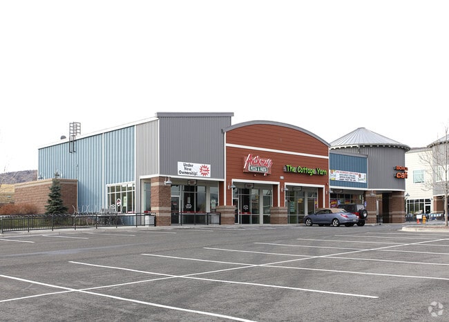
5925 S Zang St, Littleton, CO 80127

NEARBY LISTINGS FOR SALE OR LEASE
Property Detail
5925 S Zang St
Denver-Aurora-Centennial, CO
Ridge At West Meadows
59-202-04-004
SECTION 20 TOWNSHIP 05 RANGE 69 QTR NW SUBDIVISIONCD 639595 SUBDIVISIONNAME RIDGE AT WEST MEADOWS BLOCK LOT 0001 SIZE: 240887 TRACT 00A VALUE: 5.530 SECTION 20 TOWNSHIP 05 RANGE 69 QTR NW SUBDIVISIONCD 639595 SUBDIVISIONNAME RIDGE AT WEST MEADOWS BLO
Commercialnec
Jefferson
X
Colorado
08059C0382F
1
2021
5.57 AC
2024
Southwest
012044
Denver
54,360 SF
DEMOGRAPHICS near 5925 S Zang St
1 Mile
3 Mile
5 Mile
2024 Total Population
7,999
65,614
147,204
2029 Population
7,863
64,582
145,209
Pop Growth 2024-2029
(1.70%)
(1.57%)
(1.36%)
Average Age
41
42
42
2024 Total Households
3,192
24,519
58,178
HH Growth 2024-2029
(1.72%)
(1.66%)
(1.38%)
Median Household Inc
$114,408
$117,396
$108,117
Avg Household Size
2.50
2.60
2.50
2024 Avg HH Vehicles
2.00
2.00
2.00
Median Home Value
$586,757
$591,774
$579,632
Median Year Built
1994
1987
1987
Nearby Places
Map Layers
Map Styles
 Street
 Aerial
- Restaurants
- Banks
- Shops
- Fitness
- Groceries
PUBLIC TRANSPORTATION
AIRPORT
Denver International
DRIVE
WALK
Distance
Denver International
57 min
44.4 mi
SALE & LEASE HISTORY
LISTING DATE
SALE/LEASE

Sep 25, 2016
For Lease
May 09, 2018
For Lease
Nearby Properties
Address
Land Use
TOTAL SIZE
Lot Size
Zoning
Address
Land Use
TOTAL SIZE
Lot Size
Zoning
272,246 SF
31.76 AC
PD
Address
Land Use
TOTAL SIZE
Lot Size
Zoning
600,847 SF
32.41 AC
PD
Address
Land Use
TOTAL SIZE
Lot Size
Zoning
600,847 SF
35.87 AC
PD
Address
Land Use
TOTAL SIZE
Lot Size
Zoning
5,075 SF
1,955.14 AC
A2
Address
Land Use
TOTAL SIZE
Lot Size
Zoning
178,421 SF
12.31 AC
PD
Address
Land Use
TOTAL SIZE
Lot Size
Zoning
294,876 SF
12.25 AC
Address
Land Use
TOTAL SIZE
Lot Size
Zoning
150,951 SF
17.90 AC
PD
Address
Land Use
TOTAL SIZE
Lot Size
Zoning
151,602 SF
38.93 AC
Address
Land Use
TOTAL SIZE
Lot Size
Zoning
101,699 SF
10.34 AC
Address
Land Use
TOTAL SIZE
Lot Size
Zoning
175,000 SF
36.25 AC
PD
Address
Land Use
TOTAL SIZE
Lot Size
Zoning
221,123 SF
14.82 AC
PD
Address
Land Use
TOTAL SIZE
Lot Size
Zoning
97,000 SF
9.88 AC
PD
Address
Land Use
TOTAL SIZE
Lot Size
Zoning
218,391 SF
9.73 AC
PD
Address
Land Use
TOTAL SIZE
Lot Size
Zoning
70,614 SF
4.78 AC
CDOLI
Address
Land Use
TOTAL SIZE
Lot Size
Zoning
126,624 SF
7.30 AC
R-2-A
Address
Land Use
TOTAL SIZE
Lot Size
Zoning
86,898 SF
8.70 AC
PD
Address
Land Use
TOTAL SIZE
Lot Size
Zoning
120,766 SF
20.56 AC
PD
Address
Land Use
TOTAL SIZE
Lot Size
Zoning
100,550 SF
7.72 AC
PD
Address
Land Use
TOTAL SIZE
Lot Size
Zoning
188,653 SF
17.64 AC
PD
Address
Land Use
TOTAL SIZE
Lot Size
Zoning
124,224 SF
1.56 AC
Address
Land Use
TOTAL SIZE
Lot Size
Zoning
65,463 SF
4.80 AC
PD
Address
Land Use
TOTAL SIZE
Lot Size
Zoning
68,365 SF
12.17 AC
PD
Address
Land Use
TOTAL SIZE
Lot Size
Zoning
94,577 SF
5.76 AC
B-4
Address
Land Use
TOTAL SIZE
Lot Size
Zoning
107,693 SF
9.17 AC
PD
Address
Land Use
TOTAL SIZE
Lot Size
Zoning
57,221 SF
2.31 AC
Address
Land Use
TOTAL SIZE
Lot Size
Zoning
187,987 SF
10.07 AC
PD
Address
Land Use
TOTAL SIZE
Lot Size
Zoning
177,688 SF
8.45 AC
Address
Land Use
TOTAL SIZE
Lot Size
Zoning
77,135 SF
8.09 AC
Address
Land Use
TOTAL SIZE
Lot Size
Zoning
71,791 SF
24.38 AC
PD
Address
Land Use
TOTAL SIZE
Lot Size
Zoning
134.98 AC
PD
The World's #1 Commercial Real Estate Marketplace
Connect with us
© 2026 CoStar Group
The information above has been obtained from sources believed reliable. While we do not doubt its accuracy we have not verified it and make no guarantee, warranty or representation about it. It is your responsibility to independently confirm its accuracy and completeness. Any projections, opinions, assumptions, or estimates used are for example only and do not represent the current or future performance of the property. The value of this transaction to you depends on tax and other factors which should be evaluated by your tax, financial, and legal advisors. You and your advisors should conduct a careful, independent investigation of the property to determine to your satisfaction the suitability of the property for your needs.