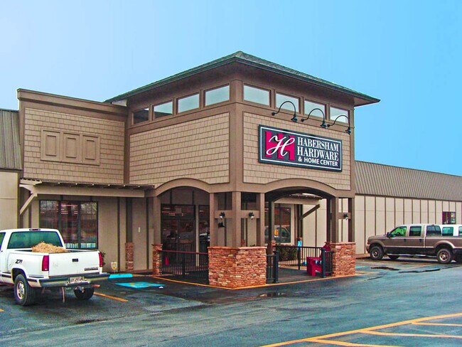
Property Record
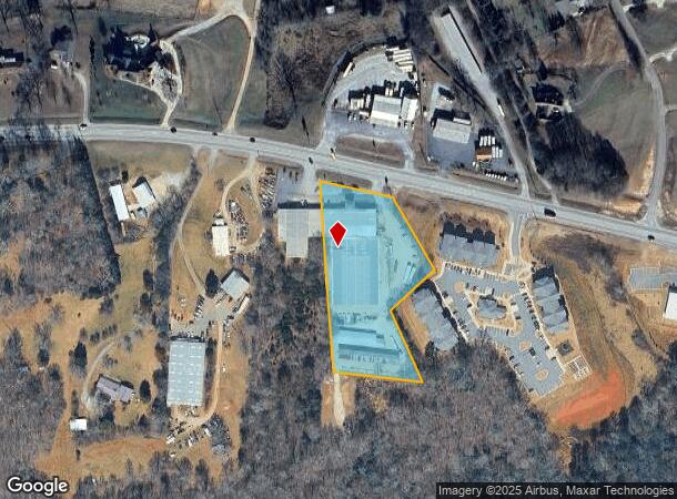
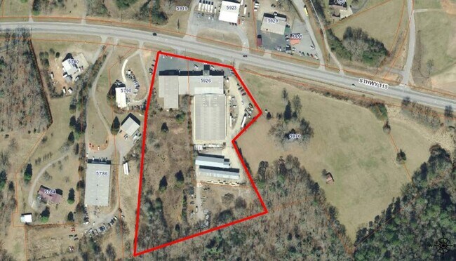
5926 Highway 115, Clarkesville, GA 30523

NEARBY LISTINGS FOR SALE OR LEASE
Property Detail
5926 Highway 115
068-041
10-2 PB-23-124 DB 1231-138
Warehouse
Habersham
X
Georgia
13137C0206D
3 AC
2025
Georgia Northeast
2025
Other Market Areas
000201
Cornelia, GA
27,200 SF
DEMOGRAPHICS near 5926 Highway 115
1 Mile
3 Mile
5 Mile
2024 Total Population
933
7,731
16,954
2029 Population
1,016
8,415
18,472
Pop Growth 2024-2029
+ 8.90%
+ 8.85%
+ 8.95%
Average Age
43
42
42
2024 Total Households
367
3,016
6,434
HH Growth 2024-2029
+ 8.45%
+ 8.52%
+ 8.70%
Median Household Inc
$60,652
$61,343
$62,001
Avg Household Size
2.50
2.50
2.50
2024 Avg HH Vehicles
2.00
2.00
2.00
Median Home Value
$222,857
$222,115
$216,913
Median Year Built
1991
1991
1991
Nearby Places
Map Layers
Map Styles
 Street
 Aerial
- Restaurants
- Banks
- Shops
- Fitness
- Groceries
SALE & LEASE HISTORY
LISTING DATE
SALE/LEASE

Mar 09, 2020
For Sale
Nearby Properties
Address
Land Use
TOTAL SIZE
Lot Size
Zoning
Address
Land Use
TOTAL SIZE
Lot Size
Zoning
253,404 SF
22 AC
HI
Address
Land Use
TOTAL SIZE
Lot Size
Zoning
238,071 SF
303.19 AC
HI
Address
Land Use
TOTAL SIZE
Lot Size
Zoning
78,537 SF
41.34 AC
LI
Address
Land Use
TOTAL SIZE
Lot Size
Zoning
144,690 SF
7.51 AC
HI
Address
Land Use
TOTAL SIZE
Lot Size
Zoning
105,213 SF
8.49 AC
HI
Address
Land Use
TOTAL SIZE
Lot Size
Zoning
247,562 SF
26.58 AC
I
Address
Land Use
TOTAL SIZE
Lot Size
Zoning
66,865 SF
7.06 AC
R2
Address
Land Use
TOTAL SIZE
Lot Size
Zoning
17,955 SF
12 AC
INS
Address
Land Use
TOTAL SIZE
Lot Size
Zoning
70,563 SF
9.66 AC
R1A
Address
Land Use
TOTAL SIZE
Lot Size
Zoning
8,725 SF
7.44 AC
LI
Address
Land Use
TOTAL SIZE
Lot Size
Zoning
183,619 SF
15.20 AC
MI
Address
Land Use
TOTAL SIZE
Lot Size
Zoning
44,885 SF
33.44 AC
LI
Address
Land Use
TOTAL SIZE
Lot Size
Zoning
72,402 SF
8.45 AC
HI
Address
Land Use
TOTAL SIZE
Lot Size
Zoning
50,890 SF
0.80 AC
CB
Address
Land Use
TOTAL SIZE
Lot Size
Zoning
32,210 SF
25.25 AC
HI
Address
Land Use
TOTAL SIZE
Lot Size
Zoning
34,422 SF
1.50 AC
CB
Address
Land Use
TOTAL SIZE
Lot Size
Zoning
40,450 SF
2.20 AC
INS
Address
Land Use
TOTAL SIZE
Lot Size
Zoning
10,256 SF
1.35 AC
HB
Address
Land Use
TOTAL SIZE
Lot Size
Zoning
77,778 SF
18 AC
MI
Address
Land Use
TOTAL SIZE
Lot Size
Zoning
13,560 SF
0.36 AC
PRO
Address
Land Use
TOTAL SIZE
Lot Size
Zoning
18,240 SF
8.19 AC
HI
Address
Land Use
TOTAL SIZE
Lot Size
Zoning
18,958 SF
16.49 AC
I
Address
Land Use
TOTAL SIZE
Lot Size
Zoning
62,550 SF
6.52 AC
PRO
Address
Land Use
TOTAL SIZE
Lot Size
Zoning
16,920 SF
0.98 AC
CB
Address
Land Use
TOTAL SIZE
Lot Size
Zoning
6,826 SF
1.93 AC
HI
Address
Land Use
TOTAL SIZE
Lot Size
Zoning
8,820 SF
2.78 AC
HI
Address
Land Use
TOTAL SIZE
Lot Size
Zoning
48,405 SF
2.30 AC
INS
Address
Land Use
TOTAL SIZE
Lot Size
Zoning
952 SF
2.22 AC
R2
Address
Land Use
TOTAL SIZE
Lot Size
Zoning
10,256 SF
2 AC
HI
The World's #1 Commercial Real Estate Marketplace
Connect with us
© 2025 CoStar Group
The information above has been obtained from sources believed reliable. While we do not doubt its accuracy we have not verified it and make no guarantee, warranty or representation about it. It is your responsibility to independently confirm its accuracy and completeness. Any projections, opinions, assumptions, or estimates used are for example only and do not represent the current or future performance of the property. The value of this transaction to you depends on tax and other factors which should be evaluated by your tax, financial, and legal advisors. You and your advisors should conduct a careful, independent investigation of the property to determine to your satisfaction the suitability of the property for your needs.